Kissing Couple

Log in to your account

AroundUs is a community-driven map of interesting places, built by curious explorers like you. It grows with every review, story, and photo you share.
Connect to save your favorite spots, contribute locations, and create personalized routes.
Continue with Google
Continue with Apple
Continue with X
Continue with Facebook
Continue with email
By continuing, you accept our Terms and Conditions and our Privacy Policy
Create an account
Add to collection
Map
Suggest a change
Share

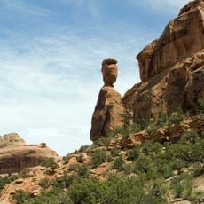
Kissing Couple, Rock formation in Mesa County, Colorado.

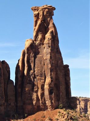
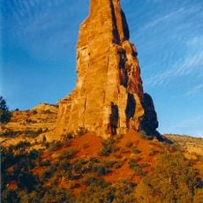
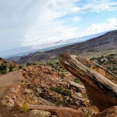
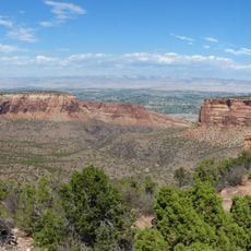
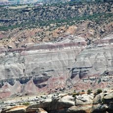
The Kissing Couple is a sandstone spire roughly 400 feet tall in Monument Canyon, displaying warm reddish tones created by wind and water erosion over time. The column rises sharply with complex erosion patterns that change appearance depending on light conditions.

The formation developed over millions of years as erosion removed softer surrounding rock, leaving the more resistant sandstone column exposed. Climbers first reached the summit in 1960, establishing it as a notable climbing objective.

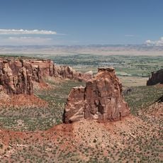
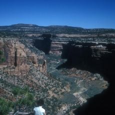
Rock climbers and photographers regularly visit to document and ascend the formation, making it a recognizable landmark in climbing communities. The distinctive shape has made it a reference point in local outdoor circles and guidebooks.

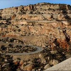
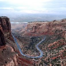
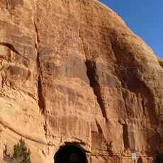
Access is via the Monument Canyon Trail, which involves a steep climb of roughly 800 feet and takes about 40 minutes from the trailhead. The terrain is rocky and uneven, so sturdy footwear and sure footing are essential.

A small natural opening runs through the formation, created by the enlargement of a vertical joint in the rock, adding geological complexity to its structure. This hidden feature becomes apparent to those who climb closer and examine the column carefully.

Location: Mesa County

GPS coordinates: 39.08915,-108.71815

Latest update: December 13, 2025 11:44

Photos
Around this place
Colorado National Monument
United States of America

Colorado National Monument

5.9 km
Independence Monument
United States of America

Independence Monument

871 m
Rim Rock Drive
United States of America

Rim Rock Drive

5.6 km
Serpents Trail
United States of America

Serpents Trail

9.6 km
Saddlehorn Comfort Station
United States of America

Saddlehorn Comfort Station

2.2 km
Colorado National Monument Visitor Center Complex
United States of America

Colorado National Monument Visitor Center Complex

1.9 km
Devils Kitchen Picnic Shelter
United States of America

Devils Kitchen Picnic Shelter

9.6 km
Saddlehorn Caretaker's House and Garage
United States of America

Saddlehorn Caretaker's House and Garage

1.9 km
Saddlehorn Utility Area Historic District
United States of America

Saddlehorn Utility Area Historic District

2.3 km
Dinosaur Diamond Prehistoric Highway
United States of America

Dinosaur Diamond Prehistoric Highway

12.9 km
Fruita Museum
United States of America

Fruita Museum

6.8 km
Monument Canyon
United States of America

Monument Canyon

830 m
No Thoroughfare Canyon
United States of America

No Thoroughfare Canyon

11.8 km
Fruita Canyon
United States of America

Fruita Canyon

3.3 km
Ute Canyon
United States of America

Ute Canyon

6.1 km
Saddlehorn Visitor Center
United States of America

Saddlehorn Visitor Center

1.9 km
Bookcliff Shelter
United States of America

Bookcliff Shelter

1.8 km
Horsethief Canyon
United States of America

Horsethief Canyon

7.6 km
Saddlehorn Caretaker's Garage
United States of America

Saddlehorn Caretaker's Garage

1.9 km
Saddlehorn Caretaker's Residence
United States of America

Saddlehorn Caretaker's Residence

1.9 km
East Tunnel
United States of America

East Tunnel

8.8 km
Mather Plaque in Colorado National Monument
United States of America

Mather Plaque in Colorado National Monument

1.9 km
Devils Kitchen Picnic Area
United States of America

Devils Kitchen Picnic Area

9.6 km
Fruita Bridge
United States of America

Fruita Bridge

5.4 km
Balanced Rock
United States of America

Balanced Rock

2.5 km
West Lower Tunnel
United States of America

West Lower Tunnel

3.1 km
Saddlehorn Campground
United States of America

Saddlehorn Campground

2.2 km
Saddlehorn Oil Storage Building
United States of America

Saddlehorn Oil Storage Building

2.2 km
Show the full map
Reviews

Visited this place? Tap the stars to rate it and share your experience / photos with the community! Try now! You can cancel it anytime.

« Kissing Couple - Rock formation in Mesa County, Colorado » is provided by Around Us (aroundus.com). Images and texts are derived from Wikimedia project under a Creative Commons license. You are allowed to copy, distribute, and modify copies of this page, under the conditions set by the license, as long as this note is clearly visible.

Discover hidden gems everywhere you go!

From secret cafés to breathtaking viewpoints, skip the crowded tourist spots and find places that match your style. Our app makes it easy with voice search, smart filtering, route optimization, and insider tips from travelers worldwide. Download now for the complete mobile experience.

Around Us App Screenshot

A unique approach to discovering new places

Le Figaro

All the places worth exploring

France Info

A tailor-made excursion in just a few clicks

20 Minutes