Enable Location

We need your location to show you interesting places around you

Discover nearby places

Find interesting locations and hidden gems around you

Precise directions

Get accurate directions and distances to places

Your location is never shared with other users. It's only used when you tap the location button.

Log in to your account

Start exploring — it's free

Trusted by 62,842 travelers worldwide

Continue with Google
Continue with Apple
or

We will send you a code to connect

By continuing, you accept our Terms and Conditions and our Privacy Policy

Check your inbox

We've sent a pincode in your inbox. Please enter the code below.

East Temple Peak

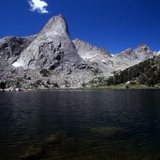
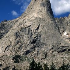
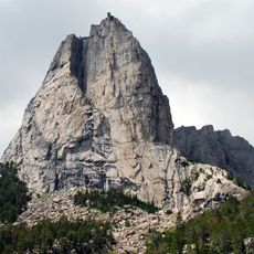
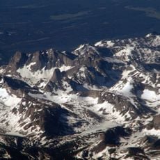
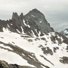
East Temple Peak, Mountain summit in Wind River Range, Wyoming, US.

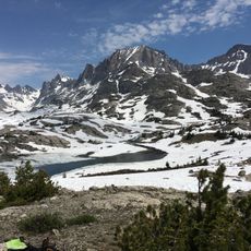
East Temple Peak is a mountain summit in the Wind River Range that rises to about 12,600 feet and features steep granite walls on multiple sides. A small glacier clings to the northeastern slope, adding to the rugged character of this striking peak.

The peak has drawn mountaineers since the early 1900s, with various climbing routes developing over the decades on its challenging slopes. The mountain remains a destination for experienced climbers seeking technical ascents in the Wind River Range.

The peak serves as a destination for mountaineers seeking technical ascents, with several unclimbed free routes remaining on its challenging rock faces.

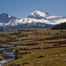
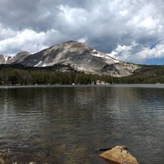
The hike to this peak starts at Big Sandy Trailhead and covers about 23 miles round trip, with camping spots available at Clear Lake and Deep Lake along the route. Climbers should be prepared for high altitude conditions and bring proper gear for the steep sections.

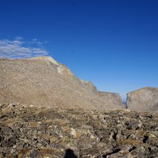
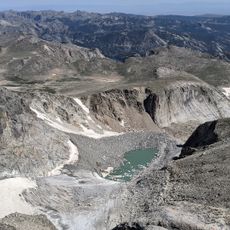
The mountain features an unusual rock formation called the Diving Board that juts out over a steep drop. This striking geological feature has become a favorite spot for photographers visiting the area.

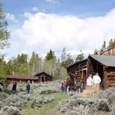
The community of curious travelers

AroundUs brings together thousands of curated places, local tips, and hidden gems, enriched daily by 60,000 contributors worldwide.

Start exploring
Location
GPS coordinates
42.71051,-109.15652
Latest update
December 14, 2025 18:40
« East Temple Peak - Mountain summit in Wind River Range, Wyoming, US » is provided by Around Us (aroundus.com). Images and texts are derived from Wikimedia project under a Creative Commons license. You are allowed to copy, distribute, and modify copies of this page, under the conditions set by the license, as long as this note is clearly visible.

Discover hidden gems everywhere you go!

From secret cafés to breathtaking viewpoints, skip the crowded tourist spots and find places that match your style. Our app makes it easy with voice search, smart filtering, route optimization, and insider tips from travelers worldwide. Download now for the complete mobile experience.

Around Us App Screenshot

A unique approach to discovering new places

Le Figaro

All the places worth exploring

France Info

A tailor-made excursion in just a few clicks

20 Minutes

Around Us
Travel Guide & Maps
Download

Send to your phone

QR Code
1

Open the camera app on your mobile.

2

Point at the QR code with your camera. A notification will appear.

3

Tap the notification to open the link.