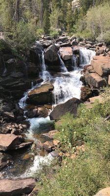
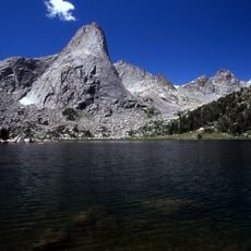
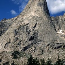
Popo Agie Falls, Cascading waterfall in Shoshone National Forest, Wyoming, United States.
Popo Agie Falls is a series of cascades along the Middle Popo Agie River that drops through multiple stages over about a mile of river corridor. The water flows through rocky channels and pools as it makes its descent through the forested landscape.
This area served as hunting and gathering grounds for Native American tribes for countless generations before the region became part of the national forest system. The river and surrounding landscape have remained relatively unchanged for many years.
Local residents consider sliding down certain sections of Popo Agie Falls during summer months a traditional initiation ritual for young people in the community.
The main trail to view the falls starts from Bruce's Bridge parking area and requires a moderate hike with some elevation gain through forested terrain. The warmer months offer the best conditions for walking the trail and viewing the full cascade of water.
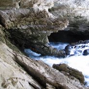
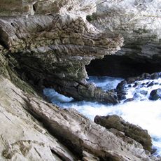
The falls feature natural stone water slides that allow visitors to slide into deep pools when water conditions are right during warmer seasons. This feature turns the location into an interactive experience rather than just a viewing area.
Location: Fremont County
GPS coordinates: 42.72167,-108.88273
Latest update: December 6, 2025 19:08
Wyoming preserves geological sites that include thermal springs, canyons, and rock formations. The state protects historic locations such as forts, rock art, and dinosaur tracks. Devils Tower rises 1,267 feet (386 meters) above the terrain and represents a significant geological formation. Fossil Butte conserves Eocene-era fossils in a former lakebed. Independence Rock served as a landmark for Oregon Trail travelers, while Fort Phil Kearny documents 1860s military history. The landscape includes waterfalls such as Popo Agie Falls and Jenny Lake Hidden Falls, mountain passes like Sylvan Pass, and Wind River Canyon. The Bighorn Medicine Wheel consists of stones arranged in a pattern on Medicine Mountain. Castle Gardens and Legend Rock display prehistoric petroglyphs. Red Gulch preserves dinosaur tracks more than 100 million years old. Sinks Canyon demonstrates a geological phenomenon where the Popo Agie River disappears into limestone caverns. Nature parks, hot springs like Granite Hot Springs, and forest areas such as Medicine Bow-Routt National Forests provide access to these areas.
Sinks Canyon State Park
6.9 km
Fort Washakie
31.6 km
Popo Agie Wilderness
13.9 km
Wind River Peak
20.1 km
Pingora Peak
28.7 km
Red Canyon
19.2 km
Jackson Park Town Site Addition Brick Row
17 km
Atlantic Peak
15.2 km
Mount Nystrom
19.6 km
Cathedral Peak
26.8 km
Raid Peak
40.6 km
DDZ Bridge over New Fork River
69 km
War Bonnet Peak
27.5 km
Temple Peak
23.7 km
East Temple Peak
22.4 km
BMU Bridge over Wind River
49 km
Mount Bonneville
40.9 km
Wind River Glacier
20.1 km
Silas Canyon
11.8 km
ELY Wind River Diversion Dam Bridge
56.3 km
Bair Peak
30.9 km
Shoshone-Episcopal Mission
29.5 km
Warrior Peaks
28.2 km
United States Post Office and Courthouse
17.6 km
Lander Downtown Historic District
17.5 km
Grand Theatre
17.6 km
Steamboat Geyser
60.9 km
Acme Theatre
52.7 kmReviews
Visited this place? Tap the stars to rate it and share your experience / photos with the community! Try now! You can cancel it anytime.
Discover hidden gems everywhere you go!
From secret cafés to breathtaking viewpoints, skip the crowded tourist spots and find places that match your style. Our app makes it easy with voice search, smart filtering, route optimization, and insider tips from travelers worldwide. Download now for the complete mobile experience.
A unique approach to discovering new places❞
— Le Figaro
All the places worth exploring❞
— France Info
A tailor-made excursion in just a few clicks❞
— 20 Minutes