Sinks Canyon State Park, State park near Lander, Wyoming.
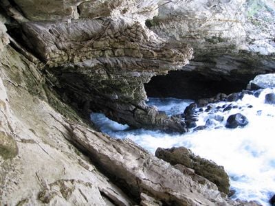
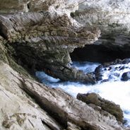
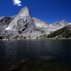
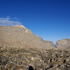
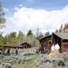
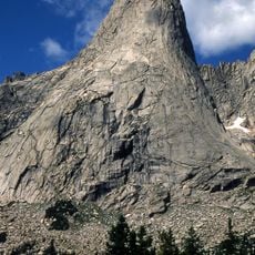
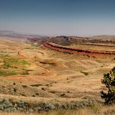
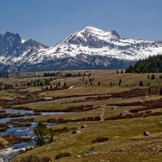
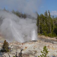
Sinks Canyon State Park is a natural preserve in the southern Wind River Mountains where the Middle Fork Popo Agie River cuts through limestone formations creating narrow canyons. The park includes hiking trails, picnic areas, and four year-round heated yurts with electricity for overnight stays.
The site received official status as a Wyoming State Park in 1971, protecting the limestone formations and natural resources for public access. This designation ensures the geological features remain preserved for future visitors to explore and study.
The river's name originates from the Crow language, reflecting the indigenous peoples who inhabited these mountains for generations. You can sense this connection to Native American history through the place names and the landscape itself.
The park offers easily accessible hiking trails of varying difficulty and picnic areas with basic facilities. The heated yurts provide comfortable overnight accommodations and appeal to visitors who want to explore the area without traditional tent camping.
At a spot called The Sinks, the river disappears completely into a limestone cavern and resurfaces about 400 meters downstream at a pool named The Rise. This natural phenomenon draws visitors fascinated by how water shapes rock over time.
Location: Wyoming
Inception: 1971
Website: https://wyoparks.wyo.gov/index.php/places-to-go/sinks-canyon
GPS coordinates: 42.75000,-108.80700
Latest update: December 6, 2025 17:40
Wyoming preserves geological sites that include thermal springs, canyons, and rock formations. The state protects historic locations such as forts, rock art, and dinosaur tracks. Devils Tower rises 1,267 feet (386 meters) above the terrain and represents a significant geological formation. Fossil...
South Pass
43.2 km
Fort Washakie
29.2 km
Popo Agie Wilderness
20.2 km
Wind River Peak
26.7 km
Miner's Delight
26.3 km
Pingora Peak
34.3 km
Red Canyon
15 km
Jackson Park Town Site Addition Brick Row
10.5 km
Atlantic Peak
21.8 kmMount Nystrom
26.6 km
Cathedral Peak
31.5 km
Raid Peak
45.5 km
War Bonnet Peak
33.4 kmTemple Peak
30.3 kmEast Temple Peak
28.9 km
BMU Bridge over Wind River
44.5 km
Mount Bonneville
45.6 km
Wind River Glacier
26.7 km
Silas Canyon
18.2 km
ELY Wind River Diversion Dam Bridge
54.2 kmBair Peak
36.2 km
Shoshone-Episcopal Mission
27.4 km
Warrior Peaks
34 km
United States Post Office and Courthouse
11.2 km
Lander Downtown Historic District
11.1 km
Grand Theatre
11.2 km
Steamboat Geyser
58.1 km
Acme Theatre
45.9 kmVisited this place? Tap the stars to rate it and share your experience / photos with the community! Try now! You can cancel it anytime.
Discover hidden gems everywhere you go!
From secret cafés to breathtaking viewpoints, skip the crowded tourist spots and find places that match your style. Our app makes it easy with voice search, smart filtering, route optimization, and insider tips from travelers worldwide. Download now for the complete mobile experience.
A unique approach to discovering new places❞
— Le Figaro
All the places worth exploring❞
— France Info
A tailor-made excursion in just a few clicks❞
— 20 Minutes