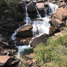
Red Canyon, National Natural Landmark canyon in Fremont County, Wyoming, US
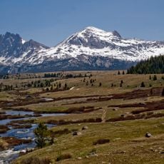
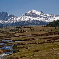
Red Canyon is a canyon in Fremont County, Wyoming, cut by Red Canyon Creek, which drains it and feeds the Little Popo Agie River at the northern end. Its walls expose the Phosphoria Formation of the Permian Period and the Chugwater Formation of the Triassic Period, and oxidized iron deposits in the rock give the canyon its red colour. Streams along the floor support wildlife in an otherwise arid region.
The canyon formed roughly 60 million years ago when uplift of the Wind River Range tilted ancient rock layers and water action carved through them. This slow carving exposed the geological layers we see today.
The canyon holds evidence of more than 10,000 years of human presence. The Shoshone and Washakie tribes used it as a transportation corridor between South Pass and the Wind River Basin. The name comes from the oxidized iron deposits that color the rock walls red.
Red Canyon lies along U.S. Highway 28 southeast of Lander, and the canyon floor is largely private land held by the Nature Conservancy as a working ranch, so visitors view it from the road and pullouts rather than walking the bottom. Red Canyon Creek runs through the canyon and joins the Little Popo Agie River at its northern end.
Red Canyon Creek runs along the canyon floor and joins the Little Popo Agie River at the northern end, a water source that supports wildlife in an otherwise arid region. The Nature Conservancy owns much of the floor and runs it as a working ranch.
The community of curious travelers
AroundUs brings together thousands of curated places, local tips, and hidden gems, enriched daily by 93,860 contributors worldwide.