Great Divide Basin

Log in to your account

AroundUs is a community-driven map of interesting places, built by curious explorers like you. It grows with every review, story, and photo you share.
Connect to save your favorite spots, contribute locations, and create personalized routes.
Continue with Google
Continue with Apple
Continue with X
Continue with Facebook
Continue with email
By continuing, you accept our Terms and Conditions and our Privacy Policy
Create an account
Add to collection
Map
Suggest a change
Share

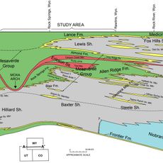
Great Divide Basin, Endorheic basin in Wyoming, United States

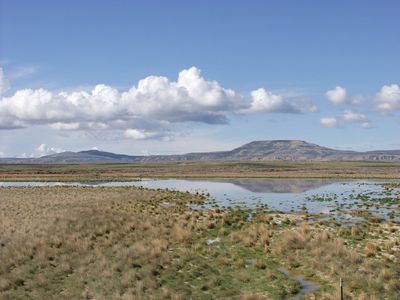
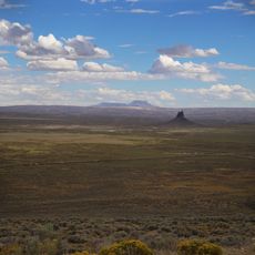
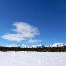
The Great Divide Basin is an endorheic basin in Wyoming, a high desert area spanning thousands of square miles at high elevation where water never reaches the ocean. Instead, water evaporates or pools in shallow lakes within the enclosed landscape.

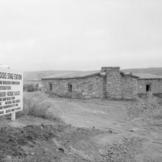
In the 1800s, pioneers deliberately avoided crossing this basin during westward expansion, choosing safer routes through South Pass and Bridger Pass instead. This choice kept many settlers away from the harsh terrain of the enclosed landscape.

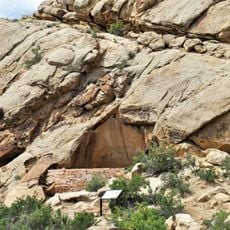
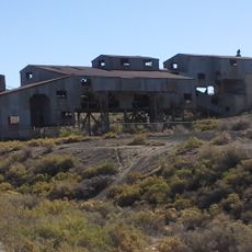
The region contains numerous petroglyphs and archaeological sites that reveal centuries of human presence in this challenging desert environment. Visitors can still discover these traces of earlier inhabitants at various locations today.

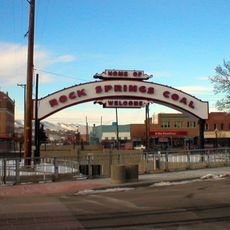
Interstate 80 crosses the basin from east to west, offering the main access route through the region. Wamsutter is the only significant town where travelers can find water, fuel, and other supplies they might need.

The Killpecker Dunes form a dynamic system of sand dunes that slowly shift eastward from Essex Mountain over time. During summer months, these shifting dunes create temporary seasonal marshes and shallow pools.

Location: Wyoming

GPS coordinates: 42.09306,-108.36111

Latest update: December 20, 2025 14:23

Photos
Around this place
Sinks Canyon State Park
United States of America

Sinks Canyon State Park

81.8 km
Popo Agie Wilderness
United States of America

Popo Agie Wilderness

91 km
Boars Tusk
United States of America

Boars Tusk

70.6 km
Frontier Formation
United States of America

Frontier Formation

64.4 km
Point of Rocks Stage Station State Historic Site
United States of America

Point of Rocks Stage Station State Historic Site

58.6 km
Red Canyon
United States of America

Red Canyon

68.9 km
Almond Formation
United States of America

Almond Formation

89.8 km
Jackson Park Town Site Addition Brick Row
United States of America

Jackson Park Town Site Addition Brick Row

87.3 km
Atlantic Peak
United States of America

Atlantic Peak

78.5 km
United States of America

Mount Nystrom

85.6 km
Saints Cyril and Methodius Catholic Church and Rectory
United States of America

Saints Cyril and Methodius Catholic Church and Rectory

90.5 km
Downtown Rock Springs Historic District
United States of America

Downtown Rock Springs Historic District

90.8 km
First National Bank Building
United States of America

First National Bank Building

90.5 km
Slovenski Dom
United States of America

Slovenski Dom

90.6 km
Reliance Tipple
United States of America

Reliance Tipple

83.8 km
City Hall
United States of America

City Hall

91 km
Silas Canyon
United States of America

Silas Canyon

78 km
Masonic Temple
United States of America

Masonic Temple

91 km
Reliance School and Gymnasium
United States of America

Reliance School and Gymnasium

84 km
United States Post Office and Courthouse
United States of America

United States Post Office and Courthouse

87.9 km
South Superior Union Hall
United States of America

South Superior Union Hall

62.3 km
Lander Downtown Historic District
United States of America

Lander Downtown Historic District

87.8 km
Gras House
United States of America

Gras House

90.5 km
Taliaferro House
United States of America

Taliaferro House

91.1 km
Rock Springs Elks' Lodge No. 624
United States of America

Rock Springs Elks' Lodge No. 624

90.9 km
Wardell Court Historic Residential District
United States of America

Wardell Court Historic Residential District

90.8 km
Grand Theatre
United States of America

Grand Theatre

87.8 km
Popo Agie Falls
United States of America

Popo Agie Falls

82.1 km
Show the full map
Reviews

Visited this place? Tap the stars to rate it and share your experience / photos with the community! Try now! You can cancel it anytime.

« Great Divide Basin - Endorheic basin in Wyoming, United States » is provided by Around Us (aroundus.com). Images and texts are derived from Wikimedia project under a Creative Commons license. You are allowed to copy, distribute, and modify copies of this page, under the conditions set by the license, as long as this note is clearly visible.

Discover hidden gems everywhere you go!

From secret cafés to breathtaking viewpoints, skip the crowded tourist spots and find places that match your style. Our app makes it easy with voice search, smart filtering, route optimization, and insider tips from travelers worldwide. Download now for the complete mobile experience.

Around Us App Screenshot

A unique approach to discovering new places

Le Figaro

All the places worth exploring

France Info

A tailor-made excursion in just a few clicks

20 Minutes