Frontier Formation

Log in to your account

AroundUs is a community-driven map of interesting places, built by curious explorers like you. It grows with every review, story, and photo you share.
Connect to save your favorite spots, contribute locations, and create personalized routes.
Continue with Google
Continue with Apple
Continue with X
Continue with Facebook
Continue with email
By continuing, you accept our Terms and Conditions and our Privacy Policy
Create an account

Frontier Formation

Add to collection
Map
Suggest a change
Share

Frontier Formation, Sedimentary geological formation in Wyoming, United States

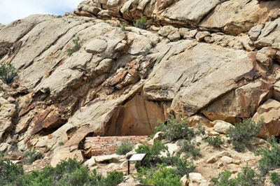
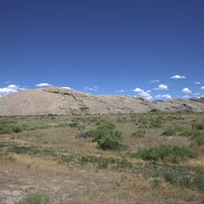
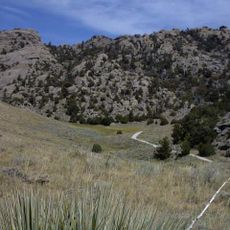
Frontier Formation is a sedimentary deposit in Wyoming composed of multiple rock layers including gray sandstone, dark shale, and oyster shell deposits. It extends across several counties and displays complex patterns of alternating yellow and gray sandstone layers with multiple coal seams.

The formation was officially named and documented by W.C. Knight in 1902, establishing its significance in scientific research. This naming was part of broader studies of Wyoming's natural resources during the early 20th century.

The name reflects the region's frontier heritage and the geological importance of understanding these rock layers. Visitors can observe how the strata reveal different environmental conditions that existed during the Late Cretaceous period.

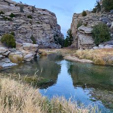
The site is located in Wyoming and can be visited for geological and paleontological study, with accessibility varying by season and weather conditions. Visitors should bring appropriate equipment for exploring rock formations and take local conditions into account.

The layers contain fossils of extinct dinosaurs such as Nodosaurus textilis and Stegopelta landerensis, allowing paleontologists to better understand the Cretaceous period. These discoveries make the formation an important window into the past that continues to be studied today.

GPS coordinates: 42.13333,-107.58333

Latest update: December 13, 2025 11:41

Photos
Around this place
Independence Rock
United States of America

Independence Rock

54.8 km
Great Divide Basin
United States of America

Great Divide Basin

64.4 km
Devil's Gate
United States of America

Devil's Gate

46.6 km
Martin's Cove
United States of America

Martin's Cove

45.6 km
Pathfinder Dam
United States of America

Pathfinder Dam

70.7 km
Fort Fred Steele State Historic Site
United States of America

Fort Fred Steele State Historic Site

65.8 km
Phosphoria Formation
United States of America

Phosphoria Formation

96 km
Elk Mountain
United States of America

Elk Mountain

103.8 km
United States of America

Bone Cabin Quarry

108.4 km
Tom Sun Ranch
United States of America

Tom Sun Ranch

45.8 km
George Ferris Mansion
United States of America

George Ferris Mansion

47.4 km
Seminoe State Park
United States of America

Seminoe State Park

59.3 km
Point of Rocks Stage Station State Historic Site
United States of America

Point of Rocks Stage Station State Historic Site

112.4 km
Pathfinder National Wildlife Refuge
United States of America

Pathfinder National Wildlife Refuge

63.4 km
Red Canyon
United States of America

Red Canyon

106.8 km
Castle Gardens Petroglyph Site
United States of America

Castle Gardens Petroglyph Site

88.6 km
Bishop House
United States of America

Bishop House

112.2 km
Parco Historic District
United States of America

Parco Historic District

55.1 km
Ryan Ranch
United States of America

Ryan Ranch

111.1 km
DMJ Pick Bridge
United States of America

DMJ Pick Bridge

88.1 km
Rawlins Residential Historic District
United States of America

Rawlins Residential Historic District

47.6 km
France Memorial United Presbyterian Church
United States of America

France Memorial United Presbyterian Church

47.9 km
DFU Elk Mountain Bridge
United States of America

DFU Elk Mountain Bridge

108.9 km
Downtown Rawlins Historic District
United States of America

Downtown Rawlins Historic District

47.9 km
DUX Bessemer Bend Bridge
United States of America

DUX Bessemer Bend Bridge

111.9 km
Acme Theatre
United States of America

Acme Theatre

119.1 km
Pathfinder Dam Historic District
United States of America

Pathfinder Dam Historic District

70.7 km
Lincoln Highway Bridge over Platte River
United States of America

Lincoln Highway Bridge over Platte River

67.6 km
Show the full map
Reviews

Visited this place? Tap the stars to rate it and share your experience / photos with the community! Try now! You can cancel it anytime.

« Frontier Formation - Sedimentary geological formation in Wyoming, United States » is provided by Around Us (aroundus.com). Images and texts are derived from Wikimedia project under a Creative Commons license. You are allowed to copy, distribute, and modify copies of this page, under the conditions set by the license, as long as this note is clearly visible.

Discover hidden gems everywhere you go!

From secret cafés to breathtaking viewpoints, skip the crowded tourist spots and find places that match your style. Our app makes it easy with voice search, smart filtering, route optimization, and insider tips from travelers worldwide. Download now for the complete mobile experience.

Around Us App Screenshot

A unique approach to discovering new places

Le Figaro

All the places worth exploring

France Info

A tailor-made excursion in just a few clicks

20 Minutes