Enable Location

We need your location to show you interesting places around you

Discover nearby places

Find interesting locations and hidden gems around you

Precise directions

Get accurate directions and distances to places

Your location is never shared with other users. It's only used when you tap the location button.

Devil's Gate

Log in to your account

Start exploring — it's free

Trusted by 61,649 travelers worldwide

Continue with Google
Continue with Apple
or

We will send you a code to connect

By continuing, you accept our Terms and Conditions and our Privacy Policy

Check your inbox

We've sent a pincode in your inbox. Please enter the code below.

Devil's Gate

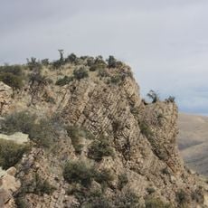
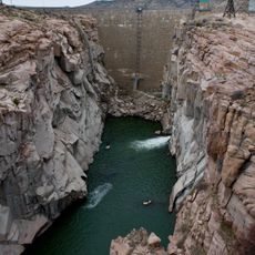
Devil's Gate, Natural rock formation and canyon in Natrona County, Wyoming.

Description

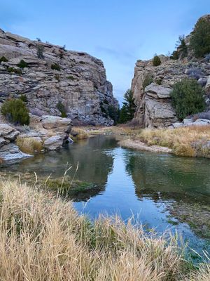
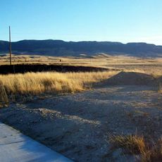
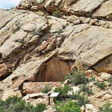
Devil's Gate is a natural rock cleft carved by the Sweetwater River through granite, creating a distinct passage through the landscape. The narrow opening became a landmark that countless travelers encountered as they journeyed westward across the continent.

History

The cleft formed over millions of years as the Sweetwater River eroded through granite bedrock. During the 1800s, thousands of westbound travelers relied on this landmark to guide them along established migration routes.

Culture

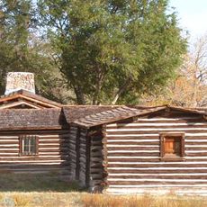
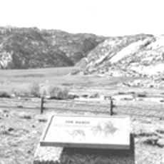
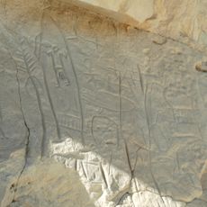
The passage held deep meaning for Native American groups who traveled through the region long before settlers arrived. For pioneer travelers, the narrow cut through rock became a place where people left marks and inscriptions to record their passage.

Practical

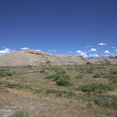
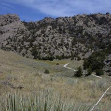
The site is reachable on foot via marked trails starting from nearby visitor centers and historical landmarks. Spring through fall offers the most comfortable conditions for exploring the cleft and surrounding canyon walls.

Did you know?

The canyon walls still display carved inscriptions and names left by travelers during the pioneer era, some dating back over 150 years. A burial ground nearby holds the remains of more than twenty pioneers who did not survive their journey.
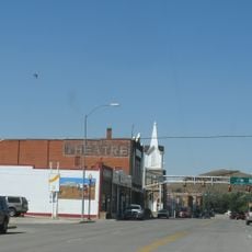
Location
GPS coordinates
42.44870,-107.21100
Latest update
December 7, 2025 19:23

AroundUs brings together thousands of curated places, local tips, and hidden gems, enriched daily by 60,000 contributors worldwide. Discover all places nearby (Wyoming).

Around this place
Independence Rock
United States of America

Independence Rock

8.4 km
Wyoming State Penitentiary
United States of America

Wyoming State Penitentiary

76 km
Martin's Cove
United States of America

Martin's Cove

2.3 km
Fort Caspar
United States of America

Fort Caspar

81.2 km
Natrona County High School
United States of America

Natrona County High School

84.4 km
Casper Mountain
United States of America

Casper Mountain

80.9 km
Pathfinder Dam
United States of America

Pathfinder Dam

29.4 km
Fort Fred Steele State Historic Site
United States of America

Fort Fred Steele State Historic Site

77.7 km
Phosphoria Formation
United States of America

Phosphoria Formation

66.9 km
Tom Sun Ranch
United States of America

Tom Sun Ranch

832 m
George Ferris Mansion
United States of America

George Ferris Mansion

73.2 km
Seminoe State Park
United States of America

Seminoe State Park

51.6 km
Frontier Formation
United States of America

Frontier Formation

46.6 km
Pathfinder National Wildlife Refuge
United States of America

Pathfinder National Wildlife Refuge

19.5 km
Dean Morgan Junior High School
United States of America

Dean Morgan Junior High School

84 km
Castle Gardens Petroglyph Site
United States of America

Castle Gardens Petroglyph Site

62.8 km
Bishop House
United States of America

Bishop House

74.3 km
Parco Historic District
United States of America

Parco Historic District

74.9 km
United States of America

Church of Saint Anthony

84.8 km
Midwest Oil Company Hotel
United States of America

Midwest Oil Company Hotel

85 km
Elks Lodge No. 1353
United States of America

Elks Lodge No. 1353

84.9 km
Rawlins Residential Historic District
United States of America

Rawlins Residential Historic District

73.2 km
France Memorial United Presbyterian Church
United States of America

France Memorial United Presbyterian Church

73.6 km
Downtown Rawlins Historic District
United States of America

Downtown Rawlins Historic District

73.6 km
DUX Bessemer Bend Bridge
United States of America

DUX Bessemer Bend Bridge

66.3 km
Casper Motor Company-Natrona Motor Company
United States of America

Casper Motor Company-Natrona Motor Company

85 km
South Wolcott Street Historic District
United States of America

South Wolcott Street Historic District

84.8 km
Pathfinder Dam Historic District
United States of America

Pathfinder Dam Historic District

29.4 km
Show the full map
« Devil's Gate - Natural rock formation and canyon in Natrona County, Wyoming » is provided by Around Us (aroundus.com). Images and texts are derived from Wikimedia project under a Creative Commons license. You are allowed to copy, distribute, and modify copies of this page, under the conditions set by the license, as long as this note is clearly visible.

Discover hidden gems everywhere you go!

From secret cafés to breathtaking viewpoints, skip the crowded tourist spots and find places that match your style. Our app makes it easy with voice search, smart filtering, route optimization, and insider tips from travelers worldwide. Download now for the complete mobile experience.

Around Us App Screenshot

A unique approach to discovering new places

Le Figaro

All the places worth exploring

France Info

A tailor-made excursion in just a few clicks

20 Minutes

Around Us
Travel Guide & Maps
Download

Send to your phone

QR Code
1

Open the camera app on your mobile.

2

Point at the QR code with your camera. A notification will appear.

3

Tap the notification to open the link.