Enable Location

We need your location to show you interesting places around you

Discover nearby places

Find interesting locations and hidden gems around you

Precise directions

Get accurate directions and distances to places

Your location is never shared with other users. It's only used when you tap the location button.

Fort Fred Steele State Historic Site

Log in to your account

Start exploring — it's free

Trusted by 62,200 travelers worldwide

Continue with Google
Continue with Apple
or

We will send you a code to connect

By continuing, you accept our Terms and Conditions and our Privacy Policy

Check your inbox

We've sent a pincode in your inbox. Please enter the code below.

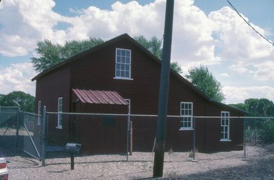
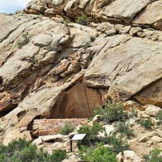
Fort Fred Steele State Historic Site, Military fort in Carbon County, United States.

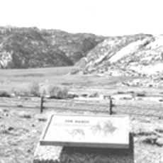
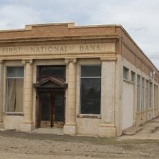
Fort Fred Steele was a military post built alongside the North Platte River and positioned near the path of the Union Pacific Railroad. Scattered across the site are foundation remains and partial structures that show where soldiers lived, worked, and managed daily operations.

The post was founded in 1868 to guard railroad workers and trains during the construction of the transcontinental line. Its role shifted over the following decades as the region evolved and military needs changed.

The fort served as a gathering place where soldiers, traders, and settlers encountered one another during the region's growth. This mixing of military and civilian life left a lasting mark on how transportation corridors developed across Wyoming Territory.

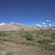
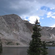
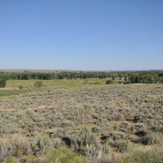
The site invites walking and exploration of the ruins across open ground near the river valley. The landscape is relatively flat and accessible, making it easy to move between the scattered remains.

The installation witnessed severe combat during regional conflicts of the 1870s when troops suffered heavy casualties in mountain campaigns. This period became central to the post's story as a place of struggle and sacrifice.

The community of curious travelers

AroundUs brings together thousands of curated places, local tips, and hidden gems, enriched daily by 60,000 contributors worldwide.

Start exploring
Location
GPS coordinates
41.77833,-106.94750
Latest update
December 11, 2025 11:02
Around this place
Independence Rock
United States of America

Independence Rock

81 km
Devil's Gate
United States of America

Devil's Gate

77.7 km
Martin's Cove
United States of America

Martin's Cove

79 km
Medicine Bow Peak
United States of America

Medicine Bow Peak

70.1 km
Como Bluff
United States of America

Como Bluff

74.8 km
Pathfinder Dam
United States of America

Pathfinder Dam

77.2 km
Elk Mountain
United States of America

Elk Mountain

38.5 km
United States of America

Bone Cabin Quarry

58.3 km
Tom Sun Ranch
United States of America

Tom Sun Ranch

77.3 km
George Ferris Mansion
United States of America

George Ferris Mansion

24.6 km
Seminoe State Park
United States of America

Seminoe State Park

31.8 km
Frontier Formation
United States of America

Frontier Formation

65.8 km
Pathfinder National Wildlife Refuge
United States of America

Pathfinder National Wildlife Refuge

79 km
Willis House
United States of America

Willis House

64.8 km
Parco Historic District
United States of America

Parco Historic District

14.1 km
Ryan Ranch
United States of America

Ryan Ranch

49.1 km
First National Bank of Rock River
United States of America

First National Bank of Rock River

80.5 km
DMJ Pick Bridge
United States of America

DMJ Pick Bridge

27.2 km
Rawlins Residential Historic District
United States of America

Rawlins Residential Historic District

24.2 km
France Memorial United Presbyterian Church
United States of America

France Memorial United Presbyterian Church

24.1 km
DML Butler Bridge
United States of America

DML Butler Bridge

63.5 km
Brooklyn Lodge
United States of America

Brooklyn Lodge

75.9 km
DFU Elk Mountain Bridge
United States of America

DFU Elk Mountain Bridge

45.5 km
Downtown Rawlins Historic District
United States of America

Downtown Rawlins Historic District

24.2 km
Centennial Work Center
United States of America

Centennial Work Center

84.2 km
Pathfinder Dam Historic District
United States of America

Pathfinder Dam Historic District

77.2 km
Lincoln Highway Bridge over Platte River
United States of America

Lincoln Highway Bridge over Platte River

3 km
Snowy Range Scenic Byway
United States of America

Snowy Range Scenic Byway

71.7 km
Show the full map
« Fort Fred Steele State Historic Site - Military fort in Carbon County, United States » is provided by Around Us (aroundus.com). Images and texts are derived from Wikimedia project under a Creative Commons license. You are allowed to copy, distribute, and modify copies of this page, under the conditions set by the license, as long as this note is clearly visible.

Discover hidden gems everywhere you go!

From secret cafés to breathtaking viewpoints, skip the crowded tourist spots and find places that match your style. Our app makes it easy with voice search, smart filtering, route optimization, and insider tips from travelers worldwide. Download now for the complete mobile experience.

Around Us App Screenshot

A unique approach to discovering new places

Le Figaro

All the places worth exploring

France Info

A tailor-made excursion in just a few clicks

20 Minutes

Around Us
Travel Guide & Maps
Download

Send to your phone

QR Code
1

Open the camera app on your mobile.

2

Point at the QR code with your camera. A notification will appear.

3

Tap the notification to open the link.