Enable Location

We need your location to show you interesting places around you

Discover nearby places

Find interesting locations and hidden gems around you

Precise directions

Get accurate directions and distances to places

Your location is never shared with other users. It's only used when you tap the location button.

Phosphoria Formation

Log in to your account

Start exploring — it's free

Trusted by 61,652 travelers worldwide

Continue with Google
Continue with Apple
or

We will send you a code to connect

By continuing, you accept our Terms and Conditions and our Privacy Policy

Check your inbox

We've sent a pincode in your inbox. Please enter the code below.

Phosphoria Formation

Phosphoria Formation, Permian geologic formation in western Idaho and Wyoming, United States.

Description

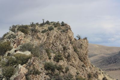
The Phosphoria Formation is a Permian-era rock layer spanning several western states, composed of phosphorite, black shale, chert, and limestone. The layers extend hundreds of meters deep beneath the landscape surface.

History

The formation developed about 280 million years ago during the Early Permian period, when marine sediments accumulated in a basin between the continental margin and the North American shelf. This sediment buildup created the rock layers visible today.

Culture

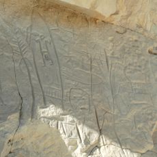
The formation holds fossils of brachiopods and crinoids along with teeth from the prehistoric shark Helicoprion, revealing what marine life looked like in ancient oceans. These remains help visitors understand the creatures that once inhabited these waters.

Practical

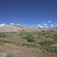
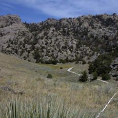
The formation lies beneath the surface and is visible in several locations through mining operations where phosphate rock is extracted. Visitors can best explore the deposit in mining regions like Idaho and Wyoming.

Did you know?

The formation is one of North America's largest oil sources, having generated more than 225 billion barrels of petroleum. This potential makes it one of the most important energy resources in the region.

Location
Location
Location
Location
Location
GPS coordinates
42.99570,-107.55120
Latest update
December 11, 2025 18:01

AroundUs brings together thousands of curated places, local tips, and hidden gems, enriched daily by 60,000 contributors worldwide. Discover all places nearby (Idaho).

Around this place
Independence Rock
United States of America

Independence Rock

65.7 km
Devil's Gate
United States of America

Devil's Gate

66.9 km
Martin's Cove
United States of America

Martin's Cove

65.5 km
Hot Springs State Park
United States of America

Hot Springs State Park

90.2 km
Wind River Canyon
United States of America

Wind River Canyon

77.5 km
Fort Caspar
United States of America

Fort Caspar

97.8 km
Wyoming Dinosaur Center
United States of America

Wyoming Dinosaur Center

89.2 km
Boysen Reservoir
United States of America

Boysen Reservoir

69 km
Pathfinder Dam
United States of America

Pathfinder Dam

81.8 km
Tom Sun Ranch
United States of America

Tom Sun Ranch

67.3 km
Frontier Formation
United States of America

Frontier Formation

96 km
Boysen State Park
United States of America

Boysen State Park

69.1 km
Pathfinder National Wildlife Refuge
United States of America

Pathfinder National Wildlife Refuge

73.3 km
Red Canyon
United States of America

Red Canyon

97.3 km
Jackson Park Town Site Addition Brick Row
United States of America

Jackson Park Town Site Addition Brick Row

98.2 km
Castle Gardens Petroglyph Site
United States of America

Castle Gardens Petroglyph Site

9 km
CQA Four Mile Bridge
United States of America

CQA Four Mile Bridge

85.5 km
BMU Bridge over Wind River
United States of America

BMU Bridge over Wind River

95.5 km
Alex Halone House
United States of America

Alex Halone House

89.2 km
Downtown Thermopolis Historic District
United States of America

Downtown Thermopolis Historic District

90 km
C. H. King Company and First National Bank of Shoshoni
United States of America

C. H. King Company and First National Bank of Shoshoni

52.5 km
United States Post Office and Courthouse
United States of America

United States Post Office and Courthouse

97.8 km
Lander Downtown Historic District
United States of America

Lander Downtown Historic District

97.9 km
DUX Bessemer Bend Bridge
United States of America

DUX Bessemer Bend Bridge

86.9 km
Ainsworth House
United States of America

Ainsworth House

91.2 km
Grand Theatre
United States of America

Grand Theatre

97.8 km
Acme Theatre
United States of America

Acme Theatre

68.1 km
Pathfinder Dam Historic District
United States of America

Pathfinder Dam Historic District

81.9 km
Show the full map
« Phosphoria Formation - Permian geologic formation in western Idaho and Wyoming, United States » is provided by Around Us (aroundus.com). Images and texts are derived from Wikimedia project under a Creative Commons license. You are allowed to copy, distribute, and modify copies of this page, under the conditions set by the license, as long as this note is clearly visible.

Discover hidden gems everywhere you go!

From secret cafés to breathtaking viewpoints, skip the crowded tourist spots and find places that match your style. Our app makes it easy with voice search, smart filtering, route optimization, and insider tips from travelers worldwide. Download now for the complete mobile experience.

Around Us App Screenshot

A unique approach to discovering new places

Le Figaro

All the places worth exploring

France Info

A tailor-made excursion in just a few clicks

20 Minutes

Around Us
Travel Guide & Maps
Download

Send to your phone

QR Code
1

Open the camera app on your mobile.

2

Point at the QR code with your camera. A notification will appear.

3

Tap the notification to open the link.