Almond Formation, Geological formation in Wyoming and Colorado, United States
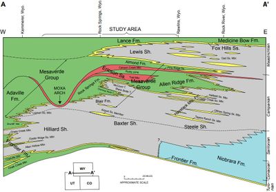
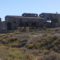
The Almond Formation is a Late Cretaceous geological layer spanning southwestern Wyoming and northern Colorado, composed of sandstones and shales in varying colors. The formation also holds significant coal and mineral deposits that have been extracted from the region.
This layer formed during the Late Cretaceous, roughly 74 to 71 million years ago, when the region lay beneath a vast inland sea. The retreat patterns of this sea left behind the different rock types visible today.
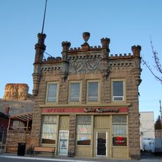
Fossils discovered here reveal what animals lived in this region millions of years ago. Local museums display these remains, helping visitors understand the prehistoric life that once existed in the area.
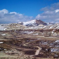
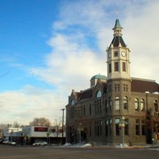
The best way to see this formation is to drive along regional highways or visit museums displaying rock samples and fossils from this period. Many geological sites are easily accessible, but check in advance for specific locations and visitor hours.
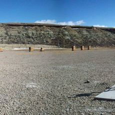
The formation stands out for its transition patterns showing how the environment shifted from ocean to drier land. These shifts are clearly visible in the different layers and tell the story of these geological changes.
Location: Wyoming
Location: Colorado
Part of: Mesaverde Group
GPS coordinates: 41.60694,-109.22611
Latest update: December 14, 2025 14:24
Flaming Gorge Reservoir
56.5 km
Flaming Gorge Dam
78.8 km
Flaming Gorge National Recreation Area
78.8 km
Seedskadee National Wildlife Refuge
57.9 km
Boars Tusk
39.7 km
Expedition Island
22.4 km
Point of Rocks Stage Station State Historic Site
36.9 km
Wilkins Peak
16 km
Granger Stage Station State Historic Site
61.9 km
Our Lady of Sorrows Catholic Church
2.7 km
Saints Cyril and Methodius Catholic Church and Rectory
1.8 km
ETR Big Island Bridge
45.8 km
Downtown Rock Springs Historic District
2.3 km
First National Bank Building
1.8 km
Slovenski Dom
1.8 km
Reliance Tipple
7.3 km
City Hall
2.5 km
Scott's Bottom Nature Area
21.6 km
Masonic Temple
2.5 km
Reliance School and Gymnasium
6.6 km
ETD Bridge over Green River
79.7 km
South Superior Union Hall
27.6 km
Swett Ranch
83.9 km
Gras House
2 km
Taliaferro House
2.9 km
Rock Springs Elks' Lodge No. 624
2.6 km
Green River Downtown Historic District
21.8 km
Wardell Court Historic Residential District
2.9 kmVisited this place? Tap the stars to rate it and share your experience / photos with the community! Try now! You can cancel it anytime.
Discover hidden gems everywhere you go!
From secret cafés to breathtaking viewpoints, skip the crowded tourist spots and find places that match your style. Our app makes it easy with voice search, smart filtering, route optimization, and insider tips from travelers worldwide. Download now for the complete mobile experience.
A unique approach to discovering new places❞
— Le Figaro
All the places worth exploring❞
— France Info
A tailor-made excursion in just a few clicks❞
— 20 Minutes