Enable Location

We need your location to show you interesting places around you

Discover nearby places

Find interesting locations and hidden gems around you

Precise directions

Get accurate directions and distances to places

Your location is never shared with other users. It's only used when you tap the location button.

Seedskadee National Wildlife Refuge

Log in to your account

Start exploring — it's free

Trusted by 62,247 travelers worldwide

Continue with Google
Continue with Apple
or

We will send you a code to connect

By continuing, you accept our Terms and Conditions and our Privacy Policy

Check your inbox

We've sent a pincode in your inbox. Please enter the code below.

Seedskadee National Wildlife Refuge

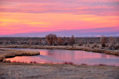
Seedskadee National Wildlife Refuge, National Wildlife Refuge in Sweetwater County, US.

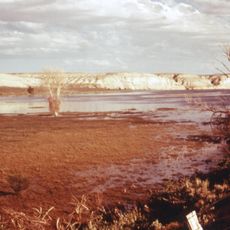
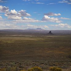
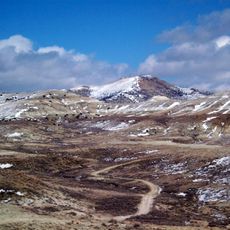
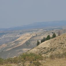
Seedskadee National Wildlife Refuge is a protected area along the Green River in southwestern Wyoming, combining river landscapes, forests, and open plains. The land offers different habitats that attract birds, mammals, and other animals, particularly during spring and fall migration periods.

The refuge was established in 1965 to protect important habitats and migration routes for wildlife. This creation was part of a national effort to preserve threatened ecosystems along river landscapes in the American West.

The refuge serves as an educational center where visitors learn about Wyoming's wildlife through guided tours and observation programs.

Visitors can explore on multiple trails for hiking, photography, and wildlife observation, with seasonal opportunities for fishing and hunting. Comfortable shoes and binoculars are helpful, and the best time to visit is spring and fall when many animals are traveling.

Over 300 animal species live here, including moose, pronghorn, elk, and rare swan populations. This variety makes the refuge a rare place where you can encounter so many different wildlife species in one location.

The community of curious travelers

AroundUs brings together thousands of curated places, local tips, and hidden gems, enriched daily by 60,000 contributors worldwide.

Start exploring
GPS coordinates
41.85690,-109.83700
Latest update
December 10, 2025 20:04
Around this place
Fontenelle Reservoir
United States of America

Fontenelle Reservoir

27.3 km
Names Hill
United States of America

Names Hill

45.9 km
J. C. Penney Historic District
United States of America

J. C. Penney Historic District

58.4 km
J.C. Penney House
United States of America

J.C. Penney House

58.4 km
Boars Tusk
United States of America

Boars Tusk

54.3 km
Expedition Island
United States of America

Expedition Island

48 km
Wilkins Peak
United States of America

Wilkins Peak

57.2 km
Almond Formation
United States of America

Almond Formation

57.9 km
Granger Stage Station State Historic Site
United States of America

Granger Stage Station State Historic Site

31.6 km
Our Lady of Sorrows Catholic Church
United States of America

Our Lady of Sorrows Catholic Church

59.5 km
Saints Cyril and Methodius Catholic Church and Rectory
United States of America

Saints Cyril and Methodius Catholic Church and Rectory

59.2 km
ETR Big Island Bridge
United States of America

ETR Big Island Bridge

13.3 km
Downtown Rock Springs Historic District
United States of America

Downtown Rock Springs Historic District

59.4 km
First National Bank Building
United States of America

First National Bank Building

59.2 km
Slovenski Dom
United States of America

Slovenski Dom

59.1 km
Reliance Tipple
United States of America

Reliance Tipple

57.2 km
City Hall
United States of America

City Hall

59.5 km
Scott's Bottom Nature Area
United States of America

Scott's Bottom Nature Area

52 km
Masonic Temple
United States of America

Masonic Temple

59.5 km
Reliance School and Gymnasium
United States of America

Reliance School and Gymnasium

57.9 km
Lincoln County Courthouse
United States of America

Lincoln County Courthouse

58.8 km
ETD Bridge over Green River
United States of America

ETD Bridge over Green River

22 km
Gras House
United States of America

Gras House

59.3 km
Taliaferro House
United States of America

Taliaferro House

59.8 km
Rock Springs Elks' Lodge No. 624
United States of America

Rock Springs Elks' Lodge No. 624

59.7 km
Green River Downtown Historic District
United States of America

Green River Downtown Historic District

47.8 km
Wardell Court Historic Residential District
United States of America

Wardell Court Historic Residential District

60.1 km
American Fossil Quarry
United States of America

American Fossil Quarry

69.5 km
Show the full map
« Seedskadee National Wildlife Refuge - National Wildlife Refuge in Sweetwater County, US » is provided by Around Us (aroundus.com). Images and texts are derived from Wikimedia project under a Creative Commons license. You are allowed to copy, distribute, and modify copies of this page, under the conditions set by the license, as long as this note is clearly visible.

Discover hidden gems everywhere you go!

From secret cafés to breathtaking viewpoints, skip the crowded tourist spots and find places that match your style. Our app makes it easy with voice search, smart filtering, route optimization, and insider tips from travelers worldwide. Download now for the complete mobile experience.

Around Us App Screenshot

A unique approach to discovering new places

Le Figaro

All the places worth exploring

France Info

A tailor-made excursion in just a few clicks

20 Minutes

Around Us
Travel Guide & Maps
Download

Send to your phone

QR Code
1

Open the camera app on your mobile.

2

Point at the QR code with your camera. A notification will appear.

3

Tap the notification to open the link.