Wilkins Peak

Log in to your account

AroundUs is a community-driven map of interesting places, built by curious explorers like you. It grows with every review, story, and photo you share.
Connect to save your favorite spots, contribute locations, and create personalized routes.
Continue with Google
Continue with Apple
Continue with X
Continue with Facebook
Continue with email
By continuing, you accept our Terms and Conditions and our Privacy Policy
Create an account
Add to collection
Map
Suggest a change
Share

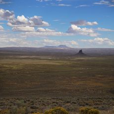
Wilkins Peak, Mountain summit in Sweetwater County, Wyoming, US

Wilkins Peak is a mountain summit in Sweetwater County located between Green River and Rock Springs. The peak reaches approximately 2300 meters in elevation and supports multiple towers for radio and television broadcasting throughout the region.

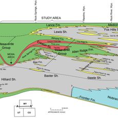
The peak formed during the Eocene epoch as part of the Green River Formation, which contains substantial deposits of oil shale and mineral salts. This geological foundation shaped the economic development of the surrounding area over millions of years.

The mountain supports local communication infrastructure, hosting FM radio stations KYCS, KFRZ, and KTME, along with television translators serving the regional population.

The mountain is accessible by a network of trails that offer different routes and difficulty levels for visitors. Information about trail conditions and the best times to visit can be found at the visitor center in Green River.

In 2003, an unusual incident occurred when a delivery vehicle collided with broadcasting equipment on the peak, interrupting local radio service to the region. This accident highlighted how vital the tower infrastructure is for communications in the area.

Location: Wyoming

GPS coordinates: 41.49580,-109.34735

Latest update: December 14, 2025 09:44

Photos
Around this place
Flaming Gorge Reservoir
United States of America

Flaming Gorge Reservoir

40.9 km
Flaming Gorge Dam
United States of America

Flaming Gorge Dam

65 km
Flaming Gorge National Recreation Area
United States of America

Flaming Gorge National Recreation Area

65 km
Seedskadee National Wildlife Refuge
United States of America

Seedskadee National Wildlife Refuge

57.2 km
Boars Tusk
United States of America

Boars Tusk

53.5 km
Expedition Island
United States of America

Expedition Island

10.8 km
Point of Rocks Stage Station State Historic Site
United States of America

Point of Rocks Stage Station State Historic Site

50.4 km
Almond Formation
United States of America

Almond Formation

16 km
Granger Stage Station State Historic Site
United States of America

Granger Stage Station State Historic Site

52.8 km
Our Lady of Sorrows Catholic Church
United States of America

Our Lady of Sorrows Catholic Church

14.3 km
Saints Cyril and Methodius Catholic Church and Rectory
United States of America

Saints Cyril and Methodius Catholic Church and Rectory

15 km
ETR Big Island Bridge
United States of America

ETR Big Island Bridge

44 km
Downtown Rock Springs Historic District
United States of America

Downtown Rock Springs Historic District

14.7 km
First National Bank Building
United States of America

First National Bank Building

15 km
Slovenski Dom
United States of America

Slovenski Dom

15 km
Reliance Tipple
United States of America

Reliance Tipple

23 km
Ute Mountain Fire Tower
United States of America

Ute Mountain Fire Tower

78.9 km
City Hall
United States of America

City Hall

14.5 km
Scott's Bottom Nature Area
United States of America

Scott's Bottom Nature Area

7.6 km
Masonic Temple
United States of America

Masonic Temple

14.4 km
Reliance School and Gymnasium
United States of America

Reliance School and Gymnasium

22.4 km
South Superior Union Hall
United States of America

South Superior Union Hall

43.4 km
Swett Ranch
United States of America

Swett Ranch

69.6 km
Gras House
United States of America

Gras House

15 km
Taliaferro House
United States of America

Taliaferro House

14.3 km
Rock Springs Elks' Lodge No. 624
United States of America

Rock Springs Elks' Lodge No. 624

14.6 km
Green River Downtown Historic District
United States of America

Green River Downtown Historic District

10.6 km
Wardell Court Historic Residential District
United States of America

Wardell Court Historic Residential District

14.7 km
Show the full map
Reviews

Visited this place? Tap the stars to rate it and share your experience / photos with the community! Try now! You can cancel it anytime.

« Wilkins Peak - Mountain summit in Sweetwater County, Wyoming, US » is provided by Around Us (aroundus.com). Images and texts are derived from Wikimedia project under a Creative Commons license. You are allowed to copy, distribute, and modify copies of this page, under the conditions set by the license, as long as this note is clearly visible.

Discover hidden gems everywhere you go!

From secret cafés to breathtaking viewpoints, skip the crowded tourist spots and find places that match your style. Our app makes it easy with voice search, smart filtering, route optimization, and insider tips from travelers worldwide. Download now for the complete mobile experience.

Around Us App Screenshot

A unique approach to discovering new places

Le Figaro

All the places worth exploring

France Info

A tailor-made excursion in just a few clicks

20 Minutes