See the monuments around you in AROpen chests in the app
Around Us is built for your phone — point your camera at the streets and discover the monuments and places around you in augmented reality.Around Us is built for your phone — chests unlock when you walk, explore and capture nearby places.
Wyoming preserves geological sites that include thermal springs, canyons, and rock formations. The state protects historic locations such as forts, rock art, and dinosaur tracks. Devils Tower rises 1,267 feet (386 meters) above the terrain and represents a significant geological formation. Fossil Butte conserves Eocene-era fossils in a former lakebed. Independence Rock served as a landmark for Oregon Trail travelers, while Fort Phil Kearny documents 1860s military history.
The landscape includes waterfalls such as Popo Agie Falls and Jenny Lake Hidden Falls, mountain passes like Sylvan Pass, and Wind River Canyon. The Bighorn Medicine Wheel consists of stones arranged in a pattern on Medicine Mountain. Castle Gardens and Legend Rock display prehistoric petroglyphs. Red Gulch preserves dinosaur tracks more than 100 million years old. Sinks Canyon demonstrates a geological phenomenon where the Popo Agie River disappears into limestone caverns. Nature parks, hot springs like Granite Hot Springs, and forest areas such as Medicine Bow-Routt National Forests provide access to these areas.
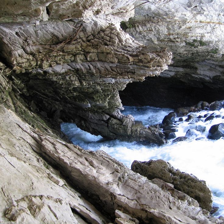
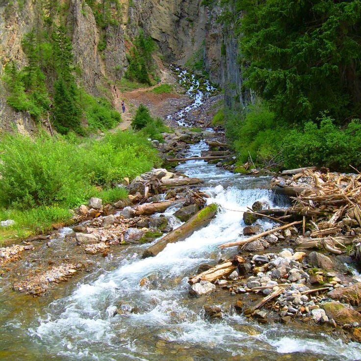
This canyon is known for its geological features where the Popo Agie River vanishes into a limestone cave system and reemerges approximately a quarter mile (400 meters) downstream. The water disappears into a natural pool called The Sinks and resurfaces at a spot named The Rise, with the underground flow taking about two hours. The canyon lies within the Shoshone National Forest and offers hiking trails along the river as well as access to the Wind River Mountains backcountry, where visitors can observe wildlife and explore the geological formations that characterize this part of Wyoming's landscape.
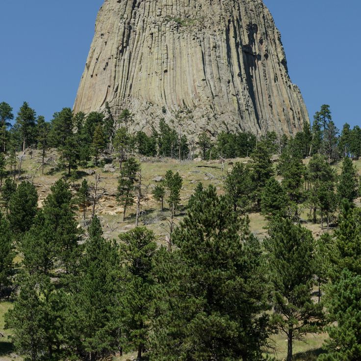
This 867-foot (264-meter) phonolite tower formed approximately 40 million years ago through volcanic activity and rises above the northeastern Wyoming prairie. The tower displays vertical columns created by cooling and contraction of molten rock. Established as a national monument in 1906, it was the first such designation in the United States and preserves both geological features and cultural significance for several Native American tribes.
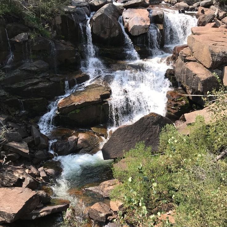
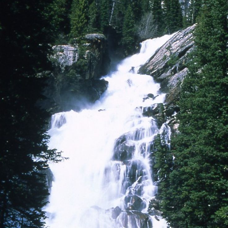
This waterfall drops over several granite steps in Shoshone National Forest and forms natural pools. Popo Agie Falls sits in a forested canyon and is accessible via a short hiking trail. The water from the Middle Fork Popo Agie River falls about 40 feet (12 meters) and creates habitat for trout.
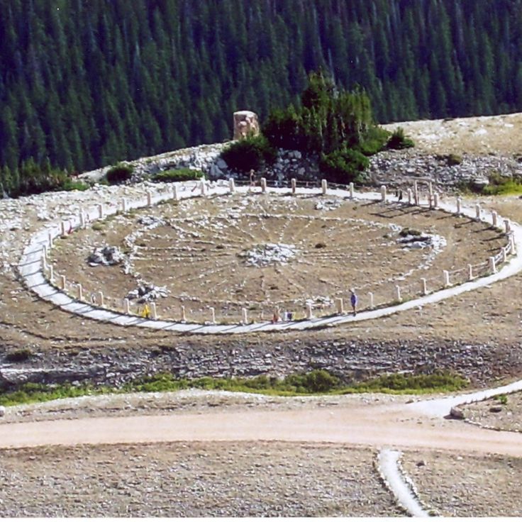
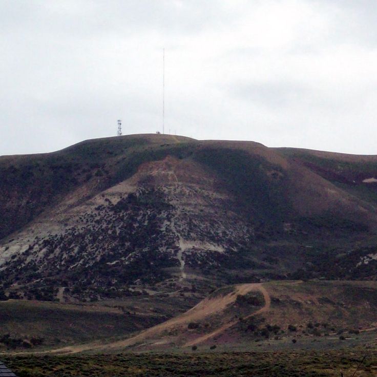
This stone structure consists of a circle with 28 spokes at 9500 feet (2900 meters) elevation and dates from pre-Columbian times. The Bighorn Medicine Wheel measures 80 feet (24 meters) in diameter and sits within Bighorn National Forest. The stones form a pattern that likely served astronomical or ceremonial purposes. Archaeologists date the site to several centuries before European settlement. The monument represents one of Wyoming's significant historical locations documenting the culture of indigenous peoples in this region.
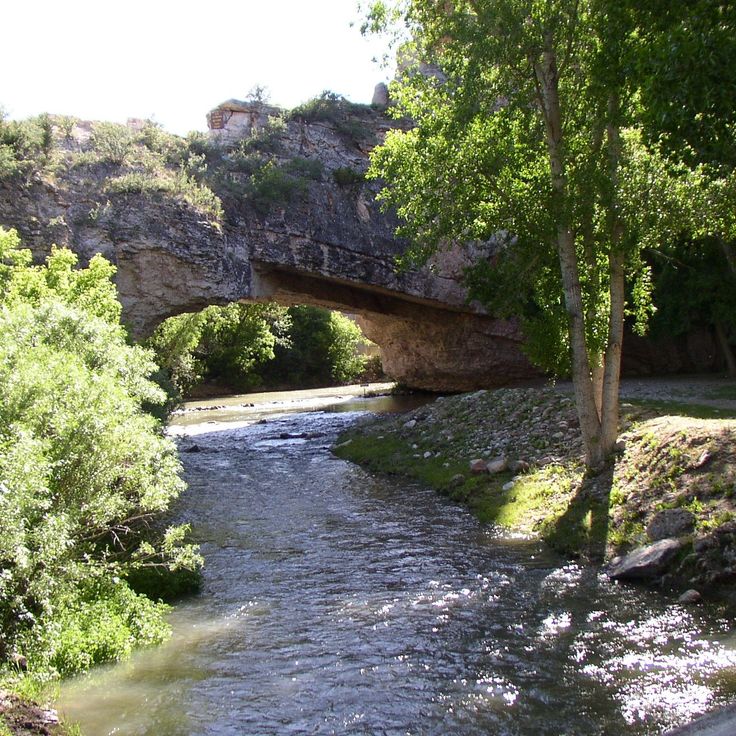
This natural sandstone bridge spans LaPrele Creek in a geologically notable formation. The red sandstone structure provides hiking trails and observation points that allow visitors to explore the erosion patterns and surrounding landscape, complementing Wyoming's collection of natural formations and historic sites.
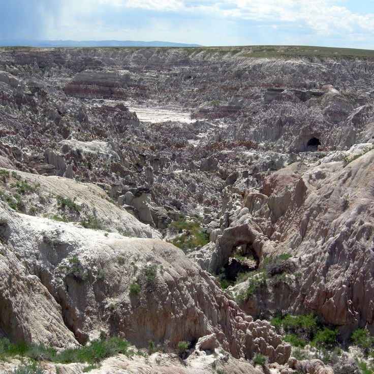
This erosion landscape covers 320 acres (130 hectares) and presents rock formations of red and gray stone. Geological markers explain the formation processes that shaped this unusual topography over thousands of years. Hell's Half Acre offers insight into the geological forces that created Wyoming's natural sites.
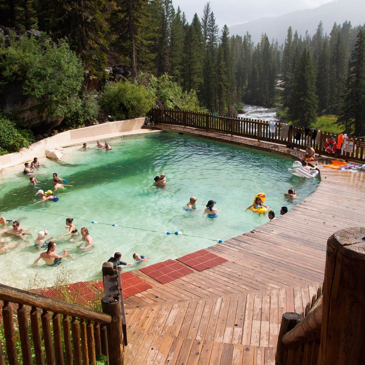
These natural springs in the Gros Ventre Range feed a swimming pool with 110°F (43°C) mineral water and add to Wyoming's collection of geological and historic sites with a thermal feature set within the mountain landscape.
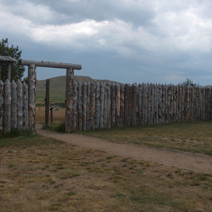
This military installation from 1866 protected travelers along the Bozeman Trail during the Indian Wars in Wyoming Territory. The museum displays military equipment, historical documents and artifacts from the fort's brief two-year operation before its abandonment in 1868, making it an important site for understanding frontier conflicts.
This state park covers 788 acres (319 hectares) and offers hiking trails, observation points and access to the North Platte River, reflecting Wyoming's natural diversity and the region's historical connections to the waterway that played a central role in the settlement of the American West.
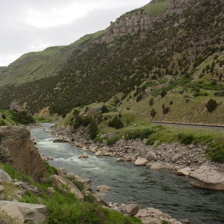
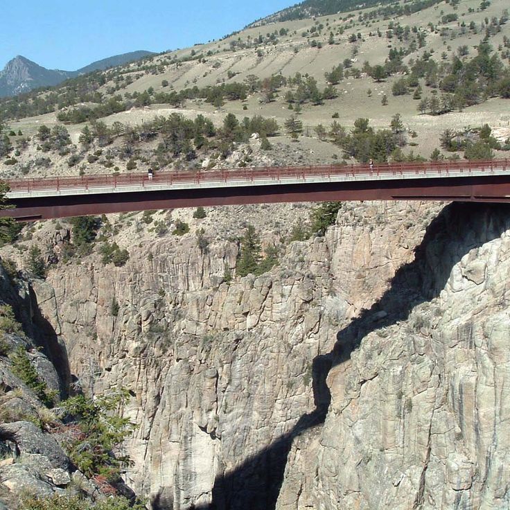
This canyon along the Wind River features geological formations with cliffs rising 2,700 feet (823 meters) and exposing three distinct rock layers: granite, sedimentary and volcanic stone. The Wind River has carved through these layers over millions of years, creating one of Wyoming's most significant geological sites. The drive through the canyon follows the river and provides access to the exposed rock formations. Several viewpoints along the road allow visitors to study the different layers and appreciate the depth of the cut.
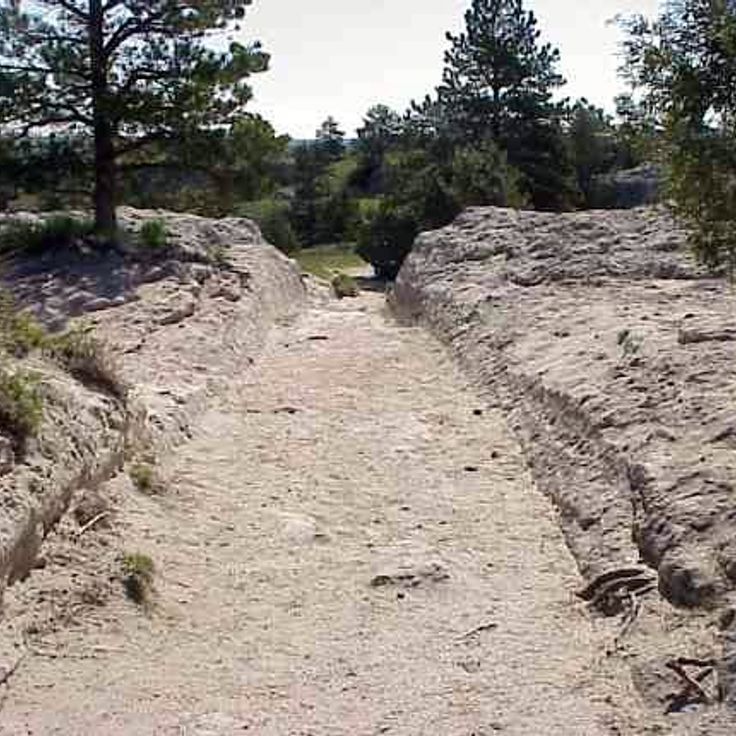
This historic site preserves deep grooves in sandstone created by heavy wagon traffic on the westward migration route between 1841 and 1869, offering physical evidence of westward migration during American expansion.
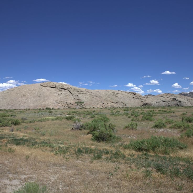
This granite formation contains more than 5000 names of pioneers who traveled the Oregon Trail between 1840 and 1870. The 130-foot (40-meter) rock served as an important landmark for emigrants heading west. The inscriptions were made using various methods including chisels, paint, and axle grease. The historic site preserves these records of westward expansion and allows visitors to trace the route followed by settlers crossing Wyoming.
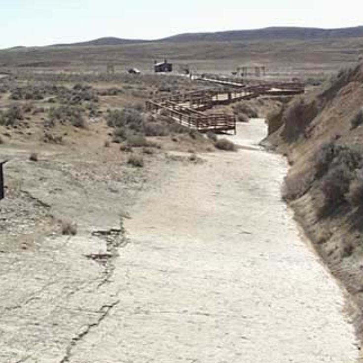
This paleontological site preserves over 1000 theropod footprints from the Middle Jurassic period, 167 million years ago, documenting prehistoric life in Wyoming. The tracks appear on an exposed limestone surface that once formed a coastal area, offering insight into the movement patterns and behavior of these bipedal dinosaurs.
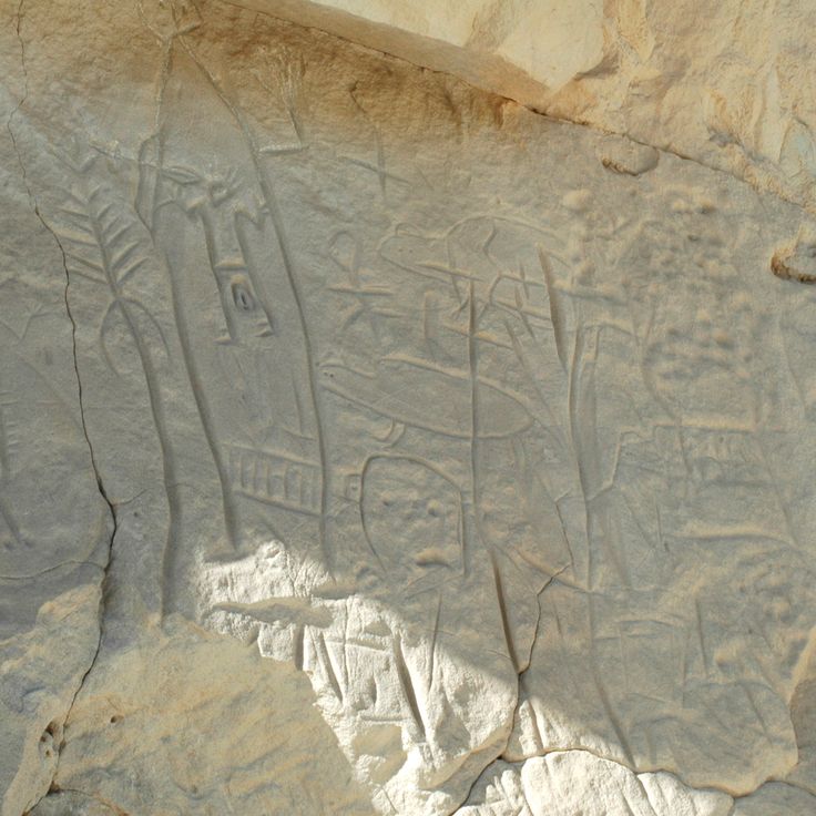
This remote archaeological site preserves hundreds of carved images created by the Fremont culture between 1000 and 1250 CE. Castle Gardens Petroglyph Site displays human figures, animals, and geometric patterns chiseled into distinctive sandstone formations. The site sits on a desert plateau northwest of Riverton and requires travel on unpaved roads that may demand four-wheel drive depending on weather conditions. A short walking path leads to the main concentrations of rock art, where visitors can examine the craftsmanship of these prehistoric hunter-gatherers at close range. The area covers roughly 10 hectares (25 acres) with scattered boulders and outcrops that served as canvases for these ancient artists.
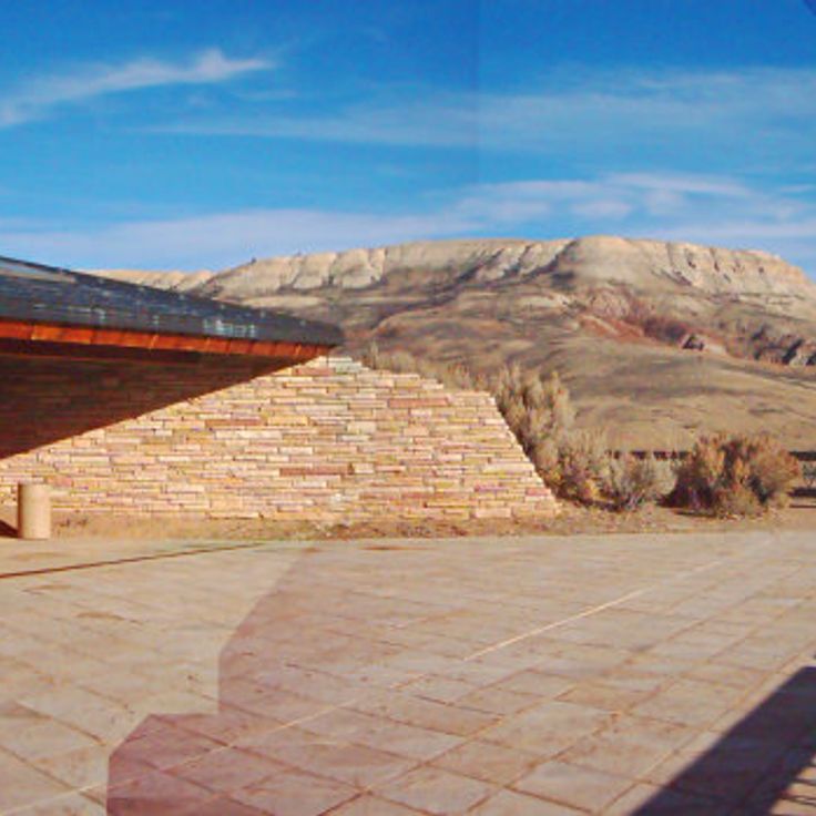
This national monument preserves fossils from an Eocene lake that existed 52 million years ago. The sedimentary layers contain fish, insects, plants and other organisms. Fossil Butte offers insight into Wyoming's prehistoric ecosystems. Visitors can explore the visitor center, where selected specimens are displayed, and walk trails that provide views of the geological formations.
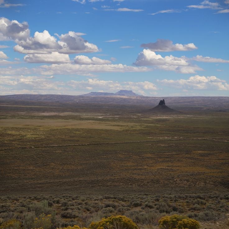
Boars Tusk is a 400-foot (122-meter) volcanic neck composed of solidified magmatic rock that rises from the Killpecker Sand Dunes in Wyoming. This geological formation represents one of the state's natural landmarks and demonstrates volcanic activity from past epochs. The isolated rock formation offers visitors insight into the geological processes that shaped Wyoming's terrain.
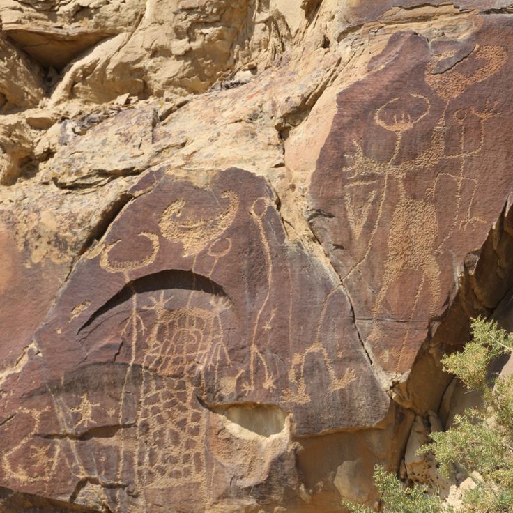
This prehistoric rock art site extends across 1,300 feet (400 meters) and displays petroglyphs created by indigenous peoples between 11,000 and 200 years ago, making it one of the most significant records of early human activity in Wyoming.
Laramie Peak is a 10,276-foot (3,132 m) granite summit with steep trails that pass through coniferous forests and alpine vegetation. This mountain stands as one of Wyoming's significant geological formations and serves as a prominent landmark in the region. The routes to the summit traverse different vegetation zones and provide insight into the geology and ecosystems of the range, which are characteristic of the higher elevations of the Rocky Mountains.
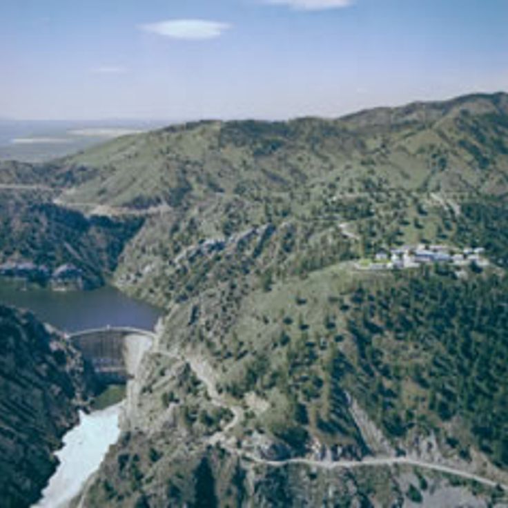
This 12,000-acre (4,856-hectare) state park surrounds Seminoe Reservoir between the Medicine Bow Range mountains and provides access to sand beaches, camping areas and water recreation. The reservoir was formed by damming the North Platte River and serves as a recreation area with opportunities for boating, fishing and hiking in the surrounding landscape of sagebrush steppes and rock formations.
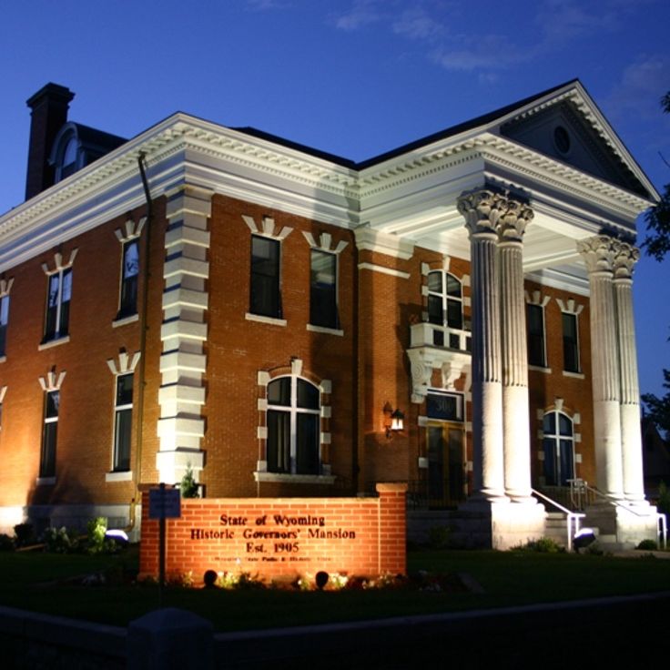
This Colonial Revival mansion was constructed in 1904 to serve as the official residence for Wyoming's state governors. The building housed thirteen gubernatorial administrations before it ceased functioning as the executive residence in 1976. The property documents over seven decades of Wyoming's political history and stands as an architectural record of the state's early governance. Tours provide insight into the living conditions and administrative practices of successive governors. The mansion displays period furnishings and personal items from its former occupants.
This steel arch bridge spans Sunlight Creek with a 250-foot (76-meter) reach at an elevation of 300 feet (91 meters), connecting the northern and southern sections of Chief Joseph Scenic Highway. Completed in 1938, the structure represents one of the historic transportation landmarks in Wyoming's mountain region and enables passage across a deep gorge in Shoshone National Forest. Sunlight Bridge provides views of the surrounding mountains and serves as a functional link between communities on the northern and southern edges of the Absaroka Range.
This mountain pass crosses Yellowstone National Park at 8,530 feet (2,600 meters) elevation, linking the eastern entrance to the Yellowstone Lake area through forested slopes that form part of Wyoming's geological and historical landscape.
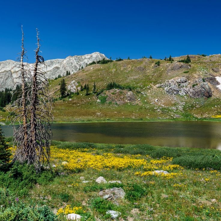
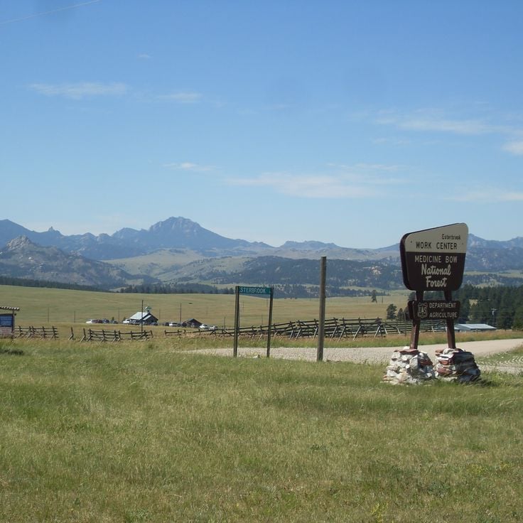
This federal forest spans 2.9 million acres (1.2 million hectares) across Wyoming and Colorado, featuring mountain ranges, grasslands, and approximately 1,200 miles (1,900 kilometers) of trails. The Medicine Bow-Routt National Forests provide access to diverse elevations and ecosystems, from alpine zones to extensive prairie areas, suitable for exploring Wyoming's natural and geological features.
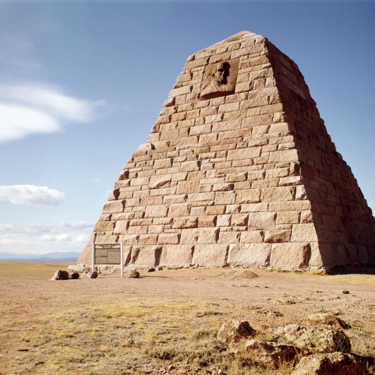
The Ames Monument is a granite pyramid built in 1882 in Albany County, standing 60 feet tall (18 meters). This monument honors railroad financiers Oliver and Oakes Ames, who contributed to the development of the Union Pacific Railroad. The pyramid sits off Interstate 80 in the prairie, marking the historic high point of the first transcontinental railroad line. Bronze relief portraits of the two brothers adorn the eastern and western sides of the structure.
This waterfall carries cold mountain snowmelt through granite formations and drops 100 feet (30 meters) into a forested canyon. Access is provided by a 2.5-mile (four-kilometer) trail or boat service across Jenny Lake, which operates during warmer months from May through September. The surrounding terrain consists of conifer forest and rock shaped by glacial retreat. The trail rises roughly 200 feet (60 meters) and passes through wooded landscape with views of the Teton Range ridgelines. This natural feature sits within Grand Teton National Park and demonstrates the hydrological and geological processes that have shaped this region for thousands of years.
This intermittent spring in Star Valley demonstrates a natural phenomenon where water emerges at approximately 285 liters (75 gallons) per second in cycles that repeat every 15 minutes. The spring's flow stops and resumes at regular intervals, a behavior controlled by underground geological conditions. The site represents one of the few places in Wyoming where such periodic water discharge can be observed, adding to the state's collection of geological features.
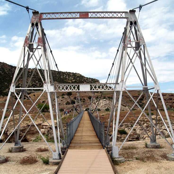
The Swinging Bridge extends 148 feet (45 meters) across the Big Horn River and stands among the historic structures that define Wyoming's heritage. This pedestrian bridge from 1916 connects both riverbanks and provides access to thermal springs and recreation areas in the region. The suspension bridge moves under the weight of visitors and offers views of the river and surrounding landscape of Hot Springs County.
These rock drawings depict hunting scenes, animals and people as part of Wyoming's extensive collection of prehistoric art. The petroglyphs were created by indigenous tribes more than 200 years ago and represent some of the most important cultural remains in the Rock Springs region. The artwork documents daily life and spiritual practices of the original inhabitants of this area.
This mountain route runs 29 miles through the Medicine Bow Mountains and reaches an elevation of 10,000 feet (3,048 meters). The road passes alpine lakes and provides access to Wyoming's high-elevation landscape with granite outcrops and conifer forests. During snow-free months, travelers use the route between Laramie and Saratoga to explore the mountain terrain.
This canyon is known for its geological features where the Popo Agie River vanishes into a limestone cave system and reemerges approximately a quarter mile (400 meters) downstream. The water disappears into a natural pool called The Sinks and resurfaces at a spot named The Rise, with the underground flow taking about two hours. The canyon lies within the Shoshone National Forest and offers hiking trails along the river as well as access to the Wind River Mountains backcountry, where visitors can observe wildlife and explore the geological formations that characterize this part of Wyoming's landscape.
This 867-foot (264-meter) phonolite tower formed approximately 40 million years ago through volcanic activity and rises above the northeastern Wyoming prairie. The tower displays vertical columns created by cooling and contraction of molten rock. Established as a national monument in 1906, it was the first such designation in the United States and preserves both geological features and cultural significance for several Native American tribes.
This waterfall drops over several granite steps in Shoshone National Forest and forms natural pools. Popo Agie Falls sits in a forested canyon and is accessible via a short hiking trail. The water from the Middle Fork Popo Agie River falls about 40 feet (12 meters) and creates habitat for trout.
This stone structure consists of a circle with 28 spokes at 9500 feet (2900 meters) elevation and dates from pre-Columbian times. The Bighorn Medicine Wheel measures 80 feet (24 meters) in diameter and sits within Bighorn National Forest. The stones form a pattern that likely served astronomical or ceremonial purposes. Archaeologists date the site to several centuries before European settlement. The monument represents one of Wyoming's significant historical locations documenting the culture of indigenous peoples in this region.
This natural sandstone bridge spans LaPrele Creek in a geologically notable formation. The red sandstone structure provides hiking trails and observation points that allow visitors to explore the erosion patterns and surrounding landscape, complementing Wyoming's collection of natural formations and historic sites.
This erosion landscape covers 320 acres (130 hectares) and presents rock formations of red and gray stone. Geological markers explain the formation processes that shaped this unusual topography over thousands of years. Hell's Half Acre offers insight into the geological forces that created Wyoming's natural sites.
These natural springs in the Gros Ventre Range feed a swimming pool with 110°F (43°C) mineral water and add to Wyoming's collection of geological and historic sites with a thermal feature set within the mountain landscape.
This military installation from 1866 protected travelers along the Bozeman Trail during the Indian Wars in Wyoming Territory. The museum displays military equipment, historical documents and artifacts from the fort's brief two-year operation before its abandonment in 1868, making it an important site for understanding frontier conflicts.
This state park covers 788 acres (319 hectares) and offers hiking trails, observation points and access to the North Platte River, reflecting Wyoming's natural diversity and the region's historical connections to the waterway that played a central role in the settlement of the American West.
This canyon along the Wind River features geological formations with cliffs rising 2,700 feet (823 meters) and exposing three distinct rock layers: granite, sedimentary and volcanic stone. The Wind River has carved through these layers over millions of years, creating one of Wyoming's most significant geological sites. The drive through the canyon follows the river and provides access to the exposed rock formations. Several viewpoints along the road allow visitors to study the different layers and appreciate the depth of the cut.
This historic site preserves deep grooves in sandstone created by heavy wagon traffic on the westward migration route between 1841 and 1869, offering physical evidence of westward migration during American expansion.
This granite formation contains more than 5000 names of pioneers who traveled the Oregon Trail between 1840 and 1870. The 130-foot (40-meter) rock served as an important landmark for emigrants heading west. The inscriptions were made using various methods including chisels, paint, and axle grease. The historic site preserves these records of westward expansion and allows visitors to trace the route followed by settlers crossing Wyoming.
This paleontological site preserves over 1000 theropod footprints from the Middle Jurassic period, 167 million years ago, documenting prehistoric life in Wyoming. The tracks appear on an exposed limestone surface that once formed a coastal area, offering insight into the movement patterns and behavior of these bipedal dinosaurs.
This remote archaeological site preserves hundreds of carved images created by the Fremont culture between 1000 and 1250 CE. Castle Gardens Petroglyph Site displays human figures, animals, and geometric patterns chiseled into distinctive sandstone formations. The site sits on a desert plateau northwest of Riverton and requires travel on unpaved roads that may demand four-wheel drive depending on weather conditions. A short walking path leads to the main concentrations of rock art, where visitors can examine the craftsmanship of these prehistoric hunter-gatherers at close range. The area covers roughly 10 hectares (25 acres) with scattered boulders and outcrops that served as canvases for these ancient artists.
This national monument preserves fossils from an Eocene lake that existed 52 million years ago. The sedimentary layers contain fish, insects, plants and other organisms. Fossil Butte offers insight into Wyoming's prehistoric ecosystems. Visitors can explore the visitor center, where selected specimens are displayed, and walk trails that provide views of the geological formations.
Boars Tusk is a 400-foot (122-meter) volcanic neck composed of solidified magmatic rock that rises from the Killpecker Sand Dunes in Wyoming. This geological formation represents one of the state's natural landmarks and demonstrates volcanic activity from past epochs. The isolated rock formation offers visitors insight into the geological processes that shaped Wyoming's terrain.
This prehistoric rock art site extends across 1,300 feet (400 meters) and displays petroglyphs created by indigenous peoples between 11,000 and 200 years ago, making it one of the most significant records of early human activity in Wyoming.
Laramie Peak is a 10,276-foot (3,132 m) granite summit with steep trails that pass through coniferous forests and alpine vegetation. This mountain stands as one of Wyoming's significant geological formations and serves as a prominent landmark in the region. The routes to the summit traverse different vegetation zones and provide insight into the geology and ecosystems of the range, which are characteristic of the higher elevations of the Rocky Mountains.
This 12,000-acre (4,856-hectare) state park surrounds Seminoe Reservoir between the Medicine Bow Range mountains and provides access to sand beaches, camping areas and water recreation. The reservoir was formed by damming the North Platte River and serves as a recreation area with opportunities for boating, fishing and hiking in the surrounding landscape of sagebrush steppes and rock formations.
This Colonial Revival mansion was constructed in 1904 to serve as the official residence for Wyoming's state governors. The building housed thirteen gubernatorial administrations before it ceased functioning as the executive residence in 1976. The property documents over seven decades of Wyoming's political history and stands as an architectural record of the state's early governance. Tours provide insight into the living conditions and administrative practices of successive governors. The mansion displays period furnishings and personal items from its former occupants.
This steel arch bridge spans Sunlight Creek with a 250-foot (76-meter) reach at an elevation of 300 feet (91 meters), connecting the northern and southern sections of Chief Joseph Scenic Highway. Completed in 1938, the structure represents one of the historic transportation landmarks in Wyoming's mountain region and enables passage across a deep gorge in Shoshone National Forest. Sunlight Bridge provides views of the surrounding mountains and serves as a functional link between communities on the northern and southern edges of the Absaroka Range.
This mountain pass crosses Yellowstone National Park at 8,530 feet (2,600 meters) elevation, linking the eastern entrance to the Yellowstone Lake area through forested slopes that form part of Wyoming's geological and historical landscape.
This federal forest spans 2.9 million acres (1.2 million hectares) across Wyoming and Colorado, featuring mountain ranges, grasslands, and approximately 1,200 miles (1,900 kilometers) of trails. The Medicine Bow-Routt National Forests provide access to diverse elevations and ecosystems, from alpine zones to extensive prairie areas, suitable for exploring Wyoming's natural and geological features.
The Ames Monument is a granite pyramid built in 1882 in Albany County, standing 60 feet tall (18 meters). This monument honors railroad financiers Oliver and Oakes Ames, who contributed to the development of the Union Pacific Railroad. The pyramid sits off Interstate 80 in the prairie, marking the historic high point of the first transcontinental railroad line. Bronze relief portraits of the two brothers adorn the eastern and western sides of the structure.
This waterfall carries cold mountain snowmelt through granite formations and drops 100 feet (30 meters) into a forested canyon. Access is provided by a 2.5-mile (four-kilometer) trail or boat service across Jenny Lake, which operates during warmer months from May through September. The surrounding terrain consists of conifer forest and rock shaped by glacial retreat. The trail rises roughly 200 feet (60 meters) and passes through wooded landscape with views of the Teton Range ridgelines. This natural feature sits within Grand Teton National Park and demonstrates the hydrological and geological processes that have shaped this region for thousands of years.
This intermittent spring in Star Valley demonstrates a natural phenomenon where water emerges at approximately 285 liters (75 gallons) per second in cycles that repeat every 15 minutes. The spring's flow stops and resumes at regular intervals, a behavior controlled by underground geological conditions. The site represents one of the few places in Wyoming where such periodic water discharge can be observed, adding to the state's collection of geological features.
The Swinging Bridge extends 148 feet (45 meters) across the Big Horn River and stands among the historic structures that define Wyoming's heritage. This pedestrian bridge from 1916 connects both riverbanks and provides access to thermal springs and recreation areas in the region. The suspension bridge moves under the weight of visitors and offers views of the river and surrounding landscape of Hot Springs County.
These rock drawings depict hunting scenes, animals and people as part of Wyoming's extensive collection of prehistoric art. The petroglyphs were created by indigenous tribes more than 200 years ago and represent some of the most important cultural remains in the Rock Springs region. The artwork documents daily life and spiritual practices of the original inhabitants of this area.
This mountain route runs 29 miles through the Medicine Bow Mountains and reaches an elevation of 10,000 feet (3,048 meters). The road passes alpine lakes and provides access to Wyoming's high-elevation landscape with granite outcrops and conifer forests. During snow-free months, travelers use the route between Laramie and Saratoga to explore the mountain terrain.