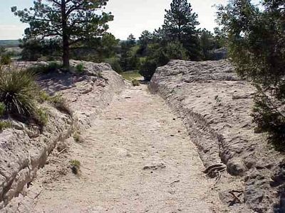
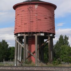
Oregon Trail Ruts, Historic wagon trail ruts in Guernsey, United States.
The Oregon Trail Ruts are deep indentations carved into sandstone that run along a ridge near the North Platte River. The grooves were created by repeated wagon passage over soft stone and show the lasting impact of thousands of people traveling the same route.
The ruts formed between 1841 and 1869 as thousands of wagons traveled westward across this ridge. The constant friction of iron wheels against the soft sandstone carved grooves that grew deeper with each passing season.
The ruts stand as a physical record of the westward movement, showing how thousands of families made this same journey toward new lives in unknown territory.
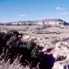
The site is located south of Guernsey and marked with interpretive signs explaining how the ruts formed. Visitors can walk the designated paths to view the grooves up close and understand why this location matters to American history.
The ruts remained protected from erosion because the sandstone sealed around the wheel marks, creating a natural barrier. This preservation has made them one of the deepest and most intact wagon trail remains in the region.
Location: Wyoming
Made from material: sandstone
Part of: Oregon Trail
GPS coordinates: 42.25611,-104.74944
Latest update: December 6, 2025 17:40
Wyoming preserves geological sites that include thermal springs, canyons, and rock formations. The state protects historic locations such as forts, rock art, and dinosaur tracks. Devils Tower rises 1,267 feet (386 meters) above the terrain and represents a significant geological formation. Fossil...
Fort Laramie
18.4 km
Ayres Natural Bridge Park
88.6 km
Register Cliff
3.4 km
Glendo State Park
38.5 km
Guernsey State Park
5.6 km
Glendo Reservoir
29.8 km
Robidoux Pass
88.8 km
Cheyenne-Black Hills Stage Route and Rawhide Buttes and Running Water Stage Stations
61.5 km
Hawk Springs State Recreation Area
76.1 km
Fort Mitchell, Nebraska
95.7 km
Signal Butte
86.4 km
Wheatland Reservoir
37.2 km
Swan Land and Cattle Company Headquarters
56.1 km
C and H Refinery Historic District
60.4 km
Jay Em Historic District
38.7 km
Lusk Water Tower
61.8 km
Christ Episcopal Church and Rectory
76.4 km
EWZ Bridge over East Channel of Laramie River
40.4 km
Morton Mansion
76.3 km
Douglas City Hall
76.4 km
Platte County Courthouse
27.9 km
Site of Ferdinand Branstetter Post No. 1, American Legion
70.4 km
Sioux County Courthouse
85.9 km
M.B. Quivey House
84.8 km
Douglas Railroad Interpretive Center
76.6 km
Guernsey Museum
4.5 km
Douglas Municipal Water Park
76.1 km
Agate Fossil Beds Visitor Center
85.6 kmVisited this place? Tap the stars to rate it and share your experience / photos with the community! Try now! You can cancel it anytime.
Discover hidden gems everywhere you go!
From secret cafés to breathtaking viewpoints, skip the crowded tourist spots and find places that match your style. Our app makes it easy with voice search, smart filtering, route optimization, and insider tips from travelers worldwide. Download now for the complete mobile experience.
A unique approach to discovering new places❞
— Le Figaro
All the places worth exploring❞
— France Info
A tailor-made excursion in just a few clicks❞
— 20 Minutes