Enable Location

We need your location to show you interesting places around you

Discover nearby places

Find interesting locations and hidden gems around you

Precise directions

Get accurate directions and distances to places

Your location is never shared with other users. It's only used when you tap the location button.

Glendo Reservoir

Log in to your account

Start exploring — it's free

Trusted by 62,248 travelers worldwide

Continue with Google
Continue with Apple
or

We will send you a code to connect

By continuing, you accept our Terms and Conditions and our Privacy Policy

Check your inbox

We've sent a pincode in your inbox. Please enter the code below.

Glendo Reservoir

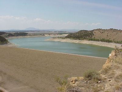
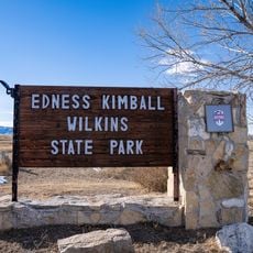
Glendo Reservoir, reservoir in Platte / Converse counties, Wyoming, USA

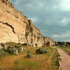
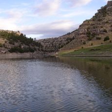
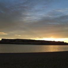
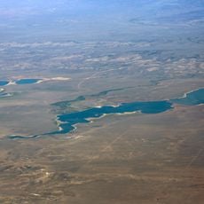
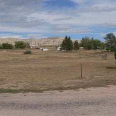
Glendo Reservoir is a large lake in Platte County, formed by the Glendo Dam across the North Platte River. The water stretches for miles along the river valley and is surrounded by open plains, gentle hills, and trees that line the shoreline.

The dam was constructed in the 1950s, with work beginning in 1954 and finishing in 1958, to enable irrigation and control flooding. The project was critical for developing agricultural use in the region and continues to operate today.

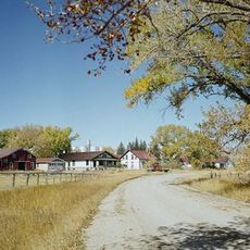
The reservoir serves as a social gathering place for the local community, where families and groups spend time outdoors together. The surrounding landscape of open plains and hills shapes the character of the region and remains central to how residents connect with their environment.

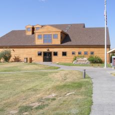
The area provides access to boat ramps, camping sites, and trails along the shore for various activities. It helps to visit an information office before heading out to learn about safety rules and the best spots for fishing or picnicking.

The dam generates electricity through two turbines that produce about 38 megawatts of clean power for the region. Many visitors are surprised by this hydroelectric function, as they come focused mainly on water and recreation activities.

The community of curious travelers

AroundUs brings together thousands of curated places, local tips, and hidden gems, enriched daily by 60,000 contributors worldwide.

Start exploring
Location
Elevation above the sea
1,418 m
GPS coordinates
42.47970,-104.94800
Latest update
February 7, 2026 11:00
Around this place
Fort Laramie
United States of America

Fort Laramie

45.3 km
Oregon Trail Ruts
United States of America

Oregon Trail Ruts

29.8 km
Como Bluff
United States of America

Como Bluff

111.4 km
Ayres Natural Bridge Park
United States of America

Ayres Natural Bridge Park

61.3 km
Register Cliff
United States of America

Register Cliff

32.4 km
Glendo State Park
United States of America

Glendo State Park

9 km
Guernsey State Park
United States of America

Guernsey State Park

24.5 km
Cheyenne-Black Hills Stage Route and Rawhide Buttes and Running Water Stage Stations
United States of America

Cheyenne-Black Hills Stage Route and Rawhide Buttes and Running Water Stage Stations

50.5 km
Hawk Springs State Recreation Area
United States of America

Hawk Springs State Recreation Area

105.8 km
Edness K. Wilkins State Park
United States of America

Edness K. Wilkins State Park

108.9 km
Wheatland Reservoir
United States of America

Wheatland Reservoir

54.1 km
Swan Land and Cattle Company Headquarters
United States of America

Swan Land and Cattle Company Headquarters

81.4 km
C and H Refinery Historic District
United States of America

C and H Refinery Historic District

50.5 km
Jay Em Historic District
United States of America

Jay Em Historic District

47.5 km
Lusk Water Tower
United States of America

Lusk Water Tower

52 km
Christ Episcopal Church and Rectory
United States of America

Christ Episcopal Church and Rectory

47.3 km
EWZ Bridge over East Channel of Laramie River
United States of America

EWZ Bridge over East Channel of Laramie River

51.1 km
Morton Mansion
United States of America

Morton Mansion

47.2 km
Douglas City Hall
United States of America

Douglas City Hall

47.3 km
Platte County Courthouse
United States of America

Platte County Courthouse

47.2 km
Site of Ferdinand Branstetter Post No. 1, American Legion
United States of America

Site of Ferdinand Branstetter Post No. 1, American Legion

73 km
Commerce Block
United States of America

Commerce Block

86.7 km
Sioux County Courthouse
United States of America

Sioux County Courthouse

90.4 km
M.B. Quivey House
United States of America

M.B. Quivey House

111 km
Douglas Railroad Interpretive Center
United States of America

Douglas Railroad Interpretive Center

47.6 km
Guernsey Museum
United States of America

Guernsey Museum

25.6 km
Agate Fossil Beds Visitor Center
United States of America

Agate Fossil Beds Visitor Center

99.9 km
Guernsey Reservoir
United States of America

Guernsey Reservoir

21 km
Show the full map
« Glendo Reservoir - reservoir in Platte / Converse counties, Wyoming, USA » is provided by Around Us (aroundus.com). Images and texts are derived from Wikimedia project under a Creative Commons license. You are allowed to copy, distribute, and modify copies of this page, under the conditions set by the license, as long as this note is clearly visible.

Discover hidden gems everywhere you go!

From secret cafés to breathtaking viewpoints, skip the crowded tourist spots and find places that match your style. Our app makes it easy with voice search, smart filtering, route optimization, and insider tips from travelers worldwide. Download now for the complete mobile experience.

Around Us App Screenshot

A unique approach to discovering new places

Le Figaro

All the places worth exploring

France Info

A tailor-made excursion in just a few clicks

20 Minutes

Around Us
Travel Guide & Maps
Download

Send to your phone

QR Code
1

Open the camera app on your mobile.

2

Point at the QR code with your camera. A notification will appear.

3

Tap the notification to open the link.