Enable Location

We need your location to show you interesting places around you

Discover nearby places

Find interesting locations and hidden gems around you

Precise directions

Get accurate directions and distances to places

Your location is never shared with other users. It's only used when you tap the location button.

Cheyenne-Black Hills Stage Route and Rawhide Buttes and Running Water Stage Stations

Log in to your account

Start exploring — it's free

Trusted by 62,250 travelers worldwide

Continue with Google
Continue with Apple
or

We will send you a code to connect

By continuing, you accept our Terms and Conditions and our Privacy Policy

Check your inbox

We've sent a pincode in your inbox. Please enter the code below.

Cheyenne-Black Hills Stage Route and Rawhide Buttes and Running Water Stage Stations

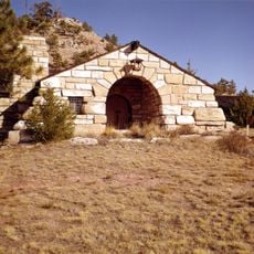
Cheyenne-Black Hills Stage Route and Rawhide Buttes and Running Water Stage Stations, Historic stagecoach route district in Wyoming, United States.

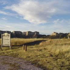
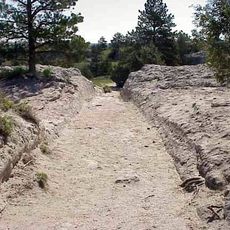
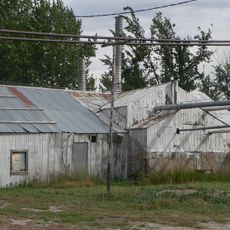
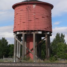
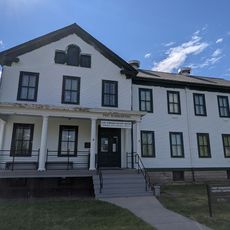
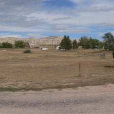
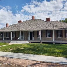
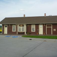
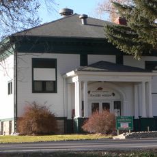
The Cheyenne-Black Hills Stage Route was a stagecoach line connecting Wyoming and South Dakota through two main stations, Running Water and Rawhide Buttes, located at crucial stops along the trail. The route crossed remote terrain with scattered station buildings, barns, and support structures positioned to serve travelers moving goods and people across the frontier.

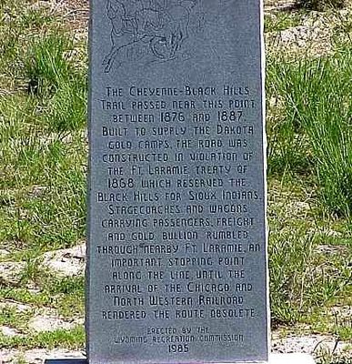
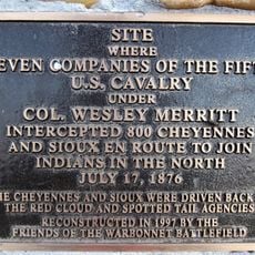
The route opened in 1876 to transport passengers, freight, and gold between Cheyenne and Deadwood across challenging terrain. Railroad expansion around 1887 eliminated the need for stagecoach travel, ending this transportation era and leaving the stations behind.

These stations were gathering places where travelers stopped to rest, eat, and exchange news during long journeys across the frontier. They represented lifelines of communication and commerce in a remote part of the expanding nation.

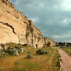
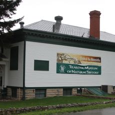
This historic district spans a wide area, so plan ahead to visit the scattered station sites and building remnants. Having information about specific locations beforehand helps you navigate the landscape and understand what each site represents.

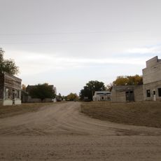
Gold mining activity flourished in this area during the 1880s, adding another layer of economic activity to the struggling stage route. This mining boom coincided with the rise of nearby Lusk as a railroad hub, drawing people and resources away from the old stagecoach stations.

The community of curious travelers

AroundUs brings together thousands of curated places, local tips, and hidden gems, enriched daily by 60,000 contributors worldwide.

Start exploring
Location
GPS coordinates
42.77000,-104.47500
Latest update
December 12, 2025 14:25
Around this place
Fort Robinson
United States of America

Fort Robinson

83.2 km
Toadstool Geologic Park
United States of America

Toadstool Geologic Park

73.6 km
Fort Laramie
United States of America

Fort Laramie

62.6 km
Hudson-Meng Bison Kill
United States of America

Hudson-Meng Bison Kill

70.2 km
Oregon Trail Ruts
United States of America

Oregon Trail Ruts

61.5 km
Register Cliff
United States of America

Register Cliff

61.1 km
Glendo State Park
United States of America

Glendo State Park

47.9 km
Guernsey State Park
United States of America

Guernsey State Park

57.2 km
Glendo Reservoir
United States of America

Glendo Reservoir

50.5 km
Trailside Museum of Natural History at Fort Robinson State Park
United States of America

Trailside Museum of Natural History at Fort Robinson State Park

83.3 km
C and H Refinery Historic District
United States of America

C and H Refinery Historic District

2.3 km
DSD Bridge over Cheyenne River
United States of America

DSD Bridge over Cheyenne River

77.7 km
Jay Em Historic District
United States of America

Jay Em Historic District

35.5 km
Lusk Water Tower
United States of America

Lusk Water Tower

2.8 km
Christ Episcopal Church and Rectory
United States of America

Christ Episcopal Church and Rectory

74.1 km
Morton Mansion
United States of America

Morton Mansion

74 km
Fort Robinson State Park
United States of America

Fort Robinson State Park

80.9 km
Douglas City Hall
United States of America

Douglas City Hall

74.3 km
Site of Ferdinand Branstetter Post No. 1, American Legion
United States of America

Site of Ferdinand Branstetter Post No. 1, American Legion

33.4 km
Sioux County Courthouse
United States of America

Sioux County Courthouse

49.3 km
Arthur and Ellen Colgan House
United States of America

Arthur and Ellen Colgan House

79.2 km
Fort Robinson Museum & History Center
United States of America

Fort Robinson Museum & History Center

83.2 km
Douglas Railroad Interpretive Center
United States of America

Douglas Railroad Interpretive Center

74.6 km
Army Theatre
United States of America

Army Theatre

83.3 km
Guernsey Museum
United States of America

Guernsey Museum

57.9 km
Agate Fossil Beds Visitor Center
United States of America

Agate Fossil Beds Visitor Center

71.8 km
Guernsey Reservoir
United States of America

Guernsey Reservoir

57.8 km
Warbonnet Battlefield Monument
United States of America

Warbonnet Battlefield Monument

63.4 km
Show the full map
« Cheyenne-Black Hills Stage Route and Rawhide Buttes and Running Water Stage Stations - Historic stagecoach route district in Wyoming, United States » is provided by Around Us (aroundus.com). Images and texts are derived from Wikimedia project under a Creative Commons license. You are allowed to copy, distribute, and modify copies of this page, under the conditions set by the license, as long as this note is clearly visible.

Discover hidden gems everywhere you go!

From secret cafés to breathtaking viewpoints, skip the crowded tourist spots and find places that match your style. Our app makes it easy with voice search, smart filtering, route optimization, and insider tips from travelers worldwide. Download now for the complete mobile experience.

Around Us App Screenshot

A unique approach to discovering new places

Le Figaro

All the places worth exploring

France Info

A tailor-made excursion in just a few clicks

20 Minutes

Around Us
Travel Guide & Maps
Download

Send to your phone

QR Code
1

Open the camera app on your mobile.

2

Point at the QR code with your camera. A notification will appear.

3

Tap the notification to open the link.