Enable Location

We need your location to show you interesting places around you

Discover nearby places

Find interesting locations and hidden gems around you

Precise directions

Get accurate directions and distances to places

Your location is never shared with other users. It's only used when you tap the location button.

Fort Laramie

Log in to your account

Start exploring — it's free

Trusted by 62,248 travelers worldwide

Continue with Google
Continue with Apple
or

We will send you a code to connect

By continuing, you accept our Terms and Conditions and our Privacy Policy

Check your inbox

We've sent a pincode in your inbox. Please enter the code below.

Fort Laramie

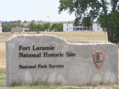
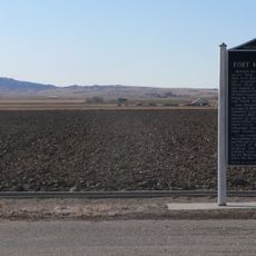
Fort Laramie, Military fort in Goshen County, Wyoming, United States.

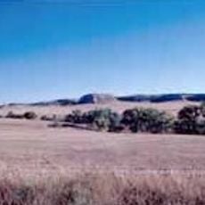
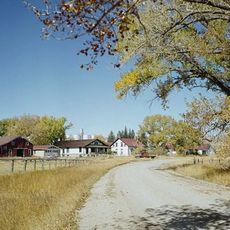
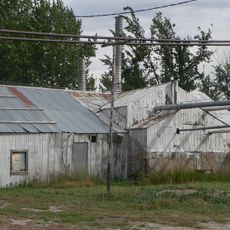
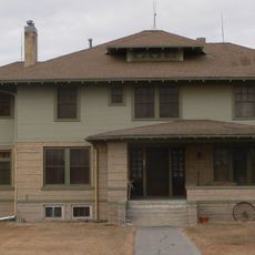
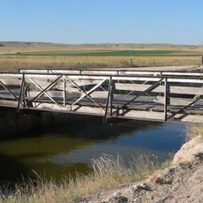
Fort Laramie sits where the North Platte and Laramie Rivers meet, displaying restored military buildings and structures from the 1800s frontier period. The site contains original architecture that shows how soldiers and civilian traders lived during westward expansion.

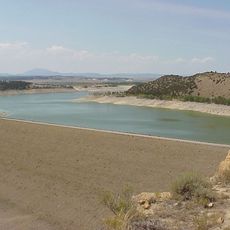
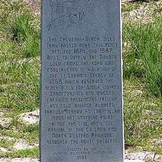
The site began in 1834 as a fur trading post and became a military fort in 1849 when the Army took control. This shift made it a key checkpoint for thousands of settlers moving westward across the continent.

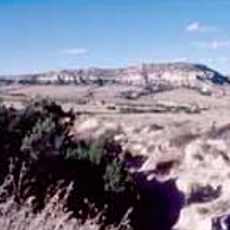
The fort served as a meeting ground where Native American nations and settlers negotiated crucial agreements about land and coexistence. These conversations shaped the relationship between the two groups during the expansion westward.

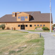
You can walk through the grounds at your own pace, with the visitor center offering exhibits and recorded guides to explain the buildings. Well-maintained paths connect the structures, making it easy to navigate without requiring a guided tour.

The oldest surviving military building in Wyoming, called Old Bedlam, once housed officer quarters and the fort's administrative center. Walking through it reveals how commanders and their staff actually worked and lived during the mid-1800s.

The community of curious travelers

AroundUs brings together thousands of curated places, local tips, and hidden gems, enriched daily by 60,000 contributors worldwide.

Start exploring
Location
GPS coordinates
42.20920,-104.53600
Latest update
December 8, 2025 19:59
Around this place
Oregon Trail Ruts
United States of America

Oregon Trail Ruts

18.4 km
Register Cliff
United States of America

Register Cliff

14.9 km
Glendo State Park
United States of America

Glendo State Park

53.3 km
Guernsey State Park
United States of America

Guernsey State Park

21.9 km
Glendo Reservoir
United States of America

Glendo Reservoir

45.3 km
Robidoux Pass
United States of America

Robidoux Pass

71.5 km
Cheyenne-Black Hills Stage Route and Rawhide Buttes and Running Water Stage Stations
United States of America

Cheyenne-Black Hills Stage Route and Rawhide Buttes and Running Water Stage Stations

62.6 km
Hawk Springs State Recreation Area
United States of America

Hawk Springs State Recreation Area

62.2 km
Riverside Park and Zoo
United States of America

Riverside Park and Zoo

80.7 km
Fort Mitchell, Nebraska
United States of America

Fort Mitchell, Nebraska

77.7 km
Signal Butte
United States of America

Signal Butte

69.4 km
Wheatland Reservoir
United States of America

Wheatland Reservoir

47.5 km
Swan Land and Cattle Company Headquarters
United States of America

Swan Land and Cattle Company Headquarters

55.7 km
C and H Refinery Historic District
United States of America

C and H Refinery Historic District

60.9 km
Jay Em Historic District
United States of America

Jay Em Historic District

31.2 km
Lusk Water Tower
United States of America

Lusk Water Tower

62.1 km
EWZ Bridge over East Channel of Laramie River
United States of America

EWZ Bridge over East Channel of Laramie River

53.7 km
Platte County Courthouse
United States of America

Platte County Courthouse

38.4 km
Site of Ferdinand Branstetter Post No. 1, American Legion
United States of America

Site of Ferdinand Branstetter Post No. 1, American Legion

62.2 km
Sioux County Courthouse
United States of America

Sioux County Courthouse

75.7 km
Marquis Opera House
United States of America

Marquis Opera House

81.9 km
M.B. Quivey House
United States of America

M.B. Quivey House

66.7 km
Scotts Bluff National Monument Visitor Center
United States of America

Scotts Bluff National Monument Visitor Center

80.6 km
Midwest Theater
United States of America

Midwest Theater

81.8 km
Scotts Bluff
United States of America

Scotts Bluff

80.7 km
Guernsey Museum
United States of America

Guernsey Museum

21 km
Interstate Canal Bridge
United States of America

Interstate Canal Bridge

77.8 km
Agate Fossil Beds Visitor Center
United States of America

Agate Fossil Beds Visitor Center

70.2 km
Show the full map
« Fort Laramie - Military fort in Goshen County, Wyoming, United States » is provided by Around Us (aroundus.com). Images and texts are derived from Wikimedia project under a Creative Commons license. You are allowed to copy, distribute, and modify copies of this page, under the conditions set by the license, as long as this note is clearly visible.

Discover hidden gems everywhere you go!

From secret cafés to breathtaking viewpoints, skip the crowded tourist spots and find places that match your style. Our app makes it easy with voice search, smart filtering, route optimization, and insider tips from travelers worldwide. Download now for the complete mobile experience.

Around Us App Screenshot

A unique approach to discovering new places

Le Figaro

All the places worth exploring

France Info

A tailor-made excursion in just a few clicks

20 Minutes

Around Us
Travel Guide & Maps
Download

Send to your phone

QR Code
1

Open the camera app on your mobile.

2

Point at the QR code with your camera. A notification will appear.

3

Tap the notification to open the link.