Enable Location

We need your location to show you interesting places around you

Discover nearby places

Find interesting locations and hidden gems around you

Precise directions

Get accurate directions and distances to places

Your location is never shared with other users. It's only used when you tap the location button.

Goshen County

Log in to your account

Start exploring — it's free

Trusted by 62,258 travelers worldwide

Continue with Google
Continue with Apple
or

We will send you a code to connect

By continuing, you accept our Terms and Conditions and our Privacy Policy

Check your inbox

We've sent a pincode in your inbox. Please enter the code below.

Goshen County, Administrative county in eastern Wyoming, United States

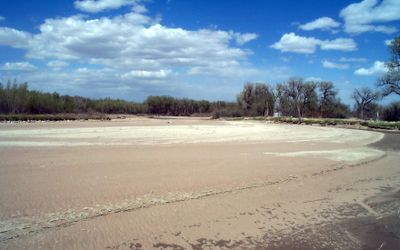
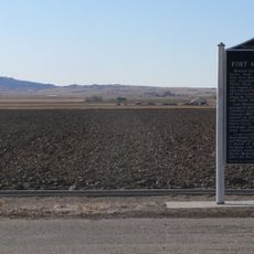
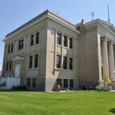
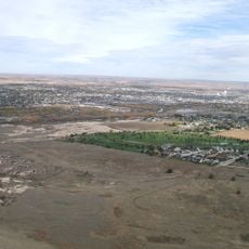
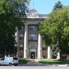
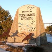
Goshen County is an administrative region in eastern Wyoming covering High Plains territory, with Torrington as its county seat and main population hub. The land stretches across expansive grasslands and agricultural areas.

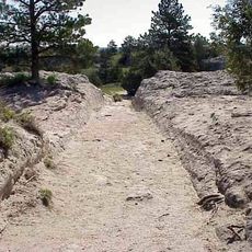
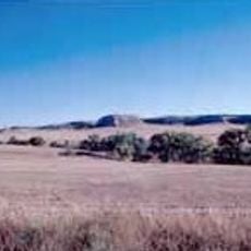
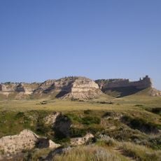
The region was named after Goshen Hole, a valley documented by explorer John C. Frémont in 1843 along the Oregon Trail. This geographic feature gave its name to the administrative division established later.

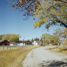
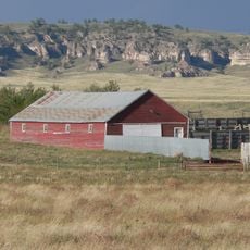
Cattle ranching and farming shape how people live and work across the territory, with ranches and farmsteads defining the landscape. These agricultural practices remain central to the community's identity and daily rhythm.

The region has a semi-arid climate with low annual rainfall and significant temperature swings between cold winters and hot summers. Visitors should prepare for variable weather and bring layers for changing conditions.

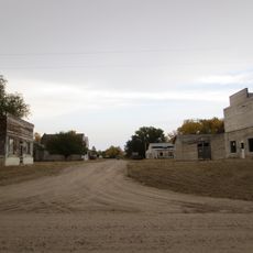
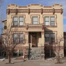
The territory passed through the hands of multiple powers before becoming part of the United States, creating a layered history visible in settlement patterns. This complex past shaped how communities developed across the landscape.

The community of curious travelers

AroundUs brings together thousands of curated places, local tips, and hidden gems, enriched daily by 60,000 contributors worldwide.

Start exploring
Location
Inception
1911
Capital city
Torrington
Shares border with
Niobrara County, Platte County, Laramie County, Banner County, Scotts Bluff County, Sioux County
GPS coordinates
42.09000,-104.36000
Latest update
December 7, 2025 20:26
Around this place
Fort Laramie
United States of America

Fort Laramie

19.7 km
Oregon Trail Ruts
United States of America

Oregon Trail Ruts

37.1 km
Register Cliff
United States of America

Register Cliff

33.8 km
Guernsey State Park
United States of America

Guernsey State Park

41.3 km
Glendo Reservoir
United States of America

Glendo Reservoir

65 km
Hawk Springs State Recreation Area
United States of America

Hawk Springs State Recreation Area

44.3 km
Fort Mitchell, Nebraska
United States of America

Fort Mitchell, Nebraska

58.6 km
Signal Butte
United States of America

Signal Butte

49.7 km
Wheatland Reservoir
United States of America

Wheatland Reservoir

56.9 km
Swan Land and Cattle Company Headquarters
United States of America

Swan Land and Cattle Company Headquarters

53.3 km
Jay Em Historic District
United States of America

Jay Em Historic District

41.3 km
EWZ Bridge over East Channel of Laramie River
United States of America

EWZ Bridge over East Channel of Laramie River

65.2 km
Platte County Courthouse
United States of America

Platte County Courthouse

49.2 km
Northfield Park Arboretum
United States of America

Northfield Park Arboretum

63.8 km
C.C. Hampton Homestead
United States of America

C.C. Hampton Homestead

62.5 km
Scotts Bluff County Courthouse
United States of America

Scotts Bluff County Courthouse

64.9 km
Fontenelle Apartment House
United States of America

Fontenelle Apartment House

63.5 km
Scottsbluff Carnegie Library
United States of America

Scottsbluff Carnegie Library

63.1 km
Marquis Opera House
United States of America

Marquis Opera House

63.1 km
M.B. Quivey House
United States of America

M.B. Quivey House

48.1 km
US Post Office-Scottsbluff
United States of America

US Post Office-Scottsbluff

63.3 km
Midwest Theater
United States of America

Midwest Theater

63 km
Scotts Bluff National Monument Visitor Center
United States of America

Scotts Bluff National Monument Visitor Center

61.4 km
Scotts Bluff
United States of America

Scotts Bluff

61.6 km
Guernsey Museum
United States of America

Guernsey Museum

40.3 km
Interstate Canal Bridge
United States of America

Interstate Canal Bridge

60.5 km
Agate Fossil Beds Visitor Center
United States of America

Agate Fossil Beds Visitor Center

63.6 km
Guernsey Reservoir
United States of America

Guernsey Reservoir

45.5 km
Show the full map
Administrative divisions
« Goshen County - Administrative county in eastern Wyoming, United States » is provided by Around Us (aroundus.com). Images and texts are derived from Wikimedia project under a Creative Commons license. You are allowed to copy, distribute, and modify copies of this page, under the conditions set by the license, as long as this note is clearly visible.

Discover hidden gems everywhere you go!

From secret cafés to breathtaking viewpoints, skip the crowded tourist spots and find places that match your style. Our app makes it easy with voice search, smart filtering, route optimization, and insider tips from travelers worldwide. Download now for the complete mobile experience.

Around Us App Screenshot

A unique approach to discovering new places

Le Figaro

All the places worth exploring

France Info

A tailor-made excursion in just a few clicks

20 Minutes

Around Us
Travel Guide & Maps
Download

Send to your phone

QR Code
1

Open the camera app on your mobile.

2

Point at the QR code with your camera. A notification will appear.

3

Tap the notification to open the link.