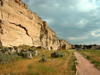
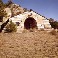
Register Cliff, Historic sandstone cliff near Guernsey, US
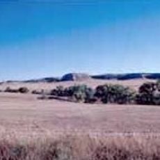
Register Cliff is a sandstone formation near Guernsey that rises about 100 feet (30 meters) above the North Platte River valley. The rock face displays horizontal limestone layers carved by river erosion and covered with countless names and dates from travelers.
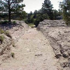
Starting in the 1840s, emigrants on the Oregon Trail carved their names into the soft stone as they traveled westward from Fort Laramie. The earliest recorded carving dates back to July 14, 1829, showing how this practice spanned decades.
The carvings at this site show how travelers marked their journey by leaving personal marks on the stone. You can see the handwriting and names vary greatly, reflecting different people and times who passed through this place.
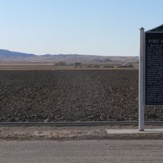
The site offers informational panels, picnic areas, restrooms, and protected viewpoints for observing the carvings at the base of the cliff. Visit during daylight hours when the sunlight helps illuminate the names carved into the soft rock face.
Three generations of the Unthank family carved their marks on the cliff across more than 80 years: T.H. in 1850, O.N. in 1869, and O.A. in 1931. This extended family story reveals how people returned to mark important moments in their lives at this location.
Location: Platte County
GPS coordinates: 42.24889,-104.70889
Latest update: December 9, 2025 18:42
Fort Laramie
14.9 km
Oregon Trail Ruts
3.4 km
Ayres Natural Bridge Park
91.7 km
Glendo State Park
41 km
Guernsey State Park
7.9 km
Glendo Reservoir
32.4 km
Robidoux Pass
85.6 km
Cheyenne-Black Hills Stage Route and Rawhide Buttes and Running Water Stage Stations
61.1 km
Hawk Springs State Recreation Area
73.4 km
Fort Mitchell, Nebraska
92.3 km
Signal Butte
83.2 km
Wheatland Reservoir
38.8 km
Swan Land and Cattle Company Headquarters
55.8 km
C and H Refinery Historic District
59.9 km
Jay Em Historic District
36.6 km
Lusk Water Tower
61.2 km
Christ Episcopal Church and Rectory
79.3 km
EWZ Bridge over East Channel of Laramie River
42.7 km
Morton Mansion
79.2 km
Douglas City Hall
79.3 km
Platte County Courthouse
29.5 km
Site of Ferdinand Branstetter Post No. 1, American Legion
68.4 km
Sioux County Courthouse
83.7 km
M.B. Quivey House
81.5 km
Douglas Railroad Interpretive Center
79.5 km
Guernsey Museum
6.8 km
Douglas Municipal Water Park
79 km
Agate Fossil Beds Visitor Center
82.6 kmVisited this place? Tap the stars to rate it and share your experience / photos with the community! Try now! You can cancel it anytime.
Discover hidden gems everywhere you go!
From secret cafés to breathtaking viewpoints, skip the crowded tourist spots and find places that match your style. Our app makes it easy with voice search, smart filtering, route optimization, and insider tips from travelers worldwide. Download now for the complete mobile experience.
A unique approach to discovering new places❞
— Le Figaro
All the places worth exploring❞
— France Info
A tailor-made excursion in just a few clicks❞
— 20 Minutes