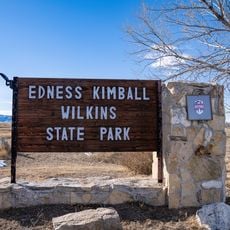
Ayres Natural Bridge Park, County park in Converse County, Wyoming, US.
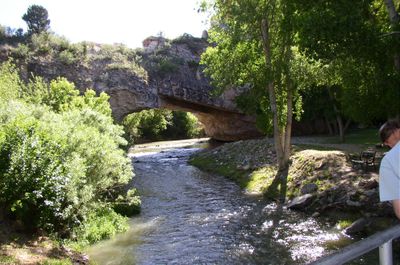
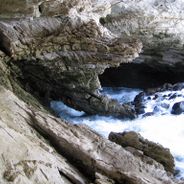
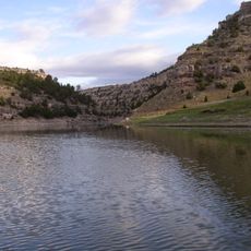
Ayres Natural Bridge Park contains a natural limestone arch that spans across LaPrele Creek within a deep red sandstone canyon. The formation extends roughly 100 feet in length and rises approximately 50 feet above the water's surface.
The park began in 1920 when Andrew and Edna Ayres donated their land to Converse County to protect the natural bridge. Decades later, the county expanded the grounds in 1977, transforming it into a public recreational area.
Early travelers on the Oregon Trail made detours to witness this natural wonder, establishing it as a destination long before modern tourism. The formation has remained a gathering place where people connect with the land's raw geological character.
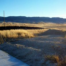
The park offers camping areas for smaller vehicles, picnic facilities, courts for recreation, and walking trails near the stream. Plan ahead with reservations and bring water and sturdy footwear to safely navigate the rocky terrain.
This natural formation ranks among only three in the entire United States where water continuously flows underneath an arching stone structure. The rarity of this geological condition makes the site exceptionally special compared to similar formations elsewhere.
Location: Converse County
GPS coordinates: 42.73410,-105.61200
Latest update: December 6, 2025 17:40
Wyoming preserves geological sites that include thermal springs, canyons, and rock formations. The state protects historic locations such as forts, rock art, and dinosaur tracks. Devils Tower rises 1,267 feet (386 meters) above the terrain and represents a significant geological formation. Fossil Butte conserves Eocene-era fossils in a former lakebed. Independence Rock served as a landmark for Oregon Trail travelers, while Fort Phil Kearny documents 1860s military history. The landscape includes waterfalls such as Popo Agie Falls and Jenny Lake Hidden Falls, mountain passes like Sylvan Pass, and Wind River Canyon. The Bighorn Medicine Wheel consists of stones arranged in a pattern on Medicine Mountain. Castle Gardens and Legend Rock display prehistoric petroglyphs. Red Gulch preserves dinosaur tracks more than 100 million years old. Sinks Canyon demonstrates a geological phenomenon where the Popo Agie River disappears into limestone caverns. Nature parks, hot springs like Granite Hot Springs, and forest areas such as Medicine Bow-Routt National Forests provide access to these areas.
Fort Caspar
63.1 km
Natrona County High School
59.8 km
Casper Mountain
57.5 km
Glendo State Park
55.2 km
Glendo Reservoir
61.3 km
National Historic Trails Interpretive Center
61 km
Edness K. Wilkins State Park
48 km
Dean Morgan Junior High School
59.8 km
Masonic Temple
59.6 km
Casper Downtown Historic District
59.6 km
Church of Saint Anthony
59.5 km
Midwest Oil Company Hotel
59.4 km
Christ Episcopal Church and Rectory
19 km
Morton Mansion
19.1 km
Elks Lodge No. 1353
59.4 km
Odd Fellows Building
59.6 km
Douglas City Hall
18.8 km
Roosevelt School
60 km
Ohio Oil Company Building
59.5 km
North Casper Clubhouse
58.9 km
Consolidated Royalty Building
59.6 km
Commerce Block
25.5 km
Ewing T. Kerr Federal Building and U.S. Courthouse
59.5 km
Tribune Building (Casper, Wyoming)
59.5 km
Casper Motor Company-Natrona Motor Company
59.8 km
South Wolcott Street Historic District
59.2 km
Douglas Railroad Interpretive Center
18.6 km
America Stadium Theatre
59.7 kmVisited this place? Tap the stars to rate it and share your experience / photos with the community! Try now! You can cancel it anytime.
Discover hidden gems everywhere you go!
From secret cafés to breathtaking viewpoints, skip the crowded tourist spots and find places that match your style. Our app makes it easy with voice search, smart filtering, route optimization, and insider tips from travelers worldwide. Download now for the complete mobile experience.
A unique approach to discovering new places❞
— Le Figaro
All the places worth exploring❞
— France Info
A tailor-made excursion in just a few clicks❞
— 20 Minutes