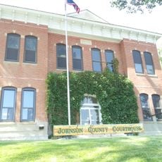
Fort Phil Kearny, Military fort in Johnson County, Wyoming, US
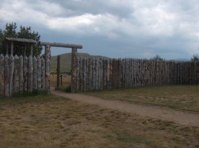
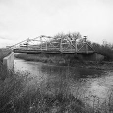
Fort Phil Kearny is a former military installation in Johnson County, Wyoming, now preserved as a memorial site. The grounds include a visitor center with exhibits, marked trails to former defensive positions, and views over the wide prairie landscape around it.
The army built this outpost in the heart of Lakota territory to protect travelers heading to Montana goldfields. After just two years, the army abandoned the site and Lakota forces burned the installation.
The installation takes its name from a Civil War general and now serves as a reminder of the conflicts between settlers and Lakota peoples. Visitors see reconstructed buildings and can imagine how soldiers and families lived here under constant threat.
The grounds are open to the public and invite walks between historical markers. The visitor center opens at set times and offers maps and information about nearby battle sites.
The garrison never numbered more than a few hundred men, though thousands of Lakota, Cheyenne, and Arapaho controlled the surrounding area. Today, white stones on the hills mark the spots where soldiers fell during the fights.
Location: Wyoming
Inception: July 13, 1866
Website: https://fortphilkearny.com
GPS coordinates: 44.53220,-106.82600
Latest update: December 5, 2025 22:29
Wyoming preserves geological sites that include thermal springs, canyons, and rock formations. The state protects historic locations such as forts, rock art, and dinosaur tracks. Devils Tower rises 1,267 feet (386 meters) above the terrain and represents a significant geological formation. Fossil...
Cloud Peak
32.3 km
Bomber Mountain
32 km
Cloud Peak Wilderness
33.4 km
Sheridan Inn
32.1 km
Black Tooth Mountain
31.5 km
Jim Gatchell Memorial Museum
22.8 km
TA Ranch Historic District
43.8 kmCloud Peak Glacier
31.7 km
Trail End
32 km
Mount Woolsey
31.5 kmBighorn Peak
38.2 km
Sheridan County Courthouse
31 km
Holland House
22.5 kmDarton Peak
36.3 km
Union Congregational Church and Parsonage
23.2 km
Main Street Historic District
23 km
Clearmont Jail
37.4 km
ECR Kooi Bridge
46.8 km
EDL Peloux Bridge
23.3 km
ECS Bridge over Big Goose Creek
33.6 km
Johnson County Courthouse
22.9 km
Holy Name Catholic School
31 km
Mount View
30.8 km
Odd Fellows Hall
21 km
St. Peter's Episcopal Church
31.3 km
Robinson-Smith House
30.8 km
Dry Creek Petrified Tree Environmental Education Area
30.9 km
Tyrrel Ranger Station
51 kmVisited this place? Tap the stars to rate it and share your experience / photos with the community! Try now! You can cancel it anytime.
Discover hidden gems everywhere you go!
From secret cafés to breathtaking viewpoints, skip the crowded tourist spots and find places that match your style. Our app makes it easy with voice search, smart filtering, route optimization, and insider tips from travelers worldwide. Download now for the complete mobile experience.
A unique approach to discovering new places❞
— Le Figaro
All the places worth exploring❞
— France Info
A tailor-made excursion in just a few clicks❞
— 20 Minutes