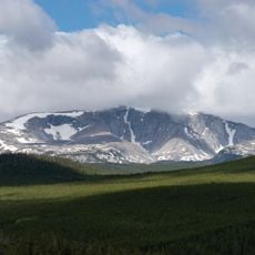
Bomber Mountain, Mountain summit in Big Horn County, Wyoming, US
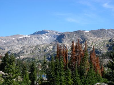
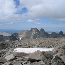
Bomber Mountain is a summit in the Cloud Peak Wilderness area of Big Horn County, Wyoming, rising above 12,000 feet (3,660 m) with rocky terrain, boulder fields, and alpine vegetation. Several small lakes sit along the trail system below the peak.
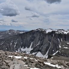
A B-17 bomber crashed near the summit in 1943 during a training flight, leaving wreckage across the mountainside that has never been removed. The crash gave the mountain its current name.
The mountain's name comes directly from the aircraft that went down here, and a memorial plaque near the summit marks the spot in honor of the crew. Hikers who reach the top often pause there for a moment before continuing.
Starting the hike early in the morning gives you the best chance to reach the summit and descend before afternoon storms roll in, which can develop fast at this elevation. Good waterproof gear and sturdy footwear are needed for the rocky approach.
The wreckage of the B-17 is still scattered across the boulders near the summit and has sometimes been used by experienced hikers as an informal landmark on the upper trail. Metal fragments remain visible among the rocks decades after the crash.
The community of curious travelers
AroundUs brings together thousands of curated places, local tips, and hidden gems, enriched daily by 60,000 contributors worldwide.