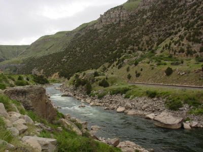
Wind River Canyon, Natural canyon in Wyoming, US.
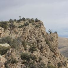
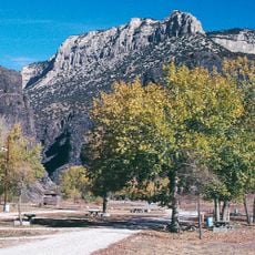
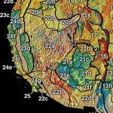
Wind River Canyon is a deep gorge carved by a river flowing between vertical rock walls that tower above the narrow valley floor. The layered rock faces display different colors and textures that tell the story of the area's geological formation.
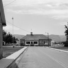
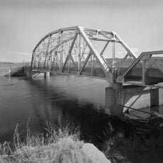
A major highway was cut through the canyon in the early 1920s, replacing an older mountain pass route that travelers had used before. This new road made the area far more accessible and changed how people moved through the region.
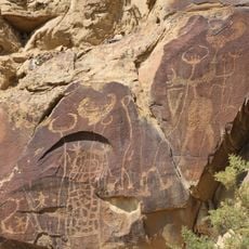
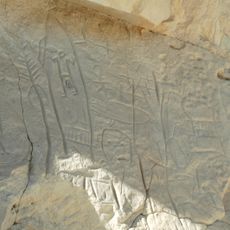
The canyon runs through lands important to the Shoshone and Arapaho peoples, who have deep connections to this river valley. Visitors may notice areas that remain central to tribal life and spiritual practices.
Driving through the canyon on the main road is straightforward, with viewpoints marked along the way where you can stop safely. Pull off at these marked spots to take in the views and read information about the geology and landscape.
At one location where the canyon reaches its northern point, the river itself changes its name to a different one. Many travelers pass through without realizing this unusual geographical transition is marked on the landscape.
Location: Wyoming
GPS coordinates: 43.52030,-108.18000
Latest update: December 6, 2025 16:04
Wyoming preserves geological sites that include thermal springs, canyons, and rock formations. The state protects historic locations such as forts, rock art, and dinosaur tracks. Devils Tower rises 1,267 feet (386 meters) above the terrain and represents a significant geological formation. Fossil Butte conserves Eocene-era fossils in a former lakebed. Independence Rock served as a landmark for Oregon Trail travelers, while Fort Phil Kearny documents 1860s military history. The landscape includes waterfalls such as Popo Agie Falls and Jenny Lake Hidden Falls, mountain passes like Sylvan Pass, and Wind River Canyon. The Bighorn Medicine Wheel consists of stones arranged in a pattern on Medicine Mountain. Castle Gardens and Legend Rock display prehistoric petroglyphs. Red Gulch preserves dinosaur tracks more than 100 million years old. Sinks Canyon demonstrates a geological phenomenon where the Popo Agie River disappears into limestone caverns. Nature parks, hot springs like Granite Hot Springs, and forest areas such as Medicine Bow-Routt National Forests provide access to these areas.
Hot Springs State Park
15 km
Wyoming Dinosaur Center
13.8 km
Boysen Reservoir
11.5 km
Fort Washakie
80.8 km
Legend Rock
45.9 km
Phosphoria Formation
77.5 km
Boysen State Park
11.5 km
Wyoming Basin
55.3 km
Castle Gardens Petroglyph Site
80.2 km
Anchor Dam
54.4 km
CQA Four Mile Bridge
9.4 km
BMU Bridge over Wind River
59.9 km
State Bath house
14.8 km
EFP Bridge over Owl Creek
25.6 km
ELY Wind River Diversion Dam Bridge
70.7 km
Worland House
57.7 km
Alex Halone House
13.6 km
Shoshone-Episcopal Mission
83.6 km
Downtown Thermopolis Historic District
14.2 km
Star Plunge
14.7 km
C. H. King Company and First National Bank of Shoshoni
32.2 km
EJP County Line Bridge
82.2 km
Rairden Bridge
78 km
Ainsworth House
76.2 km
Kirby Jail and Town Hall
31.7 km
Washakie Museum & Cultural Center
58.5 km
Steamboat Geyser
64.3 km
Acme Theatre
57.7 kmReviews
Visited this place? Tap the stars to rate it and share your experience / photos with the community! Try now! You can cancel it anytime.
Discover hidden gems everywhere you go!
From secret cafés to breathtaking viewpoints, skip the crowded tourist spots and find places that match your style. Our app makes it easy with voice search, smart filtering, route optimization, and insider tips from travelers worldwide. Download now for the complete mobile experience.
A unique approach to discovering new places❞
— Le Figaro
All the places worth exploring❞
— France Info
A tailor-made excursion in just a few clicks❞
— 20 Minutes