Enable Location

We need your location to show you interesting places around you

Discover nearby places

Find interesting locations and hidden gems around you

Precise directions

Get accurate directions and distances to places

Your location is never shared with other users. It's only used when you tap the location button.

Boysen Reservoir

Log in to your account

Start exploring — it's free

Trusted by 62,247 travelers worldwide

Continue with Google
Continue with Apple
or

We will send you a code to connect

By continuing, you accept our Terms and Conditions and our Privacy Policy

Check your inbox

We've sent a pincode in your inbox. Please enter the code below.

Boysen Reservoir

Boysen Reservoir, lake in Fremont County, Wyoming, United States of America

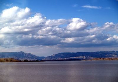
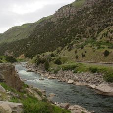
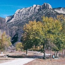
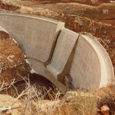
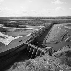
Boysen Reservoir is a large body of water created by a concrete dam across the Wind River in a deep canyon. The water spreads out behind the structure with rocky cliffs on both sides, and the surrounding landscape is dry and open with scattered trees near the shore.

Planning for the reservoir began in the 1930s and 1940s as a response to spring flooding and irrigation needs in the region. Construction started in 1947 and finished in 1952, after which water filled the basin and a power plant began operating to serve the local area.

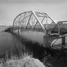
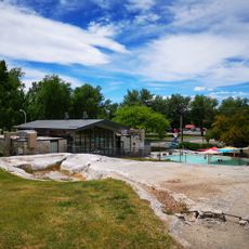
The name comes from Asmus Boysen, who had previously built a small dam on the same river for power generation. Today, visitors come to fish, boat, and enjoy the quiet shores with rocky cliffs and open views of the water.

The area has a State Park with camping facilities, boat rental, and fishing supplies available at the marina. The shoreline offers multiple accessible spots to stop and rest, though some side roads are rough and require slow driving to reach quieter areas.

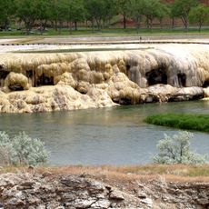
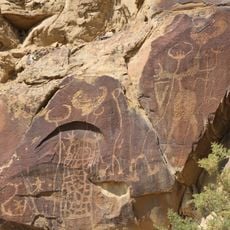
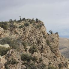
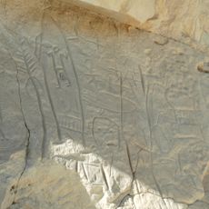
The Wind River carved through multiple layers of rock over millions of years, creating a canyon with exposed colored formations that reveal ancient geology. Visitors can drive along the scenic byway and stop at overlooks to see how the rock layers tell the story of Earth's changes.

The community of curious travelers

AroundUs brings together thousands of curated places, local tips, and hidden gems, enriched daily by 60,000 contributors worldwide.

Start exploring
Location
GPS coordinates
43.41667,-108.17583
Latest update
February 7, 2026 11:01
Around this place
Hot Springs State Park
United States of America

Hot Springs State Park

26.6 km
Wind River Canyon
United States of America

Wind River Canyon

11.5 km
Wyoming Dinosaur Center
United States of America

Wyoming Dinosaur Center

25.3 km
Fort Washakie
United States of America

Fort Washakie

73.3 km
Legend Rock
United States of America

Legend Rock

54.6 km
Phosphoria Formation
United States of America

Phosphoria Formation

69 km
Boysen State Park
United States of America

Boysen State Park

120 m
Wyoming Basin
United States of America

Wyoming Basin

66.5 km
Castle Gardens Petroglyph Site
United States of America

Castle Gardens Petroglyph Site

70.9 km
Anchor Dam
United States of America

Anchor Dam

59.2 km
CQA Four Mile Bridge
United States of America

CQA Four Mile Bridge

20.9 km
BMU Bridge over Wind River
United States of America

BMU Bridge over Wind River

52.8 km
State Bath house
United States of America

State Bath house

26.3 km
EFP Bridge over Owl Creek
United States of America

EFP Bridge over Owl Creek

35.2 km
ELY Wind River Diversion Dam Bridge
United States of America

ELY Wind River Diversion Dam Bridge

66.5 km
Worland House
United States of America

Worland House

68.7 km
Alex Halone House
United States of America

Alex Halone House

25.1 km
Shoshone-Episcopal Mission
United States of America

Shoshone-Episcopal Mission

76.1 km
Downtown Thermopolis Historic District
United States of America

Downtown Thermopolis Historic District

25.7 km
Star Plunge
United States of America

Star Plunge

26.2 km
C. H. King Company and First National Bank of Shoshoni
United States of America

C. H. King Company and First National Bank of Shoshoni

20.9 km
United States Post Office and Courthouse
United States of America

United States Post Office and Courthouse

79 km
Lander Downtown Historic District
United States of America

Lander Downtown Historic District

79.1 km
Kirby Jail and Town Hall
United States of America

Kirby Jail and Town Hall

43.2 km
Washakie Museum & Cultural Center
United States of America

Washakie Museum & Cultural Center

69.4 km
Grand Theatre
United States of America

Grand Theatre

79 km
Steamboat Geyser
United States of America

Steamboat Geyser

60.5 km
Acme Theatre
United States of America

Acme Theatre

46.9 km
Show the full map
« Boysen Reservoir - lake in Fremont County, Wyoming, United States of America » is provided by Around Us (aroundus.com). Images and texts are derived from Wikimedia project under a Creative Commons license. You are allowed to copy, distribute, and modify copies of this page, under the conditions set by the license, as long as this note is clearly visible.

Discover hidden gems everywhere you go!

From secret cafés to breathtaking viewpoints, skip the crowded tourist spots and find places that match your style. Our app makes it easy with voice search, smart filtering, route optimization, and insider tips from travelers worldwide. Download now for the complete mobile experience.

Around Us App Screenshot

A unique approach to discovering new places

Le Figaro

All the places worth exploring

France Info

A tailor-made excursion in just a few clicks

20 Minutes

Around Us
Travel Guide & Maps
Download

Send to your phone

QR Code
1

Open the camera app on your mobile.

2

Point at the QR code with your camera. A notification will appear.

3

Tap the notification to open the link.