Enable Location

We need your location to show you interesting places around you

Discover nearby places

Find interesting locations and hidden gems around you

Precise directions

Get accurate directions and distances to places

Your location is never shared with other users. It's only used when you tap the location button.

Wyoming Basin

Log in to your account

Start exploring — it's free

Trusted by 63,123 travelers worldwide

Continue with Google
Continue with Apple
or

We will send you a code to connect

By continuing, you accept our Terms and Conditions and our Privacy Policy

Check your inbox

We've sent a pincode in your inbox. Please enter the code below.

Wyoming Basin
Discussion Reviews 1 Photos
1.7k Popularity

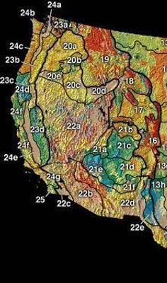
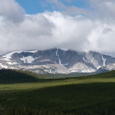
Wyoming Basin, Physiographic province in Wyoming and Colorado, United States.

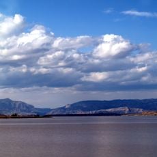
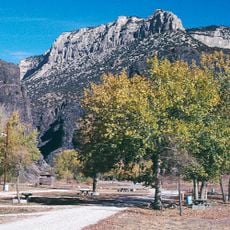
The Wyoming Basin is a high plateau between the Rocky Mountains in Wyoming and Colorado, featuring a landscape of ridges and gentle mountain chains. The region contains several broad valleys and basins marked by geological faults and displaying different rock layers.

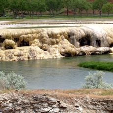
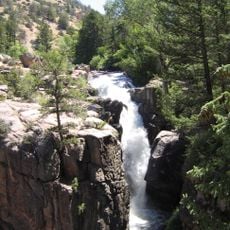
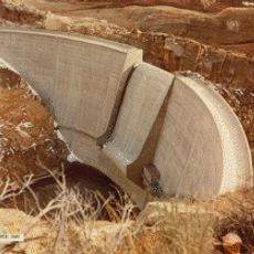
The area formed millions of years ago through massive mountain-building processes that shaped the Rocky Mountain landscape. Later, erosion carved out the valleys and basin structures visible today.

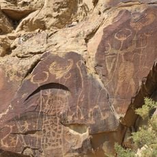
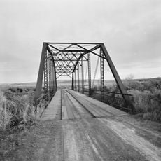
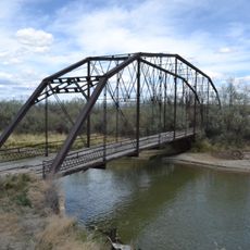
Native American tribes utilized the natural corridors of the Wyoming Basin for seasonal migrations and established trade routes through the region.

The best time for exploration is during warmer months when roads and trails are accessible. The region has multiple starting points in both states, and many locations can be reached by car.

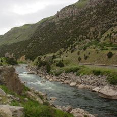
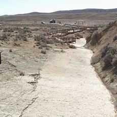
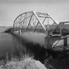
The Continental Divide runs through the region and splits water systems that flow toward different oceans. This creates streams in one area that move in completely opposite directions.

The community of curious travelers

AroundUs brings together thousands of curated places, local tips, and hidden gems, enriched daily by 60,000 contributors worldwide.

Start exploring
Location
Location
Part of
Rocky Mountain System
GPS coordinates
44.00000,-108.00000
Latest update
December 14, 2025 13:08
Around this place
Hot Springs State Park
United States of America

Hot Springs State Park

41.6 km
Wind River Canyon
United States of America

Wind River Canyon

55.3 km
Wyoming Dinosaur Center
United States of America

Wyoming Dinosaur Center

42.9 km
Boysen Reservoir
United States of America

Boysen Reservoir

66.5 km
Legend Rock
United States of America

Legend Rock

53.2 km
Red Gulch Dinosaur Tracksite
United States of America

Red Gulch Dinosaur Tracksite

56.7 km
Shell Falls
United States of America

Shell Falls

72.2 km
Boysen State Park
United States of America

Boysen State Park

66.5 km
United States of America

Bighorn Peak

76.7 km
Anchor Dam
United States of America

Anchor Dam

76.1 km
CQA Four Mile Bridge
United States of America

CQA Four Mile Bridge

46.9 km
State Bath house
United States of America

State Bath house

41.8 km
EFP Bridge over Owl Creek
United States of America

EFP Bridge over Owl Creek

46.7 km
Lower Shell School House
United States of America

Lower Shell School House

58.2 km
First National Bank of Meeteetse
United States of America

First National Bank of Meeteetse

70.7 km
Worland House
United States of America

Worland House

3.5 km
Alex Halone House
United States of America

Alex Halone House

43.1 km
Downtown Thermopolis Historic District
United States of America

Downtown Thermopolis Historic District

42.9 km
Star Plunge
United States of America

Star Plunge

41.8 km
EJE Bridge over Shell Creek
United States of America

EJE Bridge over Shell Creek

61.6 km
James T. Saban Lookout
United States of America

James T. Saban Lookout

65.9 km
EJP County Line Bridge
United States of America

EJP County Line Bridge

31.3 km
Rairden Bridge
United States of America

Rairden Bridge

22.7 km
Ainsworth House
United States of America

Ainsworth House

59.5 km
Kirby Jail and Town Hall
United States of America

Kirby Jail and Town Hall

26.1 km
Washakie Museum & Cultural Center
United States of America

Washakie Museum & Cultural Center

5.1 km
Tyrrel Ranger Station
United States of America

Tyrrel Ranger Station

63.5 km
Tensleep Ranger Station
United States of America

Tensleep Ranger Station

63.5 km
Show the full map
Reviews
Share your experience

No review yet

Discussions
Start a discussion...

No discussion yet

« Wyoming Basin - Physiographic province in Wyoming and Colorado, United States » is provided by Around Us (aroundus.com). Images and texts are derived from Wikimedia project under a Creative Commons license. You are allowed to copy, distribute, and modify copies of this page, under the conditions set by the license, as long as this note is clearly visible.

Discover hidden gems everywhere you go!

From secret cafés to breathtaking viewpoints, skip the crowded tourist spots and find places that match your style. Our app makes it easy with voice search, smart filtering, route optimization, and insider tips from travelers worldwide. Download now for the complete mobile experience.

Around Us App Screenshot

A unique approach to discovering new places

Le Figaro

All the places worth exploring

France Info

A tailor-made excursion in just a few clicks

20 Minutes

Around Us
Travel Guide & Maps
Download

Send to your phone

QR Code
1

Open the camera app on your mobile.

2

Point at the QR code with your camera. A notification will appear.

3

Tap the notification to open the link.