Anchor Dam

Log in to your account

AroundUs is a community-driven map of interesting places, built by curious explorers like you. It grows with every review, story, and photo you share.
Connect to save your favorite spots, contribute locations, and create personalized routes.
Continue with Google
Continue with Apple
Continue with X
Continue with Facebook
Continue with email
By continuing, you accept our Terms and Conditions and our Privacy Policy
Create an account
Add to collection
Map
Suggest a change
Share

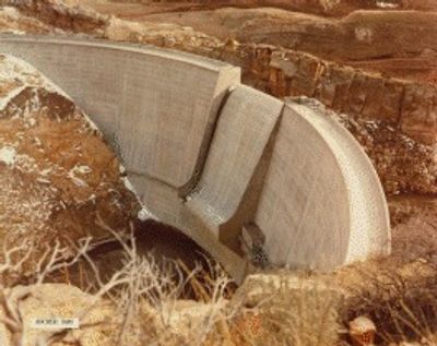
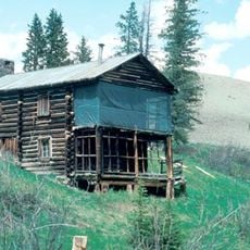
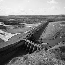
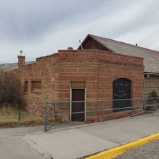
Anchor Dam, Arch dam in Hot Springs County, Wyoming, US

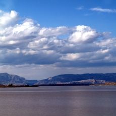
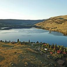
Anchor Dam is an arch dam in Wyoming that creates a reservoir for storing water. The structure spans across the valley and holds water primarily for agricultural irrigation throughout the region.

The dam was built in the 1960s as part of a larger water development project for the region. It was designed to address growing water needs for farming communities in the area.

The Anchor Dam project transformed local agricultural practices by introducing controlled water distribution systems to ranchers and farmers in the Owl Creek region.

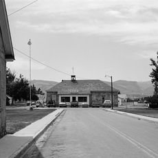
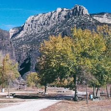
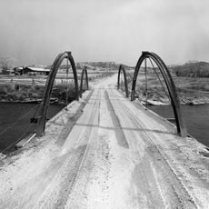
The location is accessible by local roads and offers nearby camping and hiking opportunities. The best time to visit is spring or fall when temperatures are more comfortable.

The reservoir struggles with dozens of underground cavities that prevent it from reaching full capacity. These geological features make the structure particularly interesting from a water management perspective.

Location: Wyoming

GPS coordinates: 43.66410,-108.82500

Latest update: December 14, 2025 17:40

Photos
Around this place
Hot Springs State Park
United States of America

Hot Springs State Park

50.4 km
Wind River Canyon
United States of America

Wind River Canyon

54.4 km
Wyoming Dinosaur Center
United States of America

Wyoming Dinosaur Center

50.4 km
Francs Peak
United States of America

Francs Peak

52.4 km
Boysen Reservoir
United States of America

Boysen Reservoir

59.2 km
Fort Washakie
United States of America

Fort Washakie

73.4 km
Legend Rock
United States of America

Legend Rock

23.4 km
Boysen State Park
United States of America

Boysen State Park

59.1 km
Whiskey Mountain
United States of America

Whiskey Mountain

69.4 km
Wyoming Basin
United States of America

Wyoming Basin

76.1 km
Anderson Lodge
United States of America

Anderson Lodge

68.9 km
CQA Four Mile Bridge
United States of America

CQA Four Mile Bridge

51.1 km
BMU Bridge over Wind River
United States of America

BMU Bridge over Wind River

58.7 km
EFP Bridge over Owl Creek
United States of America

EFP Bridge over Owl Creek

34.9 km
ELY Wind River Diversion Dam Bridge
United States of America

ELY Wind River Diversion Dam Bridge

50 km
First National Bank of Meeteetse
United States of America

First National Bank of Meeteetse

54.4 km
United States of America

Torrey Peak, Wyoming

73.3 km
Alex Halone House
United States of America

Alex Halone House

50.1 km
Shoshone-Episcopal Mission
United States of America

Shoshone-Episcopal Mission

75.8 km
Downtown Thermopolis Historic District
United States of America

Downtown Thermopolis Historic District

49.6 km
National Museum of Military Vehicles
United States of America

National Museum of Military Vehicles

58.2 km
Torrey Lake Historic District
United States of America

Torrey Lake Historic District

63.2 km
ELS Bridge over Big Wind River
United States of America

ELS Bridge over Big Wind River

70 km
C. H. King Company and First National Bank of Shoshoni
United States of America

C. H. King Company and First National Bank of Shoshoni

75.1 km
Amoretti, Welty, Helmer & Co Bank
United States of America

Amoretti, Welty, Helmer & Co Bank

66.8 km
Steamboat Geyser
United States of America

Steamboat Geyser

44.4 km
Acme Theatre
United States of America

Acme Theatre

79.5 km
Thermopolis Swinging Bridge
United States of America

Thermopolis Swinging Bridge

50.6 km
Show the full map
Reviews

Visited this place? Tap the stars to rate it and share your experience / photos with the community! Try now! You can cancel it anytime.

« Anchor Dam - Arch dam in Hot Springs County, Wyoming, US » is provided by Around Us (aroundus.com). Images and texts are derived from Wikimedia project under a Creative Commons license. You are allowed to copy, distribute, and modify copies of this page, under the conditions set by the license, as long as this note is clearly visible.

Discover hidden gems everywhere you go!

From secret cafés to breathtaking viewpoints, skip the crowded tourist spots and find places that match your style. Our app makes it easy with voice search, smart filtering, route optimization, and insider tips from travelers worldwide. Download now for the complete mobile experience.

Around Us App Screenshot

A unique approach to discovering new places

Le Figaro

All the places worth exploring

France Info

A tailor-made excursion in just a few clicks

20 Minutes