Enable Location

We need your location to show you interesting places around you

Discover nearby places

Find interesting locations and hidden gems around you

Precise directions

Get accurate directions and distances to places

Your location is never shared with other users. It's only used when you tap the location button.

Medicine Bow–Routt National Forest

Log in to your account

Start exploring — it's free

Trusted by 62,236 travelers worldwide

Continue with Google
Continue with Apple
or

We will send you a code to connect

By continuing, you accept our Terms and Conditions and our Privacy Policy

Check your inbox

We've sent a pincode in your inbox. Please enter the code below.

Medicine Bow–Routt National Forest

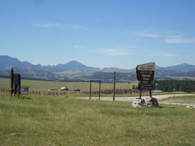
Medicine Bow–Routt National Forest, National forest between Wyoming and Colorado, United States.

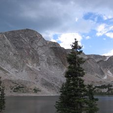
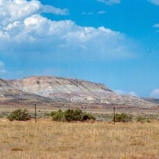
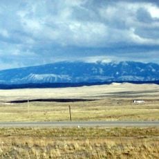
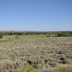
Medicine Bow–Routt National Forest is a protected woodland area stretching across southeastern Wyoming and northwestern Colorado with mountains, alpine lakes, and meadows. The forest contains varied landscapes including snow-capped peaks, clear mountain lakes, and open high meadows.

The land was established as Medicine Bow National Forest in 1902 and expanded with Routt National Forest in 1908. The two were combined under single management in 1995.

The name comes from Native American groups who gathered here to collect mountain mahogany and perform healing ceremonies. Visitors walking through the forest today see the same high mountain settings that held meaning for these communities.

The area is accessible year-round with marked trails for hiking in summer and snow sports zones during winter. Conditions vary greatly by elevation and season, so visitors should check local weather before heading out.

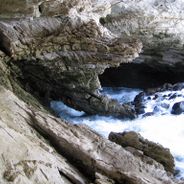
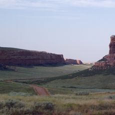
The Vedauwoo section features unusual granite rock formations that create natural climbing routes through weathered stone. These formations offer climbers an experience shaped by ancient geological forces.

The community of curious travelers

AroundUs brings together thousands of curated places, local tips, and hidden gems, enriched daily by 60,000 contributors worldwide.

Start exploring
Location
Location
GPS coordinates
41.58333,-106.21667
Latest update
December 6, 2025 16:03
Natural wonders and historic sites in Wyoming

Wyoming preserves geological sites that include thermal springs, canyons, and rock formations. The state protects historic locations such as forts, rock art, and dinosaur tracks. Devils Tower rises 1,267 feet (386 meters) above the terrain and represents a significant geological formation. Fossil...

Around this place
Show the full map
« Medicine Bow–Routt National Forest - National forest between Wyoming and Colorado, United States » is provided by Around Us (aroundus.com). Images and texts are derived from Wikimedia project under a Creative Commons license. You are allowed to copy, distribute, and modify copies of this page, under the conditions set by the license, as long as this note is clearly visible.

Discover hidden gems everywhere you go!

From secret cafés to breathtaking viewpoints, skip the crowded tourist spots and find places that match your style. Our app makes it easy with voice search, smart filtering, route optimization, and insider tips from travelers worldwide. Download now for the complete mobile experience.

Around Us App Screenshot

A unique approach to discovering new places

Le Figaro

All the places worth exploring

France Info

A tailor-made excursion in just a few clicks

20 Minutes

Around Us
Travel Guide & Maps
Download

Send to your phone

QR Code
1

Open the camera app on your mobile.

2

Point at the QR code with your camera. A notification will appear.

3

Tap the notification to open the link.