Enable Location

We need your location to show you interesting places around you

Discover nearby places

Find interesting locations and hidden gems around you

Precise directions

Get accurate directions and distances to places

Your location is never shared with other users. It's only used when you tap the location button.

Fort Saint Vrain

Log in to your account

Start exploring — it's free

Trusted by 61,596 travelers worldwide

Continue with Google
Continue with Apple
or

We will send you a code to connect

By continuing, you accept our Terms and Conditions and our Privacy Policy

Check your inbox

We've sent a pincode in your inbox. Please enter the code below.

Fort Saint Vrain

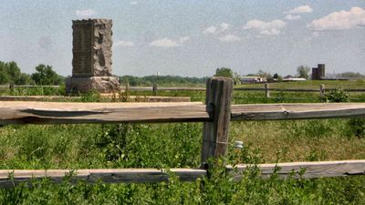
Fort Saint Vrain, 1837 trading post near Platteville, Colorado, United States.
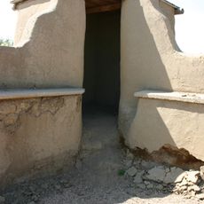
Description

Fort Saint Vrain was a two-story adobe building with an inner courtyard, situated at the junction where Saint Vrain Creek and South Platte River meet. This layout allowed traders to house people and goods securely while managing commerce across the region.

History

The Bent, St. Vrain Company obtained a trading license in 1836 and built the fort the following year to serve the fur trade. It remained operational until 1848, when shifts in commerce and new transportation routes reduced its importance.

Culture

This trading post served as a meeting point where different peoples came together to exchange goods and share knowledge. The daily presence of fur traders, mountain men, and tribal members created a space where different ways of life intersected and influenced one another.

Practical

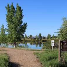
The memorial site sits west of Highway 85, accessible via Weld County Road 40 that extends into rural territory. Early morning visits work well since the location is remote, and having your own transportation is helpful for exploring the area.

Did you know?

Jean Baptiste Charbonneau, son of the famous Sacajawea from the Lewis and Clark Expedition, worked here as a translator and trader. His presence connected the history of that important expedition directly to the daily operations of this trading hub.

Location
GPS coordinates
40.27890,-104.85500
Latest update
December 10, 2025 16:24

AroundUs brings together thousands of curated places, local tips, and hidden gems, enriched daily by 60,000 contributors worldwide. Discover all places nearby (Colorado).

Around this place
Boyd Lake State Park
United States of America

Boyd Lake State Park

23.4 km
Nottingham Field
United States of America

Nottingham Field

18.8 km
Fort Vasquez
United States of America

Fort Vasquez

9.9 km
St. Vrain State Park
United States of America

St. Vrain State Park

16.5 km
Vintage Aero Flying Museum
United States of America

Vintage Aero Flying Museum

23.7 km
Rialto Theater
United States of America

Rialto Theater

22.6 km
Weld County Courthouse
United States of America

Weld County Courthouse

21.2 km
United Church of Christ of Highlandlake
United States of America

United Church of Christ of Highlandlake

13.9 km
First Methodist Episcopal Church
United States of America

First Methodist Episcopal Church

22.6 km
Downtown Loveland Historic District
United States of America

Downtown Loveland Historic District

22.7 km
First Baptist Church
United States of America

First Baptist Church

20.9 km
First United Presbyterian Church
United States of America

First United Presbyterian Church

22.5 km
Daniels School
United States of America

Daniels School

6.3 km
William H. McCreery House
United States of America

William H. McCreery House

22.6 km
Greeley Masonic Temple
United States of America

Greeley Masonic Temple

21.2 km
Greeley Tribune Building
United States of America

Greeley Tribune Building

21.5 km
Little Thompson River Bridge
United States of America

Little Thompson River Bridge

10.9 km
Anderson Barn
United States of America

Anderson Barn

10.7 km
Meeker Memorial Museum
United States of America

Meeker Memorial Museum

20.7 km
Jared L. Brush Barn
United States of America

Jared L. Brush Barn

9.2 km
Glazier House
United States of America

Glazier House

20.5 km
Joseph A. Woodbury House
United States of America

Joseph A. Woodbury House

21.1 km
Maude Stanfield Harter Borland House
United States of America

Maude Stanfield Harter Borland House

22.6 km
Gray Hall
United States of America

Gray Hall

20.1 km
Henry K. and Mary E. Shaffer House
United States of America

Henry K. and Mary E. Shaffer House

23.7 km
Loveland Museum
United States of America

Loveland Museum

22.7 km
Nettleton-Mead House
United States of America

Nettleton-Mead House

20.8 km
Old Fort Vasquez
United States of America

Old Fort Vasquez

9.8 km
Show the full map
« Fort Saint Vrain - 1837 trading post near Platteville, Colorado, United States » is provided by Around Us (aroundus.com). Images and texts are derived from Wikimedia project under a Creative Commons license. You are allowed to copy, distribute, and modify copies of this page, under the conditions set by the license, as long as this note is clearly visible.

Discover hidden gems everywhere you go!

From secret cafés to breathtaking viewpoints, skip the crowded tourist spots and find places that match your style. Our app makes it easy with voice search, smart filtering, route optimization, and insider tips from travelers worldwide. Download now for the complete mobile experience.

Around Us App Screenshot

A unique approach to discovering new places

Le Figaro

All the places worth exploring

France Info

A tailor-made excursion in just a few clicks

20 Minutes

Around Us
Travel Guide & Maps
Download

Send to your phone

QR Code
1

Open the camera app on your mobile.

2

Point at the QR code with your camera. A notification will appear.

3

Tap the notification to open the link.