Soldier Creek Wilderness

Log in to your account

AroundUs is a community-driven map of interesting places, built by curious explorers like you. It grows with every review, story, and photo you share.
Connect to save your favorite spots, contribute locations, and create personalized routes.
By continuing, you accept our Terms and Conditions and our Privacy Policy

Soldier Creek Wilderness

Add to collection
Map
Suggest a change
Share

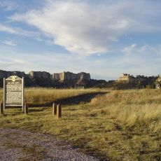
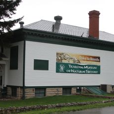
Soldier Creek Wilderness, Protected wilderness area in northwestern Nebraska, United States.
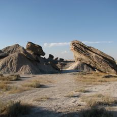
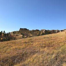
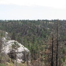
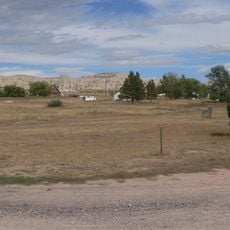
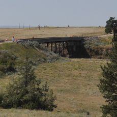
The 7,794-acre territory contains grassy upland parks that merge into Ponderosa pine-covered ridges within the Nebraska National Forest system.

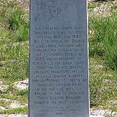
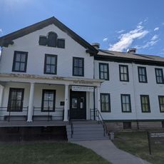
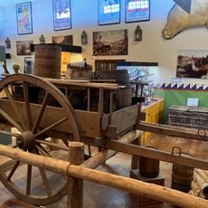
The area served as a training ground for military personnel stationed at Fort Robinson from the 1870s through World War II.

Native American tribes traversed these lands before European settlement, leaving behind evidence of their presence in the surrounding region.

Visitors can access multiple marked trails that connect to Fort Robinson State Park, with maps available at the Forest Service office in Chadron.

In 1989, a substantial wildfire affected 90 percent of the wilderness, leading to natural regeneration processes that continue today.

Location: Nebraska

GPS coordinates: 42.68890,-103.60600

Latest update: April 17, 2025 12:58

Around this place
Show the full map
Fort Robinson
United States of America

Fort Robinson

11.6 km
Toadstool Geologic Park
United States of America

Toadstool Geologic Park

19.9 km
Hudson-Meng Bison Kill
United States of America

Hudson-Meng Bison Kill

16.5 km
Angostura Reservoir
United States of America

Angostura Reservoir

70.1 km
Chadron State Park
United States of America

Chadron State Park

48.2 km
Pine Ridge National Recreation Area
United States of America

Pine Ridge National Recreation Area

39.7 km
Bordeaux Trading Post
United States of America

Bordeaux Trading Post

57.7 km
Cheyenne-Black Hills Stage Route and Rawhide Buttes and Running Water Stage Stations
United States of America

Cheyenne-Black Hills Stage Route and Rawhide Buttes and Running Water Stage Stations

71.6 km
Trailside Museum of Natural History at Fort Robinson State Park
United States of America

Trailside Museum of Natural History at Fort Robinson State Park

11.7 km
Mari Sandoz High Plains Heritage Center
United States of America

Mari Sandoz High Plains Heritage Center

51.4 km
C and H Refinery Historic District
United States of America

C and H Refinery Historic District

70 km
Jay Em Historic District
United States of America

Jay Em Historic District

67.5 km
Lusk Water Tower
United States of America

Lusk Water Tower

68.9 km
Fort Robinson State Park
United States of America

Fort Robinson State Park

9.3 km
Dawes County Courthouse
United States of America

Dawes County Courthouse

27.6 km
Chadron Commercial Historic District
United States of America

Chadron Commercial Historic District

52 km
Site of Ferdinand Branstetter Post No. 1, American Legion
United States of America

Site of Ferdinand Branstetter Post No. 1, American Legion

40 km
Crites Hall
United States of America

Crites Hall

51.6 km
Sioux County Courthouse
United States of America

Sioux County Courthouse

22.6 km
Sparks Hall
United States of America

Sparks Hall

51.6 km
Miller Hall
United States of America

Miller Hall

53.2 km
Chadron Public Library
United States of America

Chadron Public Library

51.9 km
Arthur and Ellen Colgan House
United States of America

Arthur and Ellen Colgan House

70.4 km
Edna Work Hall
United States of America

Edna Work Hall

51.5 km
Fort Robinson Museum & History Center
United States of America

Fort Robinson Museum & History Center

11.6 km
Chilson Bridge
United States of America

Chilson Bridge

72.1 km
Museum of the Fur Trade
United States of America

Museum of the Fur Trade

57.4 km
Army Theatre
United States of America

Army Theatre

11.7 km
Show the full map

Reviews

Visited this place? Tap the stars to rate it and share your experience / photos with the community! Try now! You can cancel it anytime.

« Soldier Creek Wilderness: Protected wilderness area in northwestern Nebraska, United States » is provided by Around Us (aroundus.com). Images and texts are derived from Wikimedia project under a Creative Commons license. You are allowed to copy, distribute, and modify copies of this page, under the conditions set by the license, as long as this note is clearly visible.

Discover hidden gems everywhere you go!

From secret cafés to breathtaking viewpoints, skip the crowded tourist spots and find places that match your style. Our app makes it easy with voice search, smart filtering, route optimization, and insider tips from travelers worldwide. Download now for the complete mobile experience.

Around Us App Screenshot

A unique approach to discovering new places

Le Figaro

All the places worth exploring

France Info

A tailor-made excursion in just a few clicks

20 Minutes