Chest opened
+${chestReward.xp} XP
Explorer
NOUVEAU ×${chestReward.collectible.quantity}
tapez pour fermer
Chest locked

Open chests in the app

Around Us is built for your phone — chests unlock when you walk, explore and capture nearby places.

Enable Location

We need your location to show you interesting places around you

Discover nearby places

Find interesting locations and hidden gems around you

Precise directions

Get accurate directions and distances to places

Your location is never shared with other users. It's only used when you tap the location button.

Ontario

Log in to your account

Start exploring — it's free

Trusted by 72,885 travelers worldwide

Continue with Google
Continue with Apple
or

We will send you a code to connect

By continuing, you accept our Terms and Conditions and our Privacy Policy

Check your inbox

We've sent a pincode in your inbox. Please enter the code below.

Discussion Reviews 3 Photos
45.9k Popularity

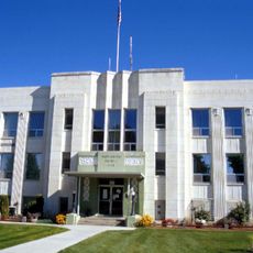
Ontario, Administrative center in Malheur County, Oregon, US

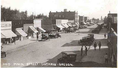
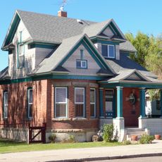
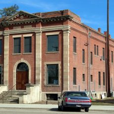
Ontario is a city in eastern Oregon situated along the Snake River at the Idaho border, extending across the landscape at an elevation of about 655 meters (2,150 feet). The community functions as a commercial hub serving the surrounding agricultural region and its farming communities.

The city was established in 1899 when settlers recognized the agricultural potential of the Snake River Valley and developed irrigation systems to bring water to the desert. This infrastructure transformed the arid landscape into productive farmland and enabled regional growth.

The city holds the Oregon Trail Daze festival each year, bringing together residents to commemorate the region's connection to westward expansion and settlement.

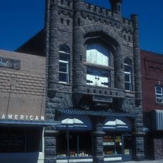
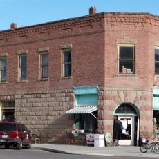
The city offers lodging, dining, and shopping facilities serving both travelers and the local farming community. The Snake River provides access points for outdoor recreation and nature exploration near residential areas.

The city was originally named after Ontario in California and represents a key point on historic trade routes connecting the Pacific Coast to inland regions. This location made it a natural stopping point for trading caravans and early travelers crossing the area.

The community of curious travelers

AroundUs brings together thousands of curated places, local tips, and hidden gems, enriched daily by 60,000 contributors worldwide.

Start exploring
Location
Inception
1899
Elevation above the sea
655 m
GPS coordinates
44.02694,-116.96861
Latest update
December 14, 2025 20:03
Around this place
Fort Boise
United States of America

Fort Boise

23 km
United States of America

Ontario State Recreation Site

1.9 km
Knights of Pythias Lodge Hall
United States of America

Knights of Pythias Lodge Hall

24.3 km
Anderson–Elwell House
United States of America

Anderson–Elwell House

24.6 km
Al Thompson and Son's Feed and Seed Company
United States of America

Al Thompson and Son's Feed and Seed Company

17 km
Archie Larsen House
United States of America

Archie Larsen House

18.9 km
Rinehart Stone House Museum
United States of America

Rinehart Stone House Museum

22.3 km
New Plymouth Congregational Church
United States of America

New Plymouth Congregational Church

13.5 km
Hotel Western
United States of America

Hotel Western

16.9 km
Vale Hotel and Grand Opera House
United States of America

Vale Hotel and Grand Opera House

22.7 km
First Bank of Vale
United States of America

First Bank of Vale

22.2 km
Washington County Courthouse
United States of America

Washington County Courthouse

24.6 km
Vale Drug Store
United States of America

Vale Drug Store

22.2 km
James Rowley and Mary J. Blackaby House
United States of America

James Rowley and Mary J. Blackaby House

698 m
Grant Whitney House
United States of America

Grant Whitney House

6.8 km
B. S. Varian House
United States of America

B. S. Varian House

24.5 km
Payette City Hall and Courthouse
United States of America

Payette City Hall and Courthouse

6.3 km
Vinsonhaler Blacksmith Shop
United States of America

Vinsonhaler Blacksmith Shop

16.9 km
United States of America

Nyssa Bridge

16.7 km
Coughanour Apartment Block
United States of America

Coughanour Apartment Block

6.1 km
Col. C. F. Drake House
United States of America

Col. C. F. Drake House

24.4 km
United States of America

Clay Point

6.2 km
United States of America

The Bluffs

17.2 km
United States of America

Cottonwood City Park

22.2 km
Rex Theater
United States of America

Rex Theater

22.4 km
United States of America

Arcadia Lake

12 km

Amphitheater

5.4 km
United States of America

Waterfall

3.8 km
Show the full map
Reviews
Share your experience

No review yet

Discussions
Start a discussion...

No discussion yet

« Ontario - Administrative center in Malheur County, Oregon, US » is provided by Around Us (aroundus.com). Images and texts are derived from Wikimedia project under a Creative Commons license. You are allowed to copy, distribute, and modify copies of this page, under the conditions set by the license, as long as this note is clearly visible.

Discover hidden gems everywhere you go!

From secret cafés to breathtaking viewpoints, skip the crowded tourist spots and find places that match your style. Our app makes it easy with voice search, smart filtering, route optimization, and insider tips from travelers worldwide. Download now for the complete mobile experience.

Around Us App Screenshot

A unique approach to discovering new places

Le Figaro

All the places worth exploring

France Info

A tailor-made excursion in just a few clicks

20 Minutes

Around Us
Travel Guide & Maps
Download

Send to your phone

QR Code
1

Open the camera app on your mobile.

2

Point at the QR code with your camera. A notification will appear.

3

Tap the notification to open the link.