Chest opened
+${chestReward.xp} XP
Explorer
NOUVEAU ×${chestReward.collectible.quantity}
tapez pour fermer
Chest locked

Open chests in the app

Around Us is built for your phone — chests unlock when you walk, explore and capture nearby places.

Enable Location

We need your location to show you interesting places around you

Discover nearby places

Find interesting locations and hidden gems around you

Precise directions

Get accurate directions and distances to places

Your location is never shared with other users. It's only used when you tap the location button.

Payette River

Log in to your account

Start exploring — it's free

Trusted by 72,879 travelers worldwide

Continue with Google
Continue with Apple
or

We will send you a code to connect

By continuing, you accept our Terms and Conditions and our Privacy Policy

Check your inbox

We've sent a pincode in your inbox. Please enter the code below.

Payette River
Discussion Reviews 1 Photos
10.5k Popularity

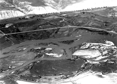
Payette River, River system in southwestern Idaho, United States.

The Payette River is a river system in southwestern Idaho that flows through mountainous terrain formed by the merging of two major forks.The waterway travels through three counties and provides varying conditions for paddlers and outdoor enthusiasts.

The river was named after Francois Payette, a French-Canadian fur trapper who explored the basin during the early 1800s fur trade era.These early expeditions helped map and open the region to further European exploration.

The river valley served as a seasonal gathering place for Native American communities who relied on its resources for hunting and fishing.These groups moved through the area following game and water sources throughout the year.

Highway 55 provides access to various sections along the route with different difficulty levels for paddling.Conditions vary significantly depending on the season and water flow from mountain snowmelt and rainfall.

The North Fork section features technical rapids that drop sharply over short distances, creating a challenging playground for experienced paddlers.This area has become a testing ground where advanced boaters refine their techniques.

The community of curious travelers

AroundUs brings together thousands of curated places, local tips, and hidden gems, enriched daily by 60,000 contributors worldwide.

Start exploring
Location
Location
Location
GPS coordinates
44.09220,-116.95200
Latest update
December 10, 2025 15:53
Around this place
United States of America

Ontario State Recreation Site

5.5 km
Knights of Pythias Lodge Hall
United States of America

Knights of Pythias Lodge Hall

17.1 km
Anderson–Elwell House
United States of America

Anderson–Elwell House

17.3 km
Al Thompson and Son's Feed and Seed Company
United States of America

Al Thompson and Son's Feed and Seed Company

24.3 km
Archie Larsen House
United States of America

Archie Larsen House

11.5 km
New Plymouth Congregational Church
United States of America

New Plymouth Congregational Church

17.3 km
Hotel Western
United States of America

Hotel Western

24.3 km
Intermountain Institute
United States of America

Intermountain Institute

19.3 km
Washington County Courthouse
United States of America

Washington County Courthouse

17.3 km
James Rowley and Mary J. Blackaby House
United States of America

James Rowley and Mary J. Blackaby House

8 km
Grant Whitney House
United States of America

Grant Whitney House

2 km
B. S. Varian House
United States of America

B. S. Varian House

17.3 km
Payette City Hall and Courthouse
United States of America

Payette City Hall and Courthouse

2.1 km
James M. Fisher House
United States of America

James M. Fisher House

18 km
Vinsonhaler Blacksmith Shop
United States of America

Vinsonhaler Blacksmith Shop

24.3 km
Coughanour Apartment Block
United States of America

Coughanour Apartment Block

2.3 km
Col. C. F. Drake House
United States of America

Col. C. F. Drake House

17.1 km
Benjamin Watlington House
United States of America

Benjamin Watlington House

17.4 km
Morris Sommer House
United States of America

Morris Sommer House

17.4 km
United States of America

Clay Point

4.8 km
United States of America

The Bluffs

19 km
United States of America

Cottonwood City Park

25.9 km
United States of America

Barton Reservoir

25.8 km
United States of America

Arcadia Lake

19.3 km
United States of America

Rocky Point

25.2 km
United States of America

Rolling Hills Golf Course

19 km
United States of America

The Holy Family

8.6 km
United States of America

Waterfall

6.4 km
Show the full map
Reviews
Share your experience

No review yet

Discussions
Start a discussion...

No discussion yet

« Payette River - River system in southwestern Idaho, United States » is provided by Around Us (aroundus.com). Images and texts are derived from Wikimedia project under a Creative Commons license. You are allowed to copy, distribute, and modify copies of this page, under the conditions set by the license, as long as this note is clearly visible.

Discover hidden gems everywhere you go!

From secret cafés to breathtaking viewpoints, skip the crowded tourist spots and find places that match your style. Our app makes it easy with voice search, smart filtering, route optimization, and insider tips from travelers worldwide. Download now for the complete mobile experience.

Around Us App Screenshot

A unique approach to discovering new places

Le Figaro

All the places worth exploring

France Info

A tailor-made excursion in just a few clicks

20 Minutes

Around Us
Travel Guide & Maps
Download

Send to your phone

QR Code
1

Open the camera app on your mobile.

2

Point at the QR code with your camera. A notification will appear.

3

Tap the notification to open the link.