Enable Location

We need your location to show you interesting places around you

Discover nearby places

Find interesting locations and hidden gems around you

Precise directions

Get accurate directions and distances to places

Your location is never shared with other users. It's only used when you tap the location button.

Baker City

Log in to your account

Start exploring — it's free

Trusted by 61,504 travelers worldwide

Continue with Google
Continue with Apple
or

We will send you a code to connect

By continuing, you accept our Terms and Conditions and our Privacy Policy

Check your inbox

We've sent a pincode in your inbox. Please enter the code below.

Baker City, County seat in Eastern Oregon, United States.

Description

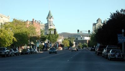
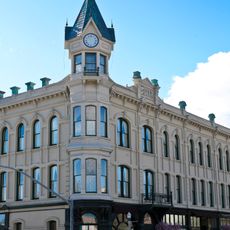
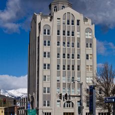
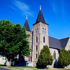
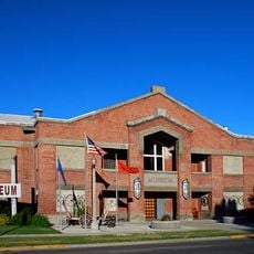
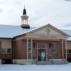
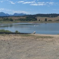
Baker City serves as the administrative center of Baker County in eastern Oregon, positioned in a high valley between forested ridges and grassland slopes. The town grid spreads around a central business district where stone and brick structures stand among later commercial buildings.

History

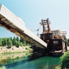
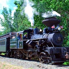
Prospectors struck gold in surrounding mountain drainages in 1861, drawing thousands of miners and settlers into the valley within a few years. The settlement gained formal incorporation in 1874 and developed into a supply hub for ranches and mining camps across the wider region.

Culture

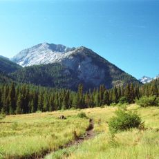
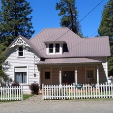
The downtown storefront architecture preserves brick and stone buildings from the late 1800s mining era, showing cast-iron detailing and wooden awnings. Local ranching families still bring cattle through nearby valleys in spring, following routes that connect high grazing meadows to winter pastures.

Practical

Summer brings warm afternoons and cool mornings, while winter months can bring snow to the streets and require chains or winter tires on mountain passes. Most facilities cluster within a few blocks of the central crossroads, making the area easy to explore on foot.

Did you know?

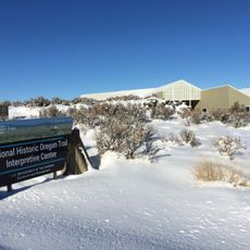
Wagon wheel ruts carved into basalt outcrops on a nearby hillside remain from pioneer journeys over 150 years ago, with some grooves deep enough to trace with your hand. These tracks lie just meters from modern hiking trails, offering a direct comparison between past and present uses of the landscape.

Location
Inception
1874
Elevation above the sea
1,052 m
GPS coordinates
44.77500,-117.83444
Latest update
December 13, 2025 19:21

AroundUs brings together thousands of curated places, local tips, and hidden gems, enriched daily by 60,000 contributors worldwide. Discover all places nearby (Baker County).

Around this place
Sumpter Valley Gold Dredge
United States of America

Sumpter Valley Gold Dredge

29.4 km
Geiser Grand Hotel
United States of America

Geiser Grand Hotel

448 m
Sumpter Valley Railway
United States of America

Sumpter Valley Railway

24 km
National Historic Oregon Trail Interpretive Center
United States of America

National Historic Oregon Trail Interpretive Center

9.4 km
Rock Creek Butte
United States of America

Rock Creek Butte

21.8 km
Baker City Tower
United States of America

Baker City Tower

337 m
Cathedral of Saint Francis de Sales
United States of America

Cathedral of Saint Francis de Sales

560 m
Baker Historic District
United States of America

Baker Historic District

403 m
Thief Valley Reservoir
United States of America

Thief Valley Reservoir

28 km
Baker Municipal Natatorium
United States of America

Baker Municipal Natatorium

1.1 km
Churchill School
United States of America

Churchill School

1.2 km
Wolf Creek Reservoir
United States of America

Wolf Creek Reservoir

34.8 km
United States of America

James O. Maxwell Farmstead

22 km
United States of America

Ed Rand House

110 m
Superintendent's House
United States of America

Superintendent's House

29.2 km
United States of America

Robert F. and Elizabeth Clark House

954 m
McEwen
United States of America

McEwen

23.9 km
United States of America

Balm Creek Reservoir

34.6 km
United States of America

Phillips Lake

20.1 km
United States of America

Sumpter Valley Dredge State Heritage Area

29.4 km
United States of America

Oregon Trail Monument

3.6 km
United States of America

Oregon Trail Historical Monument

8.2 km
United States of America

Bacher Creek Reservoir

33.3 km
United States of America

Baker County Fairgrounds

1.3 km
United States of America

Salt Lick

434 m
United States of America

Statue, Work of art

539 m
United States of America

Scenic viewpoint

29.1 km
United States of America

Monument featuring aircraft, aircraft model

6.8 km
Show the full map
« Baker City - County seat in Eastern Oregon, United States » is provided by Around Us (aroundus.com). Images and texts are derived from Wikimedia project under a Creative Commons license. You are allowed to copy, distribute, and modify copies of this page, under the conditions set by the license, as long as this note is clearly visible.

Discover hidden gems everywhere you go!

From secret cafés to breathtaking viewpoints, skip the crowded tourist spots and find places that match your style. Our app makes it easy with voice search, smart filtering, route optimization, and insider tips from travelers worldwide. Download now for the complete mobile experience.

Around Us App Screenshot

A unique approach to discovering new places

Le Figaro

All the places worth exploring

France Info

A tailor-made excursion in just a few clicks

20 Minutes

Around Us
Travel Guide & Maps
Download

Send to your phone

QR Code
1

Open the camera app on your mobile.

2

Point at the QR code with your camera. A notification will appear.

3

Tap the notification to open the link.