Lewis and Clark Trail-Travois Road
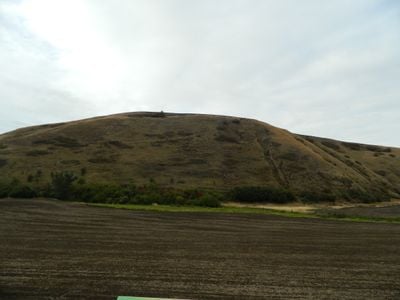
The Lewis and Clark Trail-Travois Road is a historic path in Garfield County that runs alongside Highway 12 east of Pomeroy. The route displays about a quarter-mile stretch of parallel grooves carved into the ground by dragging travois poles, showing how indigenous peoples moved across the landscape.
The path was used by the Nez Perce, Walla Walla, and Cayuse peoples for generations before explorer Meriwether Lewis mentioned it in his writings on May 3, 1806. The site was added to the National Register of Historic Places in 1974 to preserve its significance as an early trade route and record of exploration.
The name refers to the travois, sleds pulled by horses and dogs to carry goods and supplies. This path served indigenous groups as an essential route for trade, communication, and access to fishing areas and resources.
The path is easy to locate along Highway 12 and can be explored on foot with visible signs marking the historic route. The surrounding area is open and rural, making it simple to navigate and see the ancient grooves clearly.
The travois grooves are so clearly visible that visitors can trace the exact paths of horses hooves and dragging poles carved into the earth. This physical trace provides a direct connection to the daily movements of people more than two centuries ago.
The community of curious travelers
AroundUs brings together thousands of curated places, local tips, and hidden gems, enriched daily by 60,000 contributors worldwide.