Garfield County

Log in to your account

AroundUs is a community-driven map of interesting places, built by curious explorers like you. It grows with every review, story, and photo you share.
Connect to save your favorite spots, contribute locations, and create personalized routes.
By continuing, you accept our Terms and Conditions and our Privacy Policy
Add to collection
Map
Suggest a change
Share

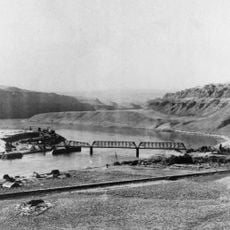
Garfield County, County seat in Washington, United States

Garfield County is an administrative division in southeastern Washington, with Pomeroy serving as its administrative center. The area covers a small region in a largely rural part of the state.

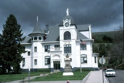
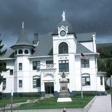
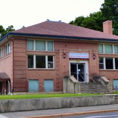
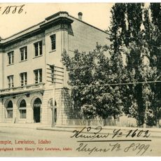
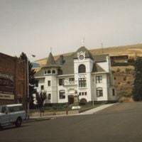
The county was established in 1881, and Pomeroy became its administrative center through a Congressional act in 1884. The town itself was officially incorporated two years later as the government seat.

The Main Street Park features a memorial monument recognizing Garfield County residents who participated in military service from the Spanish American War through Vietnam.

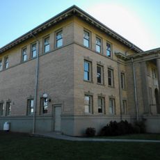
Visitors will find the main administrative buildings and local services concentrated in the downtown area of Pomeroy. The small size of the community makes it easy to explore on foot.

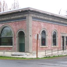
A major fire in 1900 destroyed half of Pomeroy's business district, after which the town was rebuilt with brick construction over two years. This reconstruction still shapes the appearance of the downtown today.

Location: Washington

Inception: 1881

Capital city: Pomeroy

Shares border with: Whitman County, Asotin County, Wallowa County, Columbia County

Website: https://co.garfield.wa.us

GPS coordinates: 46.43000,-117.53000

Latest update: December 7, 2025 19:23

Around this place
Show the full map
Lower Granite Dam
United States of America

Lower Granite Dam

26.8 km
Little Goose Dam
United States of America

Little Goose Dam

41.9 km
Wenaha–Tucannon Wilderness
United States of America

Wenaha–Tucannon Wilderness

44.9 km
Lewiston Hill
United States of America

Lewiston Hill

42.6 km
Fields Spring State Park
United States of America

Fields Spring State Park

48 km
Wenaha Wildlife Area
United States of America

Wenaha Wildlife Area

58.4 km
Lewis and Clark Trail-Travois Road
United States of America

Lewis and Clark Trail-Travois Road

5.4 km
Sternwheeler Jean
United States of America

Sternwheeler Jean

36.9 km
Full Gospel Church
United States of America

Full Gospel Church

38.2 km
St. Boniface Church, Convent and Rectory
United States of America

St. Boniface Church, Convent and Rectory

35.8 km
Interstate Highway Bridge
United States of America

Interstate Highway Bridge

37.9 km
Riparia Bridge
United States of America

Riparia Bridge

45.9 km
Gaylord Thompson House
United States of America

Gaylord Thompson House

40.4 km
Interior Grain Tramway
United States of America

Interior Grain Tramway

28.3 km
Garfield County Courthouse
United States of America

Garfield County Courthouse

7.4 km
Indian Timothy Memorial Bridge
United States of America

Indian Timothy Memorial Bridge

24.4 km
Grande Ronde River Bridge
United States of America

Grande Ronde River Bridge

48.2 km
Bank of Starbuck
United States of America

Bank of Starbuck

46.8 km
Nave Apartments
United States of America

Nave Apartments

39 km
Preston Hall
United States of America

Preston Hall

51.2 km
James Asposas House
United States of America

James Asposas House

40.1 km
Clarkston Public Library
United States of America

Clarkston Public Library

37.3 km
Hoodoo Ridge Lookout
United States of America

Hoodoo Ridge Lookout

54.1 km
Frank Booth House
United States of America

Frank Booth House

40.1 km
William and Elizabeth McLaren House
United States of America

William and Elizabeth McLaren House

40.1 km
C. C. Van Arsdol House
United States of America

C. C. Van Arsdol House

35.5 km
Agnes M. Tamblyn House
United States of America

Agnes M. Tamblyn House

40 km
Temple Theatre
United States of America

Temple Theatre

39 km
Show the full map

Reviews

Visited this place? Tap the stars to rate it and share your experience / photos with the community! Try now! You can cancel it anytime.

Administrative divisions
« Garfield County - County seat in Washington, United States » is provided by Around Us (aroundus.com). Images and texts are derived from Wikimedia project under a Creative Commons license. You are allowed to copy, distribute, and modify copies of this page, under the conditions set by the license, as long as this note is clearly visible.

Discover hidden gems everywhere you go!

From secret cafés to breathtaking viewpoints, skip the crowded tourist spots and find places that match your style. Our app makes it easy with voice search, smart filtering, route optimization, and insider tips from travelers worldwide. Download now for the complete mobile experience.

Around Us App Screenshot

A unique approach to discovering new places

Le Figaro

All the places worth exploring

France Info

A tailor-made excursion in just a few clicks

20 Minutes