Chest opened
+${chestReward.xp} XP
Explorer
NOUVEAU ×${chestReward.collectible.quantity}
tapez pour fermer
Chest locked

Open chests in the app

Around Us is built for your phone — chests unlock when you walk, explore and capture nearby places.

Enable Location

We need your location to show you interesting places around you

Discover nearby places

Find interesting locations and hidden gems around you

Precise directions

Get accurate directions and distances to places

Your location is never shared with other users. It's only used when you tap the location button.

Log in to your account

Start exploring — it's free

Trusted by 73,084 travelers worldwide

Continue with Google
Continue with Apple
or

We will send you a code to connect

By continuing, you accept our Terms and Conditions and our Privacy Policy

Check your inbox

We've sent a pincode in your inbox. Please enter the code below.

North–South Ski Bowl
Discussion Reviews Photo
2.9k Popularity

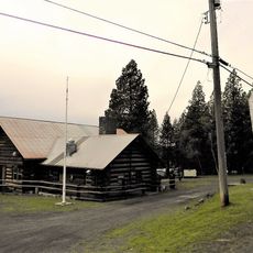
North–South Ski Bowl, Ski resort in St. Joe National Forest, Idaho.

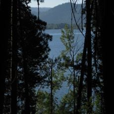
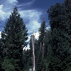
North-South Ski Bowl is a ski resort in St. Joe National Forest, spread across mountainous terrain in Idaho. The slopes descend from Dennis Mountain and offer varying difficulty levels for skiers of different abilities.

The Civilian Conservation Corps built this ski area in the late 1930s as part of the Works Progress Administration. Washington State College initially owned and operated the facility in the forest terrain.

Multiple ski teams from Washington State University and University of Idaho used these slopes for intercollegiate training and competitions throughout the years.

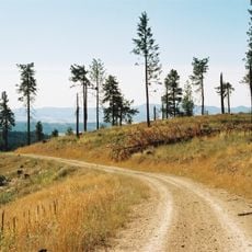
The location is accessible by road with parking available for winter visitors. Check current conditions before visiting, as access can vary depending on snow and weather.

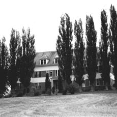
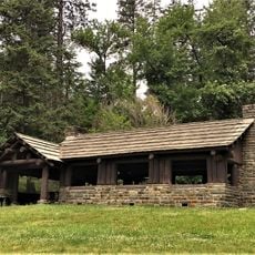
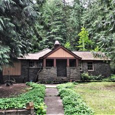
The summit now hosts the Palouse Divide Lodge, which functions as a conference and retreat center. This transformation shows how the mountain space has been repurposed for a different use over time.

The community of curious travelers

AroundUs brings together thousands of curated places, local tips, and hidden gems, enriched daily by 60,000 contributors worldwide.

Start exploring
Location
GPS coordinates
47.06600,-116.66000
Latest update
December 12, 2025 12:08
Around this place
Heyburn State Park
United States of America

Heyburn State Park

32.9 km
McCroskey State Park
United States of America

McCroskey State Park

22.1 km
Hobo Cedar Grove Botanical Area
United States of America

Hobo Cedar Grove Botanical Area

40.5 km
Coeur d'Alene Mission of the Sacred Heart
United States of America

Coeur d'Alene Mission of the Sacred Heart

21.2 km
Bovill Opera House
United States of America

Bovill Opera House

30.6 km
Hotel Bovill
United States of America

Hotel Bovill

30.7 km
Commercial Historic District
United States of America

Commercial Historic District

24.3 km
Hotel Rietmann
United States of America

Hotel Rietmann

37.8 km
Holy Trinity Episcopal Church
United States of America

Holy Trinity Episcopal Church

35.9 km
St. Maries Masonic Temple No. 63
United States of America

St. Maries Masonic Temple No. 63

28.6 km
Kootenai Inn
United States of America

Kootenai Inn

28.8 km
Benewah County Courthouse
United States of America

Benewah County Courthouse

28.6 km
American Legion Cabin
United States of America

American Legion Cabin

23.7 km
St. Maries 1910 Fire Memorial
United States of America

St. Maries 1910 Fire Memorial

28.3 km
Axel Bohman House
United States of America

Axel Bohman House

37.4 km
Ole Bohman House
United States of America

Ole Bohman House

37.4 km
Edward and Ida Soncarty Barn
United States of America

Edward and Ida Soncarty Barn

17.7 km
Rocky Point CCC Properties
United States of America

Rocky Point CCC Properties

32.8 km
Chatcolet CCC Picnic and Camping Area
United States of America

Chatcolet CCC Picnic and Camping Area

35.2 km
United States of America

Mullen Trail Park Historical Monument

28.7 km
Chatcolet Lower Picnic Shelter
United States of America

Chatcolet Lower Picnic Shelter

35.2 km
Plummer Point Picnic Shelter
United States of America

Plummer Point Picnic Shelter

34 km
Chatcolet Bridge
United States of America

Chatcolet Bridge

35.5 km
Tekoa Train Trestle
United States of America

Tekoa Train Trestle

36.4 km
Plummer Point CCC Picnic and Hiking Area
United States of America

Plummer Point CCC Picnic and Hiking Area

34 km
Rocky Point Assistant Park Manager's Residence
United States of America

Rocky Point Assistant Park Manager's Residence

32.8 km
United States of America

Lane's Lookout

3.2 km
United States of America

Scenic viewpoint

1.9 km
Show the full map
Reviews
Share your experience

No review yet

Discussions
Start a discussion...

No discussion yet

« North–South Ski Bowl - Ski resort in St. Joe National Forest, Idaho » is provided by Around Us (aroundus.com). Images and texts are derived from Wikimedia project under a Creative Commons license. You are allowed to copy, distribute, and modify copies of this page, under the conditions set by the license, as long as this note is clearly visible.

Discover hidden gems everywhere you go!

From secret cafés to breathtaking viewpoints, skip the crowded tourist spots and find places that match your style. Our app makes it easy with voice search, smart filtering, route optimization, and insider tips from travelers worldwide. Download now for the complete mobile experience.

Around Us App Screenshot

A unique approach to discovering new places

Le Figaro

All the places worth exploring

France Info

A tailor-made excursion in just a few clicks

20 Minutes

Around Us
Travel Guide & Maps
Download

Send to your phone

QR Code
1

Open the camera app on your mobile.

2

Point at the QR code with your camera. A notification will appear.

3

Tap the notification to open the link.