Hobo Cedar Grove Botanical Area

Log in to your account

AroundUs is a community-driven map of interesting places, built by curious explorers like you. It grows with every review, story, and photo you share.
Connect to save your favorite spots, contribute locations, and create personalized routes.
Continue with Google
Continue with Apple
Continue with X
Continue with Facebook
Continue with email
By continuing, you accept our Terms and Conditions and our Privacy Policy
Create an account
Add to collection
Map
Suggest a change
Share

Hobo Cedar Grove Botanical Area, Protected botanical area in St. Joe National Forest, Idaho, United States

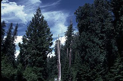
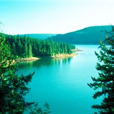
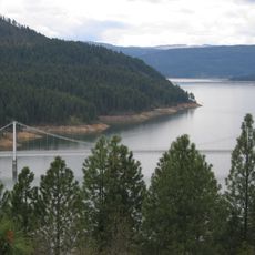
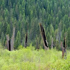
Hobo Cedar Grove is a 240-acre protected area in St. Joe National Forest where Western Red Cedar trees grow over 100 feet tall, surrounded by Oregon boxwood and Lady-fern plants. The landscape shows a mix of densely packed trees and understory vegetation in a moist woodland setting.

The area gained National Natural Landmark status in 1980, protecting cedar trees centuries old that began growing before Europeans explored North America. This protection status recognized the importance of this forest area for preserving ancient woodland ecosystems.

The place holds meaning for forest ecologists and nature conservationists studying how old-growth woodlands influence regional environments. Visitors observe how scientists and botanists use this location to understand forest relationships and ecosystem balance.

Two connected walking trails totaling 1.5 miles guide visitors through the woodland, with numbered signs identifying plant species along the way. The well-marked paths allow visitors to explore the vegetation at their own pace and learn more about forest structure.

The place hosts more than 77 plant species and 10 tree varieties in a relatively small space, creating a concentrated display of Pacific Northwest vegetation. This density allows visitors to see the diversity of an entire region within a single woodland area.

Location: Idaho

GPS coordinates: 47.09110,-116.12700

Latest update: December 9, 2025 20:22

Photos
Around this place
Old Mission State Park
United States of America

Old Mission State Park

54 km
Edward Pulaski Tunnel and Placer Creek Escape Route
United States of America

Edward Pulaski Tunnel and Placer Creek Escape Route

44.4 km
Heyburn State Park
United States of America

Heyburn State Park

56.1 km
Dworshak State Park
United States of America

Dworshak State Park

57.6 km
Dent Bridge
United States of America

Dent Bridge

54.5 km
Chicago, Milwaukee, St. Paul and Pacific Railroad Company Historic District
United States of America

Chicago, Milwaukee, St. Paul and Pacific Railroad Company Historic District

46.6 km
United States of America

Burke Canyon

51.3 km
Wallace Historic District
United States of America

Wallace Historic District

45.1 km
Bethany Memorial Chapel
United States of America

Bethany Memorial Chapel

60.6 km
Coeur d'Alene Mission of the Sacred Heart
United States of America

Coeur d'Alene Mission of the Sacred Heart

59.9 km
Bovill Opera House
United States of America

Bovill Opera House

32.8 km
Commercial Historic District
United States of America

Commercial Historic District

61.6 km
St. Maries Masonic Temple No. 63
United States of America

St. Maries Masonic Temple No. 63

41.7 km
Wallace 1910 Fire Memorial
United States of America

Wallace 1910 Fire Memorial

47 km
Benewah County Courthouse
United States of America

Benewah County Courthouse

41.5 km
American Legion Cabin
United States of America

American Legion Cabin

60.9 km
Wallace Carnegie Library
United States of America

Wallace Carnegie Library

45.3 km
St. Maries 1910 Fire Memorial
United States of America

St. Maries 1910 Fire Memorial

42.8 km
Cedar Snags
United States of America

Cedar Snags

42 km
Crystal Gold Mine
United States of America

Crystal Gold Mine

49.2 km
Edward and Ida Soncarty Barn
United States of America

Edward and Ida Soncarty Barn

58 km
Northern Pacific Railroad Depot Museum
United States of America

Northern Pacific Railroad Depot Museum

45.2 km
Rocky Point CCC Properties
United States of America

Rocky Point CCC Properties

55.3 km
Chatcolet CCC Picnic and Camping Area
United States of America

Chatcolet CCC Picnic and Camping Area

57.5 km
Chatcolet Bridge
United States of America

Chatcolet Bridge

57.1 km
Plummer Point Picnic Shelter
United States of America

Plummer Point Picnic Shelter

57.5 km
Chatcolet Lower Picnic Shelter
United States of America

Chatcolet Lower Picnic Shelter

57.5 km
Plummer Point CCC Picnic and Hiking Area
United States of America

Plummer Point CCC Picnic and Hiking Area

57.5 km
Show the full map
Reviews

Visited this place? Tap the stars to rate it and share your experience / photos with the community! Try now! You can cancel it anytime.

« Hobo Cedar Grove Botanical Area - Protected botanical area in St. Joe National Forest, Idaho, United States » is provided by Around Us (aroundus.com). Images and texts are derived from Wikimedia project under a Creative Commons license. You are allowed to copy, distribute, and modify copies of this page, under the conditions set by the license, as long as this note is clearly visible.

Discover hidden gems everywhere you go!

From secret cafés to breathtaking viewpoints, skip the crowded tourist spots and find places that match your style. Our app makes it easy with voice search, smart filtering, route optimization, and insider tips from travelers worldwide. Download now for the complete mobile experience.

Around Us App Screenshot

A unique approach to discovering new places

Le Figaro

All the places worth exploring

France Info

A tailor-made excursion in just a few clicks

20 Minutes