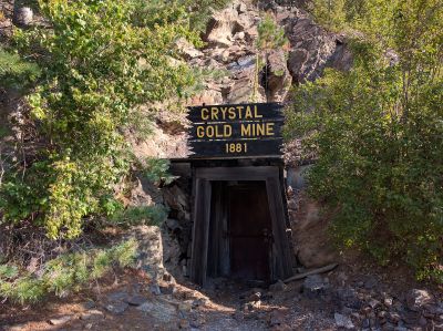
Crystal Gold Mine, Underground gold mine in Shoshone County, Idaho.
Crystal Gold Mine is an underground mine in Shoshone County, Idaho, that takes visitors through passages with exposed gold deposits and silver within quartz veins visible along the walls. The tunnels reveal mineral formations built up over geological time through natural processes.
The mine was first discovered in 1879 by prospector Tom Irwin, but its entrance was hidden away for decades until being rediscovered in 1991. This finding brought the site back to public attention and allowed it to reopen for visitors.
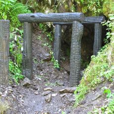
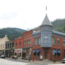
Mining shaped the identity of this region, and the equipment on display shows how workers extracted ore from the earth using simple hand tools and physical strength.
Guided tours run daily, and it is helpful to wear comfortable shoes and bring a jacket since underground passages stay cool year-round. Parking facilities including RV spaces are available on the property.
The walls are covered with multicolored mineral crystals and stalactites that formed naturally over time without human intervention. These formations give the underground spaces a shimmer that many visitors find surprising.
Location: Shoshone County
Address: Silver Valley Road
Opening Hours: 09:00-18:00
Phone: +(208)7834653
Email: crystalgoldmine1881@gmail.com
Website: https://goldmine-idaho.com
GPS coordinates: 47.53230,-116.09206
Latest update: December 9, 2025 20:28
Old Mission State Park
20.3 km
Bunker Hill Mine and Smelting Complex
4.3 km
Edward Pulaski Tunnel and Placer Creek Escape Route
20.1 km
Idaho Panhandle National Forests
22.6 km
Thompson Falls State Park
53.5 km
Veterans Memorial Centennial Bridge
48.5 km
Chicago, Milwaukee, St. Paul and Pacific Railroad Company Historic District
37.7 kmBurke Canyon
17.9 km
Wallace Historic District
14.1 km
Hobo Cedar Grove Botanical Area
49.2 km
St. Thomas Catholic Church
53.5 km
Mineral Ridge National Recreation Trail, Idaho
42.4 km
First United Methodist Church
53.5 km
Cabinet National Forest
52.5 km
St. Maries Masonic Temple No. 63
43.2 km
Wallace 1910 Fire Memorial
14.2 km
Benewah County Courthouse
43.1 km
Wallace Carnegie Library
14.1 km
St. Maries 1910 Fire Memorial
44.4 km
John P. and Stella Gray House
52.9 km
Silas W. and Elizabeth Crane House
52.8 km
Cedar Snags
30.4 km
Northern Pacific Railroad Depot Museum
14.3 km
Rocky Point CCC Properties
53.2 km
Chatcolet CCC Picnic and Camping Area
53.5 km
Chatcolet Bridge
52.7 km
Chatcolet Lower Picnic Shelter
53.5 km
Rocky Point Assistant Park Manager's Residence
53.2 kmVisited this place? Tap the stars to rate it and share your experience / photos with the community! Try now! You can cancel it anytime.
Discover hidden gems everywhere you go!
From secret cafés to breathtaking viewpoints, skip the crowded tourist spots and find places that match your style. Our app makes it easy with voice search, smart filtering, route optimization, and insider tips from travelers worldwide. Download now for the complete mobile experience.
A unique approach to discovering new places❞
— Le Figaro
All the places worth exploring❞
— France Info
A tailor-made excursion in just a few clicks❞
— 20 Minutes