Enable Location

We need your location to show you interesting places around you

Discover nearby places

Find interesting locations and hidden gems around you

Precise directions

Get accurate directions and distances to places

Your location is never shared with other users. It's only used when you tap the location button.

Edward Pulaski Tunnel and Placer Creek Escape Route

Log in to your account

Start exploring — it's free

Trusted by 61,631 travelers worldwide

Continue with Google
Continue with Apple
or

We will send you a code to connect

By continuing, you accept our Terms and Conditions and our Privacy Policy

Check your inbox

We've sent a pincode in your inbox. Please enter the code below.

Edward Pulaski Tunnel and Placer Creek Escape Route

Edward Pulaski Tunnel and Placer Creek Escape Route, Historic mining tunnel in Shoshone County, United States

Description

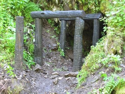
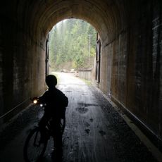
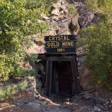
The Edward Pulaski Tunnel is a historic mining passage carved into the mountainside in Shoshone County, running deep into solid rock. The entrance is narrow and the interior is enclosed by thick stone walls that form a natural shelter.

History

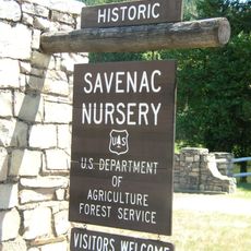
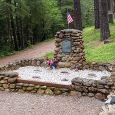
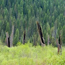
The tunnel was originally excavated as a mining operation and gained tragic significance in 1910 when Forest Service ranger Edward Pulaski led firefighters to shelter within it. This event during a devastating forest fire made the site a testament to a critical moment in firefighting history.

Culture

The site represents early American firefighting techniques and demonstrates the evolution of forest fire management strategies in the western United States.

Practical

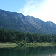
The site can be reached by following a hiking path that starts at a marked trailhead and crosses several bridges along the way. Wear sturdy shoes and bring water, as the route passes through mountainous terrain.

Did you know?

The mine was originally used by private prospectors and later became an unexpected refuge during an emergency firefighting operation. This dual story makes it a place where industrial history and a dramatic rescue intersect.

Location
GPS coordinates
47.44506,-115.85744
Latest update
December 8, 2025 20:02

AroundUs brings together thousands of curated places, local tips, and hidden gems, enriched daily by 60,000 contributors worldwide. Discover all places nearby (Shoshone County).

Around this place
Old Mission State Park
United States of America

Old Mission State Park

39.6 km
Bunker Hill Mine and Smelting Complex
United States of America

Bunker Hill Mine and Smelting Complex

24.3 km
Idaho Panhandle National Forests
United States of America

Idaho Panhandle National Forests

40.5 km
Thompson Falls State Park
United States of America

Thompson Falls State Park

40 km
Chicago, Milwaukee, St. Paul and Pacific Railroad Company Historic District
United States of America

Chicago, Milwaukee, St. Paul and Pacific Railroad Company Historic District

17.6 km
United States of America

Burke Canyon

7.6 km
Wallace Historic District
United States of America

Wallace Historic District

6 km
Hobo Cedar Grove Botanical Area
United States of America

Hobo Cedar Grove Botanical Area

44.4 km
Savenac Nursery Historic District
United States of America

Savenac Nursery Historic District

35.4 km
Tourist Hotel
United States of America

Tourist Hotel

42 km
St. Maries Masonic Temple No. 63
United States of America

St. Maries Masonic Temple No. 63

55.5 km
Wallace 1910 Fire Memorial
United States of America

Wallace 1910 Fire Memorial

6.4 km
Benewah County Courthouse
United States of America

Benewah County Courthouse

55.3 km
Wallace Carnegie Library
United States of America

Wallace Carnegie Library

6.1 km
St. Maries 1910 Fire Memorial
United States of America

St. Maries 1910 Fire Memorial

56.8 km
Sanders County Jail
United States of America

Sanders County Jail

41.6 km
Cedar Snags
United States of America

Cedar Snags

10.6 km
De Borgia Schoolhouse
United States of America

De Borgia Schoolhouse

39.1 km
Crystal Gold Mine
United States of America

Crystal Gold Mine

20.1 km
Bedard House
United States of America

Bedard House

42.1 km
Ainsworth House
United States of America

Ainsworth House

41.3 km
Preston House
United States of America

Preston House

42.3 km
Thayer House
United States of America

Thayer House

41.8 km
Grandchamp House
United States of America

Grandchamp House

41.6 km
Thompson Falls Hydroelectric Dam Historic District
United States of America

Thompson Falls Hydroelectric Dam Historic District

41.1 km
Hoyt House
United States of America

Hoyt House

41.8 km
Griffen House
United States of America

Griffen House

41.7 km
Northern Pacific Railroad Depot Museum
United States of America

Northern Pacific Railroad Depot Museum

5.9 km
Show the full map
« Edward Pulaski Tunnel and Placer Creek Escape Route - Historic mining tunnel in Shoshone County, United States » is provided by Around Us (aroundus.com). Images and texts are derived from Wikimedia project under a Creative Commons license. You are allowed to copy, distribute, and modify copies of this page, under the conditions set by the license, as long as this note is clearly visible.

Discover hidden gems everywhere you go!

From secret cafés to breathtaking viewpoints, skip the crowded tourist spots and find places that match your style. Our app makes it easy with voice search, smart filtering, route optimization, and insider tips from travelers worldwide. Download now for the complete mobile experience.

Around Us App Screenshot

A unique approach to discovering new places

Le Figaro

All the places worth exploring

France Info

A tailor-made excursion in just a few clicks

20 Minutes

Around Us
Travel Guide & Maps
Download

Send to your phone

QR Code
1

Open the camera app on your mobile.

2

Point at the QR code with your camera. A notification will appear.

3

Tap the notification to open the link.