Chest opened
+${chestReward.xp} XP
Explorer
NOUVEAU ×${chestReward.collectible.quantity}
tapez pour fermer

See the monuments around you in AR Open chests in the app

Around Us is built for your phone — point your camera at the streets and discover the monuments and places around you in augmented reality. Around Us is built for your phone — chests unlock when you walk, explore and capture nearby places.

•

Enable Location

We need your location to show you interesting places around you

Discover nearby places

Find interesting locations and hidden gems around you

Precise directions

Get accurate directions and distances to places

Your location is never shared with other users. It's only used when you tap the location button.

Hauser Dam

Log in to your account

Start exploring — it's free

Trusted by 88,976 travelers worldwide

Continue with Google
Continue with Apple
or

We will send you a code to connect

By continuing, you accept our Terms and Conditions and our Privacy Policy

Check your inbox

We've sent a pincode in your inbox. Please enter the code below.

Discussion Reviews 1 Photos
10.2k Popularity

Hauser Dam, Hydroelectric gravity dam in Lewis and Clark County, Montana.

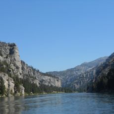
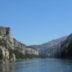
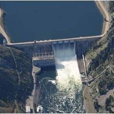
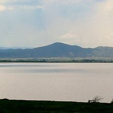
Hauser Dam is a concrete gravity dam that spans the Missouri River near Helena, Montana. The structure harnesses the river's flow to produce electricity while storing water in a substantial reservoir.

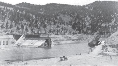
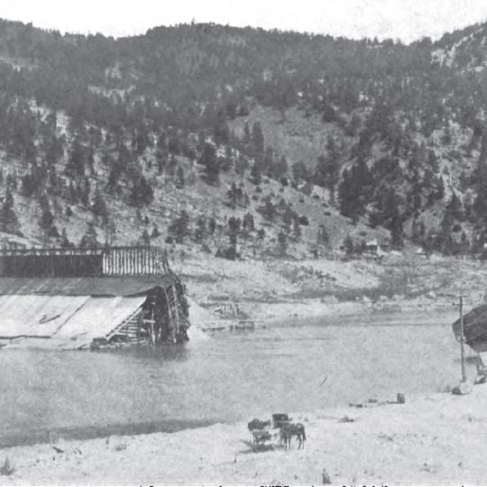
An initial steel dam was built in 1907 but collapsed dramatically in 1908. Reconstruction with a concrete structure followed and was completed by 1911.

The dam bears the name of Samuel Thomas Hauser, a territorial governor of Montana who led the Missouri River Power Company during the initial construction.

Visitors can enjoy views from the dam and explore various access points around the reservoir. Summer and early fall offer the best conditions when weather is stable and the water level is clearly visible.

When the first dam collapsed in 1908, it created a flood wave about 7 to 9 meters high. Quick warnings to downstream communities prevented any loss of life despite the disaster.

The community of curious travelers

AroundUs brings together thousands of curated places, local tips, and hidden gems, enriched daily by 60,000 contributors worldwide.
Start exploring
GPS coordinates
46.76566,-111.88688
Latest update
September 17, 2026 02:25
Around this place
Gates of the Mountains Wilderness
United States of America

Gates of the Mountains Wilderness

8.1 mi
Helena National Forest
United States of America

Helena National Forest

12.9 mi
Canyon Ferry Dam
United States of America

Canyon Ferry Dam

11.1 mi
Helena Montana Temple
United States of America

Helena Montana Temple

11 mi
Lake Helena
United States of America

Lake Helena

5.3 mi
Black Sandy State Park
United States of America

Black Sandy State Park

1.4 mi
Kluge House
United States of America

Kluge House

12.4 mi
Home of Peace Cemetery
United States of America

Home of Peace Cemetery

13 mi
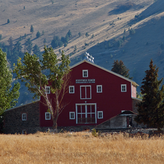
W.C. Child Ranch
United States of America

W.C. Child Ranch

13.7 mi
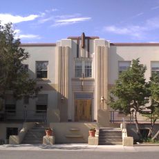
Lewis and Clark County Hospital Historic District
United States of America

Lewis and Clark County Hospital Historic District

12.2 mi
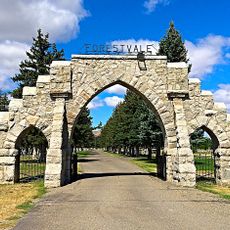
Forestvale Cemetery
United States of America

Forestvale Cemetery

10.4 mi
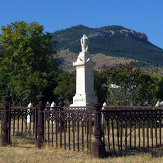
Benton Avenue Cemetery
United States of America

Benton Avenue Cemetery

13.4 mi
Spokane Hills
United States of America

Spokane Hills

11.6 mi
T. H. Kleinschmidt House
United States of America

T. H. Kleinschmidt House

13.9 mi
Great Northern Carousel
United States of America

Great Northern Carousel

13.6 mi
Young Women's Christian Association
United States of America

Young Women's Christian Association

13.8 mi
Mann Gulch Wildfire Historic District
United States of America

Mann Gulch Wildfire Historic District

7.9 mi
Wick-Seiler House
United States of America

Wick-Seiler House

13.9 mi
St John's Lutheran Church (Helena)
United States of America

St John's Lutheran Church (Helena)

13.5 mi
Sleeping Giant Lanes & Mini Golf
United States of America

Sleeping Giant Lanes & Mini Golf

12.8 mi
United States of America

Black Sandy Beach

1 mi
United States of America

Curly Slide

13.3 mi
United States of America

Speed Slide

13.3 mi
United States of America

Curly Slide

13.3 mi
United States of America

Sculpture

13.8 mi
United States of America

Sculpture

13.8 mi
United States of America

Two Camps Vista

5.8 mi
United States of America

Scenic viewpoint

11.5 mi
Show the full map
Reviews
Share your experience

No review yet

Discussions
Start a discussion...

No discussion yet

« Hauser Dam - Hydroelectric gravity dam in Lewis and Clark County, Montana » is provided by Around Us (aroundus.com). Images and texts are derived from Wikimedia project under a Creative Commons license. You are allowed to copy, distribute, and modify copies of this page, under the conditions set by the license, as long as this note is clearly visible.

Discover hidden gems everywhere you go!

From secret cafés to breathtaking viewpoints, skip the crowded tourist spots and find places that match your style. Our app makes it easy with voice search, smart filtering, route optimization, and insider tips from travelers worldwide. Download now for the complete mobile experience.

Around Us App Screenshot
❝

A unique approach to discovering new places❞

— Le Figaro

❝

All the places worth exploring❞

— France Info

❝

A tailor-made excursion in just a few clicks❞

— 20 Minutes

Around Us
Travel Guide & Maps
Download

Send to your phone

QR Code
1

Open the camera app on your mobile.

2

Point at the QR code with your camera. A notification will appear.

3

Tap the notification to open the link.