Enable Location

We need your location to show you interesting places around you

Discover nearby places

Find interesting locations and hidden gems around you

Precise directions

Get accurate directions and distances to places

Your location is never shared with other users. It's only used when you tap the location button.

Laurier-Cascade Border Crossing

Log in to your account

Start exploring — it's free

Trusted by 61,663 travelers worldwide

Continue with Google
Continue with Apple
or

We will send you a code to connect

By continuing, you accept our Terms and Conditions and our Privacy Policy

Check your inbox

We've sent a pincode in your inbox. Please enter the code below.

Laurier-Cascade Border Crossing

Laurier-Cascade Border Crossing, Border crossing point in Ferry County and Regional District of Kootenay Boundary, United States and Canada

Description

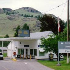
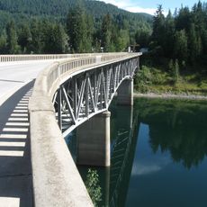
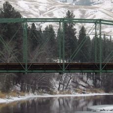
The Laurier-Cascade Border Crossing connects US Highway 395 with British Columbia Highway 395 between Kettle Falls, Washington, and Christina Lake, British Columbia. This crossing serves as the main vehicle route for people traveling between the two jurisdictions in this rural region.

History

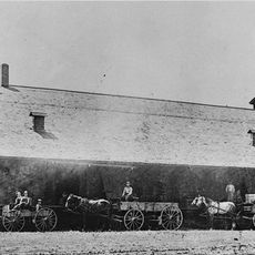
The crossing opened in 1897 during a mining boom when prospectors from the United States flooded into British Columbia in search of resources. The infrastructure grew alongside the region's needs as communities on both sides of the border expanded.

Culture

The crossing links two neighboring communities where residents regularly travel for work, shopping, and family visits across the border. This daily movement between the two nations shapes how people in this region live and connect with each other.

Practical

Canadian customs operates from 8:00 AM to midnight daily, while United States customs services run from 8:00 AM to 8:00 PM Pacific time. Travelers should have their documents ready and be aware that the two countries maintain different hours on each side.

Did you know?

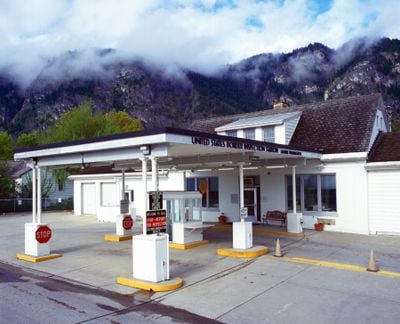
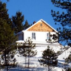
Three structures from 1936 at the Canadian border station showcase early engineering of customs facilities from that era. These buildings remain as a physical record of how border infrastructure was designed in that period.

Location
Part of
Canada–United States border
GPS coordinates
49.00008,-118.22395
Latest update
December 13, 2025 12:21

AroundUs brings together thousands of curated places, local tips, and hidden gems, enriched daily by 60,000 contributors worldwide. Discover all places nearby (Ferry County).

« Laurier-Cascade Border Crossing - Border crossing point in Ferry County and Regional District of Kootenay Boundary, United States and Canada » is provided by Around Us (aroundus.com). Images and texts are derived from Wikimedia project under a Creative Commons license. You are allowed to copy, distribute, and modify copies of this page, under the conditions set by the license, as long as this note is clearly visible.

Discover hidden gems everywhere you go!

From secret cafés to breathtaking viewpoints, skip the crowded tourist spots and find places that match your style. Our app makes it easy with voice search, smart filtering, route optimization, and insider tips from travelers worldwide. Download now for the complete mobile experience.

Around Us App Screenshot

A unique approach to discovering new places

Le Figaro

All the places worth exploring

France Info

A tailor-made excursion in just a few clicks

20 Minutes

Around Us
Travel Guide & Maps
Download

Send to your phone

QR Code
1

Open the camera app on your mobile.

2

Point at the QR code with your camera. A notification will appear.

3

Tap the notification to open the link.