Chest opened
+${chestReward.xp} XP
Explorer
NOUVEAU ×${chestReward.collectible.quantity}
tapez pour fermer
Chest locked

Open chests in the app

Around Us is built for your phone — chests unlock when you walk, explore and capture nearby places.

Enable Location

We need your location to show you interesting places around you

Discover nearby places

Find interesting locations and hidden gems around you

Precise directions

Get accurate directions and distances to places

Your location is never shared with other users. It's only used when you tap the location button.

Powder River

Log in to your account

Start exploring — it's free

Trusted by 72,890 travelers worldwide

Continue with Google
Continue with Apple
or

We will send you a code to connect

By continuing, you accept our Terms and Conditions and our Privacy Policy

Check your inbox

We've sent a pincode in your inbox. Please enter the code below.

Powder River
Discussion Reviews 1 Photos
12.9k Popularity

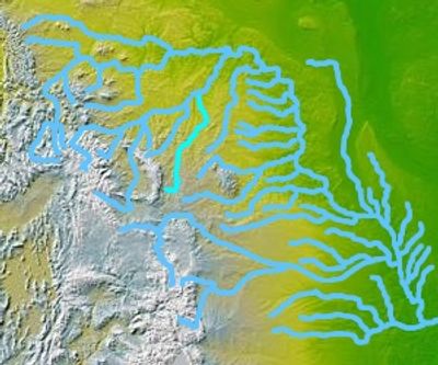
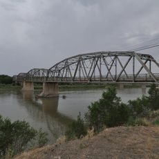
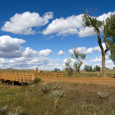
Powder River, River system in Wyoming and Montana, United States.

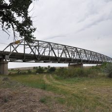
The Powder River is a river system that flows 375 miles from northeastern Wyoming to southeastern Montana. It passes through prairie landscapes before joining the Yellowstone River.

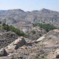
Sioux, Cheyenne, and Crow peoples used the Powder River region as hunting grounds before European settlement arrived in the 1800s. European expansion in that century transformed the area and its use.

The name comes from indigenous peoples' observation of fine sediment that winds lift from the riverbed into the air. Visitors can still see this cloudy water today, which gives the river its distinctive appearance.

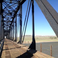
The river passes through only a few towns, so it helps to research access points before visiting. The water carries heavy sediment, so water shoes are useful if you plan to wade.

Local residents humorously describe the river as a mile wide and an inch deep, emphasizing its shallow nature. This expression captures how expansive the water surface looks while the actual depth remains remarkably shallow.

The community of curious travelers

AroundUs brings together thousands of curated places, local tips, and hidden gems, enriched daily by 60,000 contributors worldwide.

Start exploring
Location
Location
GPS coordinates
46.73333,-105.43389
Latest update
December 7, 2025 20:43
Around this place
Fort Keogh
United States of America

Fort Keogh

52.6 km
Makoshika State Park
United States of America

Makoshika State Park

67.3 km
Yellowstone River Bridge
United States of America

Yellowstone River Bridge

27.8 km
Main Street Historic District
United States of America

Main Street Historic District

48.3 km
Terry Badlands WSA
United States of America

Terry Badlands WSA

12.9 km
Holy Rosary Hospital
United States of America

Holy Rosary Hospital

47.3 km
Merrill Avenue Historic District
United States of America

Merrill Avenue Historic District

68.7 km
Miles City Waterworks Building and Pumping Plant Park
United States of America

Miles City Waterworks Building and Pumping Plant Park

49.3 km
Charles Krug House
United States of America

Charles Krug House

68.5 km
Sacred Heart Church
United States of America

Sacred Heart Church

68.8 km
Powder River Bridge
United States of America

Powder River Bridge

591 m
Bell Street Bridge
United States of America

Bell Street Bridge

68.3 km
Miles City Main Post Office
United States of America

Miles City Main Post Office

48.2 km
Ursuline Convent of the Sacred Heart
United States of America

Ursuline Convent of the Sacred Heart

47.5 km
Glendive City Water Filtration Plant
United States of America

Glendive City Water Filtration Plant

68.5 km
Walrond and Elizabeth Snell House
United States of America

Walrond and Elizabeth Snell House

47.9 km
Mountain States Telephone and Telegraph Company Building
United States of America

Mountain States Telephone and Telegraph Company Building

48.1 km
George M. Miles House
United States of America

George M. Miles House

47.6 km
Ismay Jail
United States of America

Ismay Jail

55.6 km
Cottonwood Creek Bridge
United States of America

Cottonwood Creek Bridge

58.2 km
East Main Street Residential Historic District
United States of America

East Main Street Residential Historic District

47.4 km
William Harmon House
United States of America

William Harmon House

47.9 km
Northern Pacific Railroad Settling Tanks
United States of America

Northern Pacific Railroad Settling Tanks

68.5 km
Grandey Elementary School
United States of America

Grandey Elementary School

11.6 km
Glendive Dinosaur & Fossil Museum
United States of America

Glendive Dinosaur & Fossil Museum

71.3 km
Thomas and Beulah Shore House
United States of America

Thomas and Beulah Shore House

47.8 km
St. Philip's Episcopal Church
United States of America

St. Philip's Episcopal Church

92.4 km
Blackstock Residence
United States of America

Blackstock Residence

68.7 km
Show the full map
Reviews
Share your experience

No review yet

Discussions
Start a discussion...

No discussion yet

« Powder River - River system in Wyoming and Montana, United States » is provided by Around Us (aroundus.com). Images and texts are derived from Wikimedia project under a Creative Commons license. You are allowed to copy, distribute, and modify copies of this page, under the conditions set by the license, as long as this note is clearly visible.

Discover hidden gems everywhere you go!

From secret cafés to breathtaking viewpoints, skip the crowded tourist spots and find places that match your style. Our app makes it easy with voice search, smart filtering, route optimization, and insider tips from travelers worldwide. Download now for the complete mobile experience.

Around Us App Screenshot

A unique approach to discovering new places

Le Figaro

All the places worth exploring

France Info

A tailor-made excursion in just a few clicks

20 Minutes

Around Us
Travel Guide & Maps
Download

Send to your phone

QR Code
1

Open the camera app on your mobile.

2

Point at the QR code with your camera. A notification will appear.

3

Tap the notification to open the link.