Enable Location

We need your location to show you interesting places around you

Discover nearby places

Find interesting locations and hidden gems around you

Precise directions

Get accurate directions and distances to places

Your location is never shared with other users. It's only used when you tap the location button.

Main Street Historic District

Log in to your account

Start exploring — it's free

Trusted by 62,874 travelers worldwide

Continue with Google
Continue with Apple
or

We will send you a code to connect

By continuing, you accept our Terms and Conditions and our Privacy Policy

Check your inbox

We've sent a pincode in your inbox. Please enter the code below.

Main Street Historic District, National Register of Historic Places district in Miles City, United States.

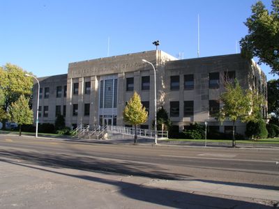
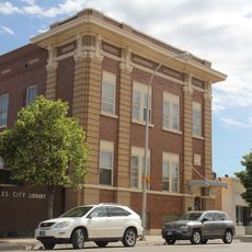
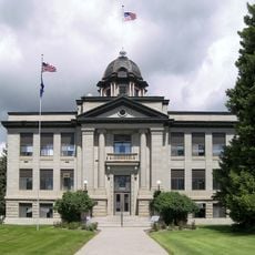
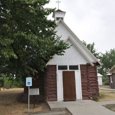
Main Street Historic District is a central business area in Miles City, Montana, that stretches between Prairie Avenue and Fourth Street. It contains multiple commercial establishments, government buildings, and religious structures that remain in active use today.

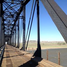
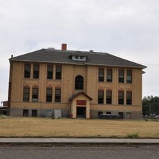
The district developed through three major growth periods between 1882 and 1940, beginning with the arrival of the Northern Pacific Railroad. This rail connection catalyzed a transformation where wooden structures were replaced by brick buildings.

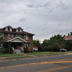
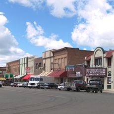
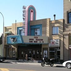
The streetscape shows how the district served as the commercial and social heart of Miles City, with buildings that still host local businesses and gatherings today. Walking along Main Street, you notice how the architecture reflects the tastes and ambitions of different generations who shaped the town.

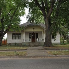
The district is best explored on foot since buildings are arranged along a continuous street corridor. Visit during daylight to see the architectural details of the facades clearly.

The Kenney Block from 1893 preserves original details from its saloon days, including a pressed tin ceiling and a three-pillared back bar. These interior features showcase how such establishments looked and functioned during that era.

The community of curious travelers

AroundUs brings together thousands of curated places, local tips, and hidden gems, enriched daily by 60,000 contributors worldwide.

Start exploring
Location
GPS coordinates
46.40583,-105.84778
Latest update
December 14, 2025 17:41
Around this place
Fort Keogh
United States of America

Fort Keogh

4.3 km
Makoshika State Park
United States of America

Makoshika State Park

114.6 km
Medicine Rocks State Park
United States of America

Medicine Rocks State Park

113.4 km
Deer Medicine Rocks
United States of America

Deer Medicine Rocks

102.5 km
Yellowstone River Bridge
United States of America

Yellowstone River Bridge

75 km
Terry Badlands WSA
United States of America

Terry Badlands WSA

61.2 km
Carter County Museum
United States of America

Carter County Museum

115.6 km
Yucca Theatre
United States of America

Yucca Theatre

107.2 km
Holy Rosary Hospital
United States of America

Holy Rosary Hospital

1.1 km
Miles City Waterworks Building and Pumping Plant Park
United States of America

Miles City Waterworks Building and Pumping Plant Park

1.6 km
Charles Krug House
United States of America

Charles Krug House

116.3 km
Powder River Bridge
United States of America

Powder River Bridge

48.9 km
Bell Street Bridge
United States of America

Bell Street Bridge

116.1 km
Miles City Main Post Office
United States of America

Miles City Main Post Office

238 m
Ursuline Convent of the Sacred Heart
United States of America

Ursuline Convent of the Sacred Heart

829 m
Glendive City Water Filtration Plant
United States of America

Glendive City Water Filtration Plant

116.2 km
Walrond and Elizabeth Snell House
United States of America

Walrond and Elizabeth Snell House

804 m
Mountain States Telephone and Telegraph Company Building
United States of America

Mountain States Telephone and Telegraph Company Building

230 m
George M. Miles House
United States of America

George M. Miles House

873 m
Cottonwood Creek Bridge
United States of America

Cottonwood Creek Bridge

81.5 km
William Harmon House
United States of America

William Harmon House

472 m
East Main Street Residential Historic District
United States of America

East Main Street Residential Historic District

1 km
Rosebud County Courthouse
United States of America

Rosebud County Courthouse

65.4 km
Grandey Elementary School
United States of America

Grandey Elementary School

59.5 km
Thomas and Beulah Shore House
United States of America

Thomas and Beulah Shore House

1.2 km
St. Philip's Episcopal Church
United States of America

St. Philip's Episcopal Church

47.8 km
Forsyth Main Street Historic District
United States of America

Forsyth Main Street Historic District

65.7 km
Montana Theatre
United States of America

Montana Theatre

208 m
Show the full map
« Main Street Historic District - National Register of Historic Places district in Miles City, United States » is provided by Around Us (aroundus.com). Images and texts are derived from Wikimedia project under a Creative Commons license. You are allowed to copy, distribute, and modify copies of this page, under the conditions set by the license, as long as this note is clearly visible.

Discover hidden gems everywhere you go!

From secret cafés to breathtaking viewpoints, skip the crowded tourist spots and find places that match your style. Our app makes it easy with voice search, smart filtering, route optimization, and insider tips from travelers worldwide. Download now for the complete mobile experience.

Around Us App Screenshot

A unique approach to discovering new places

Le Figaro

All the places worth exploring

France Info

A tailor-made excursion in just a few clicks

20 Minutes

Around Us
Travel Guide & Maps
Download

Send to your phone

QR Code
1

Open the camera app on your mobile.

2

Point at the QR code with your camera. A notification will appear.

3

Tap the notification to open the link.