Medicine Rocks State Park, State park in Carter County, Montana, US.
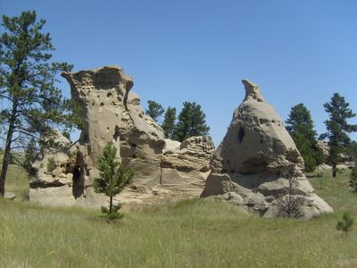
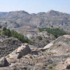
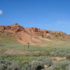
Medicine Rocks State Park is a natural area in southeastern Montana built around a collection of sandstone pillars that rise well above the surrounding grassland. The rock formations are riddled with hollows, passages, and niches shaped by wind and water over millions of years.
The site was added to the National Register of Historic Places in 2017, an acknowledgment of its long-standing cultural and natural value. Theodore Roosevelt had passed through the area decades before, during his time ranching in the region in the late 19th century.
The rock surfaces carry carvings and markings left by Native American tribes who considered this place sacred. Visitors who look closely can still find these traces on the stone, which tell of a long spiritual connection to the land.
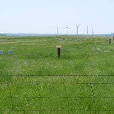
The park is open throughout the year and has basic camping facilities with tables and fire rings available on site. The terrain is open and exposed, so visits during milder months tend to be more comfortable for exploring the rocks on foot.
The sandstone here formed around 61 million years ago from ancient river deposits, and fossils of early mammal ancestors and extinct snakes from the Paleocene epoch have been found within it. This makes the site one of the few places where you can stand among rocks that date back to the first chapter of mammal life on Earth.
The community of curious travelers
AroundUs brings together thousands of curated places, local tips, and hidden gems, enriched daily by 60,000 contributors worldwide.