Wind Cave National Park

Log in to your account

AroundUs is a community-driven map of interesting places, built by curious explorers like you. It grows with every review, story, and photo you share.
Connect to save your favorite spots, contribute locations, and create personalized routes.
Continue with Google
Continue with Apple
Continue with X
Continue with Facebook
Continue with email
By continuing, you accept our Terms and Conditions and our Privacy Policy
Create an account
Add to collection
Map
Suggest a change
Share

Wind Cave National Park, National park with cave system in Custer County, United States.

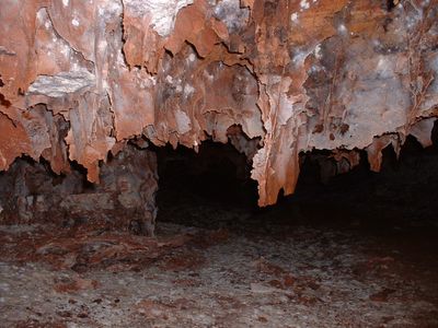
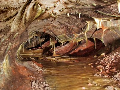
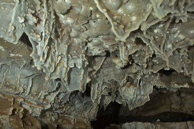
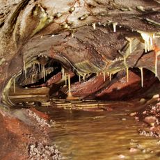
Wind Cave National Park is a protected area with an extensive cave system in Custer County, in southwestern South Dakota. The passages run through limestone layers beneath prairie hills and form chambers with different mineral structures visible under electric lighting.

Theodore Roosevelt designated this place as the first underground national park in the United States and the sixth overall in 1903. Local settlers had discovered the cave entrance in the late 19th century through wind currents flowing from small openings in the ground.

The Lakota call this place Washun Niya and regard it as the spot where people first emerged onto the earth according to their oral tradition. Tours mention the connection between the cave and the surrounding grassland, which the Plains tribes consider part of the same origin story.

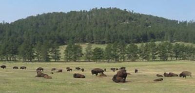
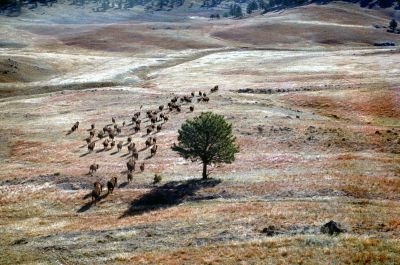
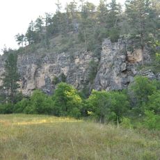
Rangers lead groups through the cave throughout the year, with tours varying in length and difficulty depending on age and fitness of participants. On the surface above, trails cross grassland and forest where bison and other animals often appear.

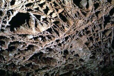
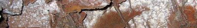
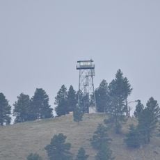
The cave holds nearly all known boxwork formations on the planet, delicate calcite webs that look like honeycomb and formed when softer rock eroded around harder veins. Air flows in or out depending on outside pressure, which is why early explorers were drawn to wind whistling from the ground.

Location: Custer County

Inception: 1903

Operator: National Park Service

Website: https://nps.gov/wica

GPS coordinates: 43.55635,-103.47865

Latest update: December 12, 2025 18:12

Photos
Mysterious underground places worldwide

Underground locations provide insights into geological processes and human history. Natural caves display limestone formations, stalactites, and subterranean rivers formed over thousands of years. Artificial sites include Roman catacombs, medieval cellars, and mining tunnels that document economic...

Around this place
Mammoth Site, Hot Springs
United States of America

Mammoth Site, Hot Springs

14.7 km
Battle Mountain Sanitarium
United States of America

Battle Mountain Sanitarium

13.4 km
Evans Plunge
United States of America

Evans Plunge

12.8 km
United States of America

Hot Springs National Cemetery

13 km
Governor Leslie Jensen House
United States of America

Governor Leslie Jensen House

14.1 km
Hot Springs High School
United States of America

Hot Springs High School

14 km
Pig Tail Bridge
United States of America

Pig Tail Bridge

5.1 km
State Soldiers Home Barn
United States of America

State Soldiers Home Barn

13.4 km
Wind Cave
United States of America

Wind Cave

202 m
Wind Cave National Park Administrative and Utility Area Historic District
United States of America

Wind Cave National Park Administrative and Utility Area Historic District

384 m
Phillip Wesch House
United States of America

Phillip Wesch House

13.3 km
Beaver Creek Rockshelter
United States of America

Beaver Creek Rockshelter

2.9 km
United States of America

Norman B. Streeter Homestead

8.1 km
Beaver Creek Bridge
United States of America

Beaver Creek Bridge

3.2 km
Rankin Ridge Lookout Tower
United States of America

Rankin Ridge Lookout Tower

7.7 km
Pioneer Museum
United States of America

Pioneer Museum

13.7 km
Wind Cave Visitor Center
United States of America

Wind Cave Visitor Center

36 m
United States of America

Argyle Canyon

14.9 km
United States of America

The Mammoth Site of Hot Springs, SD

14.7 km
United States of America

Petroglyphs

20.6 km
United States of America

Bison Center

13.5 km
United States of America

Southern Hills Golf Course

15 km
United States of America

Sculpture

10.9 km
United States of America

Statue, Work of art

13.4 km
United States of America

Work of art

13.9 km
United States of America

Work of art

13.8 km
United States of America

Heaven

14.7 km
United States of America

Scenic viewpoint

18.4 km
Show the full map
Reviews

Visited this place? Tap the stars to rate it and share your experience / photos with the community! Try now! You can cancel it anytime.

« Wind Cave National Park - National park with cave system in Custer County, United States » is provided by Around Us (aroundus.com). Images and texts are derived from Wikimedia project under a Creative Commons license. You are allowed to copy, distribute, and modify copies of this page, under the conditions set by the license, as long as this note is clearly visible.

Discover hidden gems everywhere you go!

From secret cafés to breathtaking viewpoints, skip the crowded tourist spots and find places that match your style. Our app makes it easy with voice search, smart filtering, route optimization, and insider tips from travelers worldwide. Download now for the complete mobile experience.

Around Us App Screenshot

A unique approach to discovering new places

Le Figaro

All the places worth exploring

France Info

A tailor-made excursion in just a few clicks

20 Minutes