Chest opened
+${chestReward.xp} XP
Explorer
NOUVEAU ×${chestReward.collectible.quantity}
tapez pour fermer
Chest locked

Open chests in the app

Around Us is built for your phone — chests unlock when you walk, explore and capture nearby places.

Enable Location

We need your location to show you interesting places around you

Discover nearby places

Find interesting locations and hidden gems around you

Precise directions

Get accurate directions and distances to places

Your location is never shared with other users. It's only used when you tap the location button.

Log in to your account

Start exploring — it's free

Trusted by 72,888 travelers worldwide

Continue with Google
Continue with Apple
or

We will send you a code to connect

By continuing, you accept our Terms and Conditions and our Privacy Policy

Check your inbox

We've sent a pincode in your inbox. Please enter the code below.

Camp Porter
Discussion Reviews Photo
1.2k Popularity

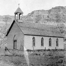
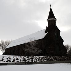
Camp Porter, Former military camp in Dawson County, Montana, US.

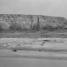
Camp Porter was a military outpost located near the Yellowstone River in Dawson County, about three miles from Glendive Creek. The installation housed multiple infantry and cavalry units from different regiments operating in the Montana Territory.

The U.S. Army established Camp Porter in October 1880 to protect workers building the Northern Pacific Railway across the region. The installation became an important military presence during the expansion of rail infrastructure in Montana Territory.

The camp integrated multiple infantry and cavalry units from different regiments, creating a diverse military presence in the Montana Territory.

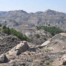
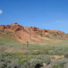
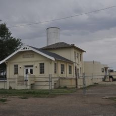
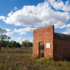
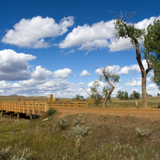
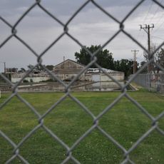
The site is largely abandoned today, and visitors should expect rough terrain when exploring the historical location. Information about its location and significance can be found through the U.S. Board on Geographic Names and local historical records.

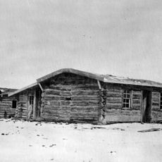
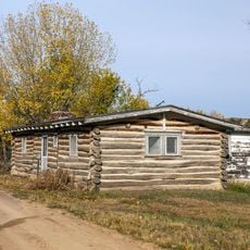
Soldiers constructed their shelters from available local materials without stoves or proper flooring. This makeshift construction reflects the harsh living conditions troops faced in this remote region.

The community of curious travelers

AroundUs brings together thousands of curated places, local tips, and hidden gems, enriched daily by 60,000 contributors worldwide.

Start exploring
Location
Inception
1880
GPS coordinates
47.15080,-104.69200
Latest update
December 14, 2025 18:45
Around this place
United States of America

Medora Musical

90.8 km
Elkhorn Ranch
United States of America

Elkhorn Ranch

81.6 km
Makoshika State Park
United States of America

Makoshika State Park

9.8 km
Theodore Roosevelt's Maltese Cross Cabin
United States of America

Theodore Roosevelt's Maltese Cross Cabin

92.2 km
Chateau de Mores
United States of America

Chateau de Mores

91.9 km
De Mores Packing Plant Ruins
United States of America

De Mores Packing Plant Ruins

92.1 km
Peaceful Valley Ranch
United States of America

Peaceful Valley Ranch

92.6 km
Yellowstone River Bridge
United States of America

Yellowstone River Bridge

46 km
Von Hoffman House
United States of America

Von Hoffman House

92.7 km
St. Mary's Catholic Church
United States of America

St. Mary's Catholic Church

92.6 km
Terry Badlands WSA
United States of America

Terry Badlands WSA

60.3 km
Billings County Courthouse
United States of America

Billings County Courthouse

92.6 km
St. Peter's Catholic Church
United States of America

St. Peter's Catholic Church

42.1 km
Merrill Avenue Historic District
United States of America

Merrill Avenue Historic District

5.3 km
Charles Krug House
United States of America

Charles Krug House

5.3 km
Sacred Heart Church
United States of America

Sacred Heart Church

5.1 km
Peoples' Congregational Church
United States of America

Peoples' Congregational Church

74.5 km
Powder River Bridge
United States of America

Powder River Bridge

72.5 km
Golden Valley County Courthouse
United States of America

Golden Valley County Courthouse

58.5 km
Bell Street Bridge
United States of America

Bell Street Bridge

5.4 km
Wibaux Commercial Historic District
United States of America

Wibaux Commercial Historic District

42.4 km
Fallon County Jail
United States of America

Fallon County Jail

93.6 km
Glendive City Water Filtration Plant
United States of America

Glendive City Water Filtration Plant

5.4 km
Ismay Jail
United States of America

Ismay Jail

73.1 km
Cottonwood Creek Bridge
United States of America

Cottonwood Creek Bridge

77.6 km
Northern Pacific Railroad Settling Tanks
United States of America

Northern Pacific Railroad Settling Tanks

5.2 km
Grandey Elementary School
United States of America

Grandey Elementary School

61.6 km
Glendive Dinosaur & Fossil Museum
United States of America

Glendive Dinosaur & Fossil Museum

2.9 km
Show the full map
Reviews
Share your experience

No review yet

Discussions
Start a discussion...

No discussion yet

« Camp Porter - Former military camp in Dawson County, Montana, US » is provided by Around Us (aroundus.com). Images and texts are derived from Wikimedia project under a Creative Commons license. You are allowed to copy, distribute, and modify copies of this page, under the conditions set by the license, as long as this note is clearly visible.

Discover hidden gems everywhere you go!

From secret cafés to breathtaking viewpoints, skip the crowded tourist spots and find places that match your style. Our app makes it easy with voice search, smart filtering, route optimization, and insider tips from travelers worldwide. Download now for the complete mobile experience.

Around Us App Screenshot

A unique approach to discovering new places

Le Figaro

All the places worth exploring

France Info

A tailor-made excursion in just a few clicks

20 Minutes

Around Us
Travel Guide & Maps
Download

Send to your phone

QR Code
1

Open the camera app on your mobile.

2

Point at the QR code with your camera. A notification will appear.

3

Tap the notification to open the link.