Coffre ${chestReward.rarityLabel}
+${chestReward.xp} XP
Explorer
NOUVEAU ×${chestReward.collectible.quantity}
tapez pour fermer

Enable Location

We need your location to show you interesting places around you

Discover nearby places

Find interesting locations and hidden gems around you

Precise directions

Get accurate directions and distances to places

Your location is never shared with other users. It's only used when you tap the location button.

Greer County

Log in to your account

Start exploring — it's free

Trusted by 70,154 travelers worldwide

Continue with Google
Continue with Apple
or

We will send you a code to connect

By continuing, you accept our Terms and Conditions and our Privacy Policy

Check your inbox

We've sent a pincode in your inbox. Please enter the code below.

Discussion Reviews 1 Photos
7.4k Popularity

Greer County, Former county in Texas, United States

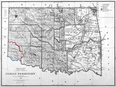
Greer County was a county in southwestern Texas that lay between the north and south forks of the Red River. This territory remained under Texas control until a court decision transferred it to a different jurisdiction.

The territory was established by Texas legislation in 1860 and was named after a state official. It remained under Texas control for nearly 4 decades until the U.S. Supreme Court ruled in 1896 that it belonged to Oklahoma Territory instead.

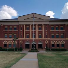
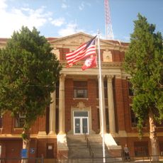
According to the 1890 census, the county population reached 5,336 residents, with Mangum serving as the administrative center.

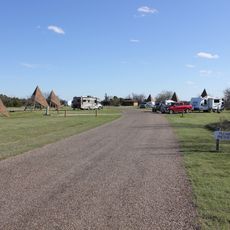
The location lies at a border between present-day states and is historically known for sitting between two river branches. Those interested in this territorial dispute can explore the region to see the geographic features and landscape that were once contested.

The original boundary dispute stemmed from an inaccurate historical map from 1818 that misplaced a key meridian line along the river. This mapping error created decades of legal confusion before finally being resolved in court.

The community of curious travelers

AroundUs brings together thousands of curated places, local tips, and hidden gems, enriched daily by 60,000 contributors worldwide.

Start exploring
Inception
February 8, 1860
GPS coordinates
34.70000,-99.70000
Latest update
March 5, 2026 18:17
Around this place
Wichita Mountains Wildlife Refuge
United States of America

Wichita Mountains Wildlife Refuge

91.8 km
Copper Breaks State Park
United States of America

Copper Breaks State Park

65.7 km
Great Plains State Park
United States of America

Great Plains State Park

66 km
Quartz Mountain Nature Park
United States of America

Quartz Mountain Nature Park

47.4 km
Tom Steed Reservoir
United States of America

Tom Steed Reservoir

65.3 km
United States of America

Charon's Garden Wilderness Area

88.6 km
Red River Valley Museum
United States of America

Red River Valley Museum

69.7 km
West Winds Motel
United States of America

West Winds Motel

59.5 km
Storm House
United States of America

Storm House

83.4 km
Washita County Courthouse
United States of America

Washita County Courthouse

92.3 km
Beckham County Courthouse
United States of America

Beckham County Courthouse

66.1 km
Doan's Adobe House
United States of America

Doan's Adobe House

56.9 km
Route 66 Bridge over the Chicago, Rock Island and Gulf Railroad
United States of America

Route 66 Bridge over the Chicago, Rock Island and Gulf Railroad

69.3 km
Perryman Ranch Headquarters
United States of America

Perryman Ranch Headquarters

15.8 km
Sayre Downtown Historic District
United States of America

Sayre Downtown Historic District

66.1 km
W.C. Baker House
United States of America

W.C. Baker House

34.5 km
Jackson County Courthouse
United States of America

Jackson County Courthouse

34.2 km
National Rt 66 and Transportation Museum
United States of America

National Rt 66 and Transportation Museum

82.8 km
Tillman County Courthouse
United States of America

Tillman County Courthouse

71.4 km
J. W. Danner House
United States of America

J. W. Danner House

66.5 km
Greer County Courthouse
United States of America

Greer County Courthouse

26.2 km
Hall County Courthouse
United States of America

Hall County Courthouse

76.6 km
Hobart City Hall
United States of America

Hobart City Hall

66.3 km
Pioneer West Museum
United States of America

Pioneer West Museum

76.2 km
Ritz Theatre
United States of America

Ritz Theatre

50 km
Ramona Theatre
United States of America

Ramona Theatre

71.7 km
Red River Valley Museum
United States of America

Red River Valley Museum

69.7 km
Childress County Heritage Museum
United States of America

Childress County Heritage Museum

55.8 km
Show the full map
Reviews
Share your experience

No review yet

Discussions
Start a discussion...

No discussion yet

« Greer County - Former county in Texas, United States » is provided by Around Us (aroundus.com). Images and texts are derived from Wikimedia project under a Creative Commons license. You are allowed to copy, distribute, and modify copies of this page, under the conditions set by the license, as long as this note is clearly visible.

Discover hidden gems everywhere you go!

From secret cafés to breathtaking viewpoints, skip the crowded tourist spots and find places that match your style. Our app makes it easy with voice search, smart filtering, route optimization, and insider tips from travelers worldwide. Download now for the complete mobile experience.

Around Us App Screenshot

A unique approach to discovering new places

Le Figaro

All the places worth exploring

France Info

A tailor-made excursion in just a few clicks

20 Minutes

Around Us
Travel Guide & Maps
Download

Send to your phone

QR Code
1

Open the camera app on your mobile.

2

Point at the QR code with your camera. A notification will appear.

3

Tap the notification to open the link.