Enable Location

We need your location to show you interesting places around you

Discover nearby places

Find interesting locations and hidden gems around you

Precise directions

Get accurate directions and distances to places

Your location is never shared with other users. It's only used when you tap the location button.

Wichita Mountains Wildlife Refuge

Log in to your account

Start exploring — it's free

Trusted by 62,499 travelers worldwide

Continue with Google
Continue with Apple
or

We will send you a code to connect

By continuing, you accept our Terms and Conditions and our Privacy Policy

Check your inbox

We've sent a pincode in your inbox. Please enter the code below.

Wichita Mountains Wildlife Refuge

Wichita Mountains Wildlife Refuge, National Wildlife Refuge in Comanche County, Oklahoma, US.

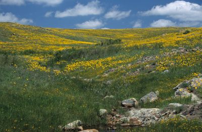
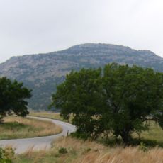
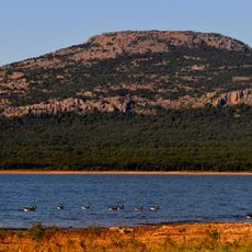
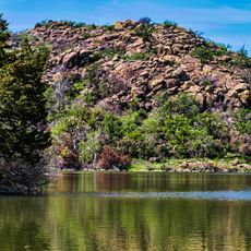
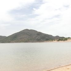
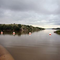
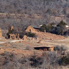
The Wichita Mountains Wildlife Refuge covers 59,020 acres (23,876 hectares) of mixed grass prairie, granite mountains, and freshwater lakes in southwestern Oklahoma. The landscape combines open plains with rocky elevations rising up to 1,000 feet (305 meters) above the surrounding terrain.

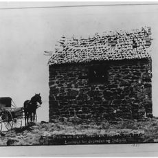
President Theodore Roosevelt designated this area as a wildlife refuge in 1905 to protect native animals and birds in their natural habitat. The refuge ranks among the oldest of its kind in the United States and was established when many species faced near extinction.

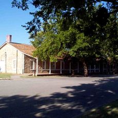
The Quanah Parker Nature Center displays exhibits about regional wildlife, Native American history, and the natural landscape of the Wichita Mountains. Visitors can join educational programs exploring ecological relationships and traditional uses of the land.

Access to hiking trails, camping areas, and fishing spots is available through the main gates on Highway 49 from Interstate 44. Paths range from flat prairie routes to steep mountain climbs, requiring appropriate preparation.

The refuge maintains free-roaming herds of American bison and Texas longhorn cattle among the ancient granite formations. These animals wander throughout the entire area and are often visible along roads and in meadows.

The community of curious travelers

AroundUs brings together thousands of curated places, local tips, and hidden gems, enriched daily by 60,000 contributors worldwide.

Start exploring
Location
Inception
1901
GPS coordinates
34.76670,-98.70030
Latest update
December 5, 2025 22:29
Around this place
Fort Sill
United States of America

Fort Sill

18.9 km
Quanah Parker Star House
United States of America

Quanah Parker Star House

15.7 km
Mount Scott
United States of America

Mount Scott

15.6 km
Lake Lawtonka
United States of America

Lake Lawtonka

18 km
Signal Mountain Blockhouse
United States of America

Signal Mountain Blockhouse

21.8 km
Great Plains State Park
United States of America

Great Plains State Park

26 km
United States of America

Fort Cobb

45.7 km
Quartz Mountain Nature Park
United States of America

Quartz Mountain Nature Park

55.8 km
Tom Steed Reservoir
United States of America

Tom Steed Reservoir

26.5 km
Mattie Beal House
United States of America

Mattie Beal House

33.8 km
United States of America

Charon's Garden Wilderness Area

5.8 km
Southern Plains Indian Museum
United States of America

Southern Plains Indian Museum

54.7 km
Museum of the Great Plains
United States of America

Museum of the Great Plains

32.2 km
First Christian Church
United States of America

First Christian Church

33 km
Carnegie Library
United States of America

Carnegie Library

33.2 km
First Baptist Church
United States of America

First Baptist Church

54.7 km
First United Methodist Church
United States of America

First United Methodist Church

57.9 km
W.C. Baker House
United States of America

W.C. Baker House

59.4 km
Tillman County Courthouse
United States of America

Tillman County Courthouse

50.9 km
Urban Air Trampoline and Adventure Park
United States of America

Urban Air Trampoline and Adventure Park

27.2 km
Hobart City Hall
United States of America

Hobart City Hall

46 km
Mahoney-Clark House
United States of America

Mahoney-Clark House

32.9 km
Elmer Thomas Park Splashpad
United States of America

Elmer Thomas Park Splashpad

32.4 km
Holy City of the Wichitas Historic District
United States of America

Holy City of the Wichitas Historic District

10.3 km
Historic Mattie Beal Home
United States of America

Historic Mattie Beal Home

33.8 km
Shepler Square Park
United States of America

Shepler Square Park

33.1 km
Lawton Federal Building and United States Courthouse
United States of America

Lawton Federal Building and United States Courthouse

33.3 km
Ramona Theatre
United States of America

Ramona Theatre

51.5 km
Show the full map
« Wichita Mountains Wildlife Refuge - National Wildlife Refuge in Comanche County, Oklahoma, US » is provided by Around Us (aroundus.com). Images and texts are derived from Wikimedia project under a Creative Commons license. You are allowed to copy, distribute, and modify copies of this page, under the conditions set by the license, as long as this note is clearly visible.

Discover hidden gems everywhere you go!

From secret cafés to breathtaking viewpoints, skip the crowded tourist spots and find places that match your style. Our app makes it easy with voice search, smart filtering, route optimization, and insider tips from travelers worldwide. Download now for the complete mobile experience.

Around Us App Screenshot

A unique approach to discovering new places

Le Figaro

All the places worth exploring

France Info

A tailor-made excursion in just a few clicks

20 Minutes

Around Us
Travel Guide & Maps
Download

Send to your phone

QR Code
1

Open the camera app on your mobile.

2

Point at the QR code with your camera. A notification will appear.

3

Tap the notification to open the link.