Comanche County

Log in to your account

AroundUs is a community-driven map of interesting places, built by curious explorers like you. It grows with every review, story, and photo you share.
Connect to save your favorite spots, contribute locations, and create personalized routes.
Continue with Google
Continue with Apple
Continue with X
Continue with Facebook
Continue with email
By continuing, you accept our Terms and Conditions and our Privacy Policy
Create an account
Add to collection
Map
Suggest a change
Share

Comanche County, County division in southwestern Oklahoma, United States

Comanche County spreads across southwestern Oklahoma and contains the Wichita Mountains and Fort Sill military installation within its borders. The region features mountains, open land, and major military facilities that shape its character and landscape.

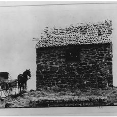
The county was established in 1901 from lands that previously belonged to Comanche, Kiowa, and Apache nations. This creation marked a turning point in the territory's history and the lives of its inhabitants.

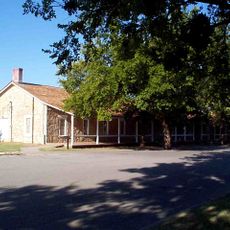
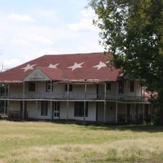
Fort Sill shapes how people in the area live and work, serving as a center for military expertise and training. Locals connect their daily routines and community stories to this installation and its role in the region.

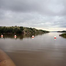
Access to the region is provided by multiple highways and a regional airport that connect travelers to surrounding areas. The open landscape makes it easy to navigate and explore different parts of the county.

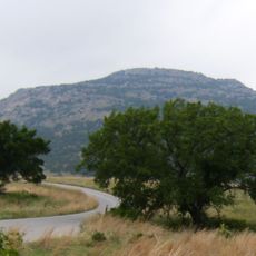
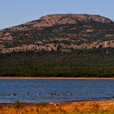
The Wichita Mountains in the area feature ancient granite formations that go back hundreds of millions of years. These old rocks form a rare landscape in the middle of the prairie and draw nature enthusiasts to explore them.

Location: Oklahoma

Inception: 1901

Capital city: Lawton

Shares border with: Caddo County, Grady County, Stephens County, Cotton County, Kiowa County, Tillman County

Website: http://comanchecounty.us

GPS coordinates: 34.66000,-98.46000

Latest update: December 7, 2025 10:06

Photos
Around this place
Fort Sill
United States of America

Fort Sill

6.6 km
Quanah Parker Star House
United States of America

Quanah Parker Star House

16.9 km
Mount Scott
United States of America

Mount Scott

11.5 km
Wichita Mountains Wildlife Refuge
United States of America

Wichita Mountains Wildlife Refuge

25 km
Lake Lawtonka
United States of America

Lake Lawtonka

11.4 km
Signal Mountain Blockhouse
United States of America

Signal Mountain Blockhouse

3.2 km
Great Plains State Park
United States of America

Great Plains State Park

49.7 km
United States of America

Fort Cobb

49.8 km
Comanche Nation Casino
United States of America

Comanche Nation Casino

10 km
Chisholm Trail Casino
United States of America

Chisholm Trail Casino

45.9 km
Tom Steed Reservoir
United States of America

Tom Steed Reservoir

49.8 km
Apache Casino Hotel
United States of America

Apache Casino Hotel

10.8 km
Mattie Beal House
United States of America

Mattie Beal House

9.3 km
United States of America

Charon's Garden Wilderness Area

25.8 km
Southern Plains Indian Museum
United States of America

Southern Plains Indian Museum

50.5 km
Museum of the Great Plains
United States of America

Museum of the Great Plains

7.3 km
First Christian Church
United States of America

First Christian Church

8.4 km
Carnegie Library
United States of America

Carnegie Library

8.4 km
First United Methodist Church
United States of America

First United Methodist Church

36.2 km
Brittain-Garvin House
United States of America

Brittain-Garvin House

49.1 km
H.C. Chrislip House
United States of America

H.C. Chrislip House

48.3 km
Mahoney-Clark House
United States of America

Mahoney-Clark House

8.1 km
Chisholm Trail Heritage Center & Garis Gallery of the American West
United States of America

Chisholm Trail Heritage Center & Garis Gallery of the American West

46.5 km
Holy City of the Wichitas Historic District
United States of America

Holy City of the Wichitas Historic District

15.1 km
Historic Mattie Beal Home
United States of America

Historic Mattie Beal Home

9.3 km
Shepler Square Park
United States of America

Shepler Square Park

8.3 km
Lawton Federal Building and United States Courthouse
United States of America

Lawton Federal Building and United States Courthouse

8.7 km
Comanche Red River Hotel Casino
United States of America

Comanche Red River Hotel Casino

55.5 km
Show the full map
Reviews

Visited this place? Tap the stars to rate it and share your experience / photos with the community! Try now! You can cancel it anytime.

Administrative divisions
« Comanche County - County division in southwestern Oklahoma, United States » is provided by Around Us (aroundus.com). Images and texts are derived from Wikimedia project under a Creative Commons license. You are allowed to copy, distribute, and modify copies of this page, under the conditions set by the license, as long as this note is clearly visible.

Discover hidden gems everywhere you go!

From secret cafés to breathtaking viewpoints, skip the crowded tourist spots and find places that match your style. Our app makes it easy with voice search, smart filtering, route optimization, and insider tips from travelers worldwide. Download now for the complete mobile experience.

Around Us App Screenshot

A unique approach to discovering new places

Le Figaro

All the places worth exploring

France Info

A tailor-made excursion in just a few clicks

20 Minutes