Chest opened
+${chestReward.xp} XP
Explorer
NOUVEAU ×${chestReward.collectible.quantity}
tapez pour fermer
Chest locked

Open chests in the app

Around Us is built for your phone — chests unlock when you walk, explore and capture nearby places.

Enable Location

We need your location to show you interesting places around you

Discover nearby places

Find interesting locations and hidden gems around you

Precise directions

Get accurate directions and distances to places

Your location is never shared with other users. It's only used when you tap the location button.

Oklahoma Panhandle

Log in to your account

Start exploring — it's free

Trusted by 72,885 travelers worldwide

Continue with Google
Continue with Apple
or

We will send you a code to connect

By continuing, you accept our Terms and Conditions and our Privacy Policy

Check your inbox

We've sent a pincode in your inbox. Please enter the code below.

Oklahoma Panhandle
Discussion Reviews 1 Photos
98.4k Popularity

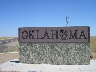
Oklahoma Panhandle, Geographic region in northwestern Oklahoma, US.

The Oklahoma Panhandle is a narrow strip of land in northwestern Oklahoma that stretches between Kansas to the north, Colorado to the northwest, New Mexico to the west, and Texas to the south. This region consists of three counties and reaches about 55 kilometers at its widest point, while extending more than 265 kilometers to the east.

Between 1850 and 1890, this strip of land remained without formal affiliation because federal laws prohibited slavery north of the 36th parallel and no other administration claimed responsibility for it. The region was only incorporated as part of Oklahoma Territory in 1890, after settlers and ranchers had begun to establish themselves there.

Native Plains tribes initially inhabited this region, establishing agricultural settlements and developing corn cultivation techniques before European exploration began.

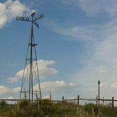
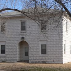
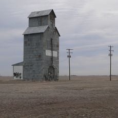
The landscape is flat and treeless, with wide fields and pasture land stretching under an often cloudless sky. Strong winds and extreme temperature swings between summer and winter shape the climate, so visitors should prepare for changing conditions.

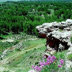
Black Mesa in western Cimarron County reaches 1,516 meters (4,973 feet) above sea level and marks the highest point in Oklahoma. From the top, you can see the borders of Colorado, Kansas, and New Mexico at the same time.

The community of curious travelers

AroundUs brings together thousands of curated places, local tips, and hidden gems, enriched daily by 60,000 contributors worldwide.

Start exploring
Location
Inception
1850
GPS coordinates
36.75000,-101.50000
Latest update
December 15, 2025 15:07
Around this place
Mid-America Air Museum
United States of America

Mid-America Air Museum

58.5 km
8 Mile Corner
United States of America

8 Mile Corner

55.3 km
United States of America

Optima National Wildlife Refuge

28.5 km
Point of Rocks
United States of America

Point of Rocks

55.5 km
Franklin Hall
United States of America

Franklin Hall

21.2 km
United States of America

CCC Ranch Headquarters

35.5 km
Texas County Courthouse
United States of America

Texas County Courthouse

7.7 km
Dorothy's House and Land of Oz
United States of America

Dorothy's House and Land of Oz

61.3 km
United States of America

Baker Woodframe Grain Elevator

45.1 km
Hooker Woodframe Grain Elevator
United States of America

Hooker Woodframe Grain Elevator

28.9 km
United States of America

Turpin Grain Elevator

57.4 km
United States of America

Baker Woodframe Elevator

45 km
United States of America

Tracey Woodframe Grain Elevator

24.6 km
United States of America

Mid-America Air Museum

58.5 km
United States of America

Hansford Cemetery

64.2 km
United States of America

Oknoname 007001 Reservoir

64.8 km
United States of America

Santa Fe Railroad Stationmaster's House

67.2 km
United States of America

Spearman Hotel

67.1 km
United States of America

Brandt Building

67.1 km
United States of America

Willow Tree Golf Course

59.4 km
United States of America

Country Club

61.5 km
United States of America

Point Rock Golf Club

44.2 km
United States of America

Forewinds Municipal Golf Club

48.1 km
United States of America

CRIP Depot

60.7 km
United States of America

Hardesty Park

32.5 km
United States of America

Prairie Dog Point

31.3 km
United States of America

Point of Rocks

55.5 km
United States of America

Cimarron Grassland and Santa Fe Trail overlook

55.5 km
Show the full map
Reviews
Share your experience

No review yet

Discussions
Start a discussion...

No discussion yet

« Oklahoma Panhandle - Geographic region in northwestern Oklahoma, US » is provided by Around Us (aroundus.com). Images and texts are derived from Wikimedia project under a Creative Commons license. You are allowed to copy, distribute, and modify copies of this page, under the conditions set by the license, as long as this note is clearly visible.

Discover hidden gems everywhere you go!

From secret cafés to breathtaking viewpoints, skip the crowded tourist spots and find places that match your style. Our app makes it easy with voice search, smart filtering, route optimization, and insider tips from travelers worldwide. Download now for the complete mobile experience.

Around Us App Screenshot

A unique approach to discovering new places

Le Figaro

All the places worth exploring

France Info

A tailor-made excursion in just a few clicks

20 Minutes

Around Us
Travel Guide & Maps
Download

Send to your phone

QR Code
1

Open the camera app on your mobile.

2

Point at the QR code with your camera. A notification will appear.

3

Tap the notification to open the link.